10/25 - 10/28 Maryland and West Virginia
Day 107
Monday October 25th
Ensign Cowall Shelter
1125.6 - 1135.9 = 10.3
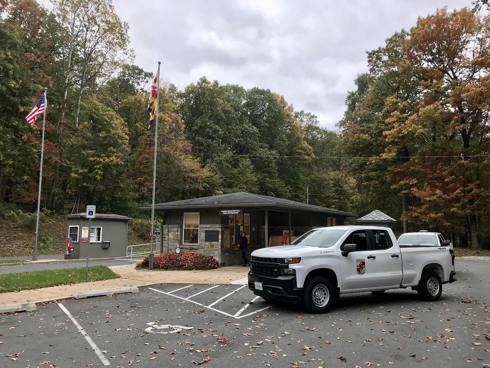
In the morning we have less than a mile to go, up a hill to Pen Mar Park, where we cross the Mason-Dixon Line and enter Maryland. We have arranged a shuttle with a local man named Dennis at 9. We arrive early at about 8:45 and he is already there waiting for us. Dennis is dropping off another hiker, named OSHA, who we recognize. He got that name because he was always telling everyone to be safe on the trail. We met him back in Maine on the day we left the Hostel of Maine and saw him once more at the laundromat in Rangeley. We had wondered if he was still out here somewhere. It’s easy to lose track of the people you meet and never see them again.
Dennis is one cool cat. He’s an older man who has lived in the area a very long time. He entertains us with funny stories of growing up in the area, hobos sleeping in the barn on the farm her grew up on and how when he first started seeing AT hikers he thought they were hobos coming out of the woods. He’s shuttling another guy at the same time he shuttles us, so he drops us at the post office in town, and then leaves to take the other guy to where he’s going. The other hiker is getting shuttled down to the Washington Monument and will hike a few days back to his car. The Maryland section of the trail is only about 40 miles, so it’s a popular section hike.
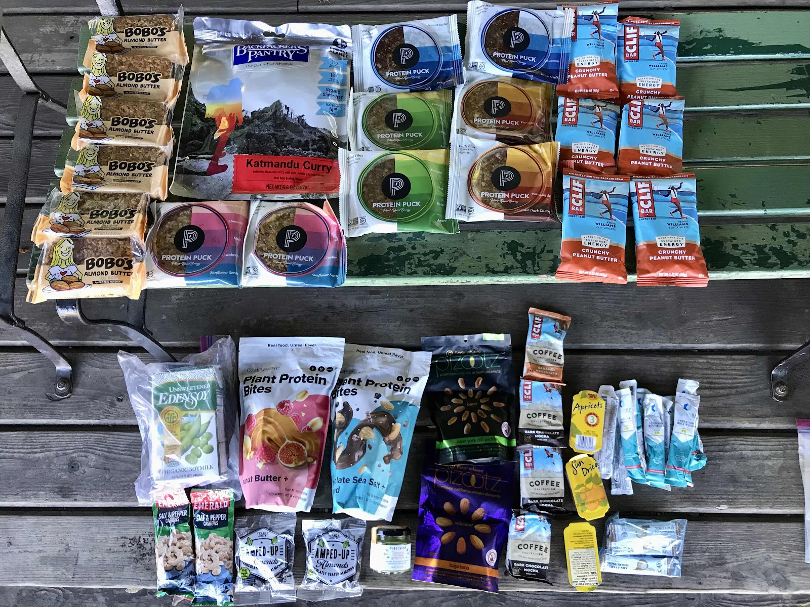
After we leave the post office we walk across the street to Walmart and do our grocery shopping. We don’t need much because in addition to the snacks my mom added to the box she sent, we also picked up a package of snack bars that we sent ahead from Duncannon. We were able to leave our backpacks in Dennis’s truck but we have our post office boxes and Jeff has to push them around in a cart. Jeff rushes us as always. We are sitting out front on a bench ready to be picked up just a half hour after we were dropped off at the post office. I look in google maps and see how long of a drive it is to Maryland’s Washington Monument, and realize it will be at least another half hour before Dennis is back. I go back inside while Jeff sits outside with our stuff and get a few more things at a more leisurely rate, without Jeff tapping his foot at me!
We are back to Pen Mar by 10:30. It’s a beautiful sunny day and the park is wonderful. There are tons of benches, playgrounds, a view, bathrooms with running water and we even find power outlets! We are there awhile, opening our packages, repacking all the food and having a picnic. We have tofu and hummus salad wraps. We have a ton of food. Definitely more than we need to get us through Maryland, which will only take 2 days. We will be in Harper’s Ferry West Virginia by Wednesday. There are no big grocery stores coming up though, mostly just gas stations, so we will have better, healthier food by carrying it ourselves. I end up having a hefty bag of food to carry in my hand when we leave, but I don’t mind. It contains bananas, blueberries, apples, an orange, a bell pepper and half of the hummus.
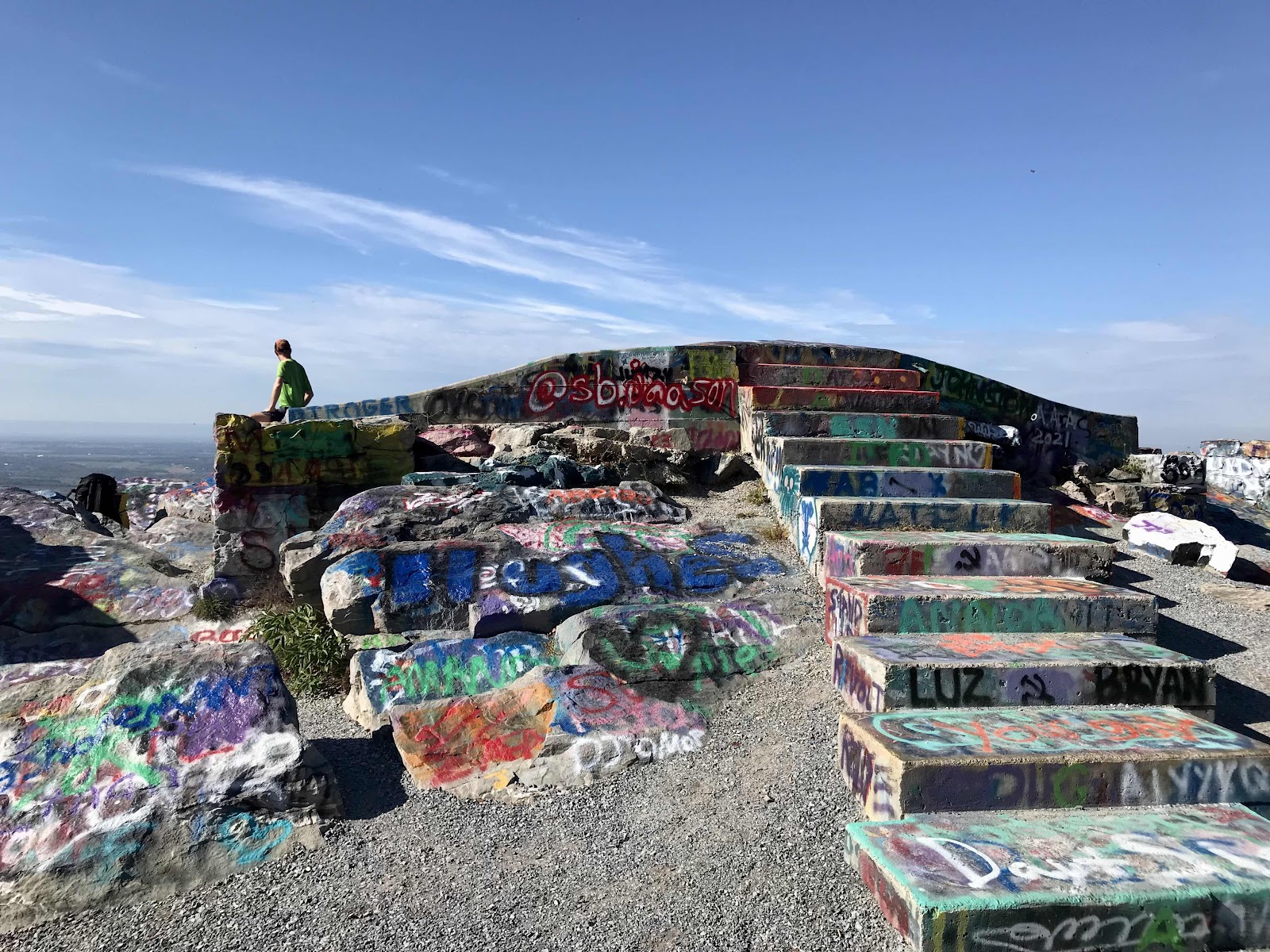
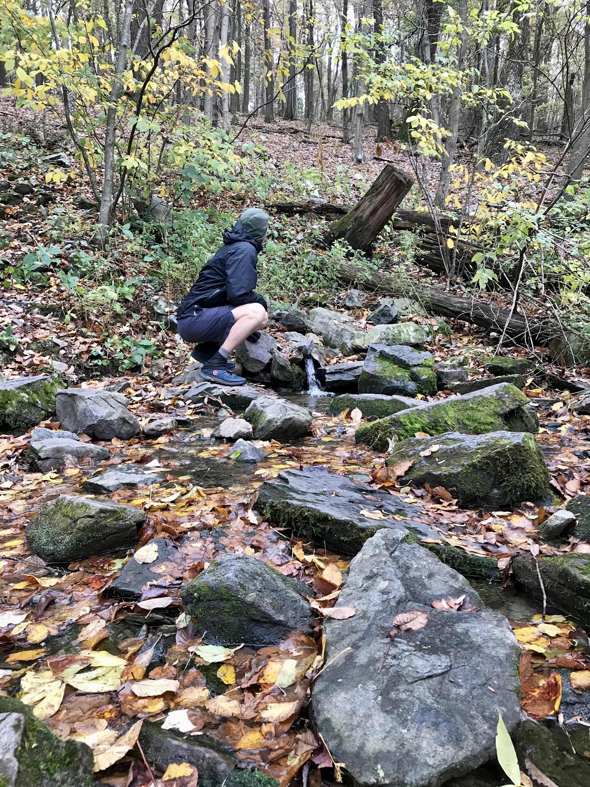
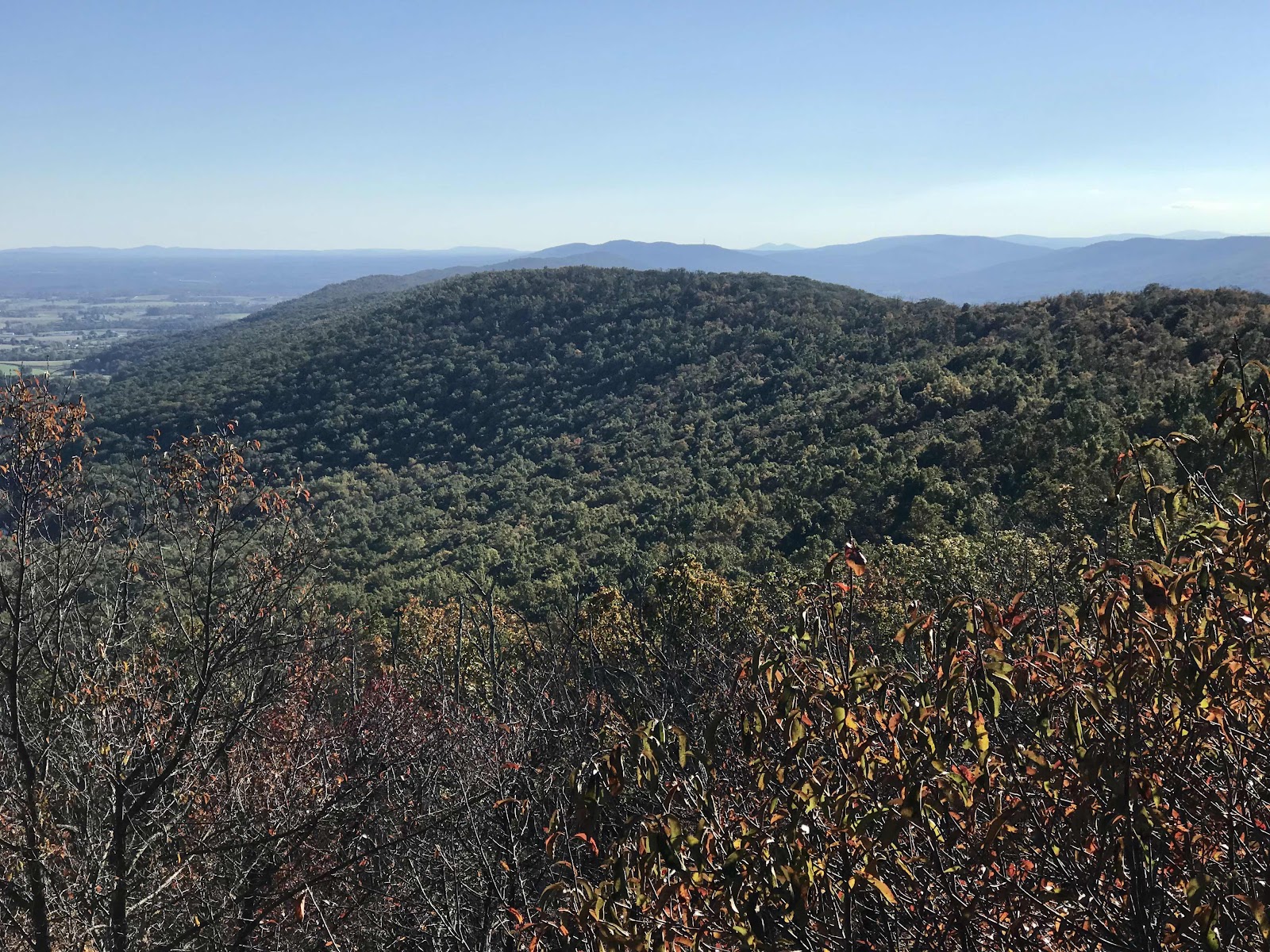
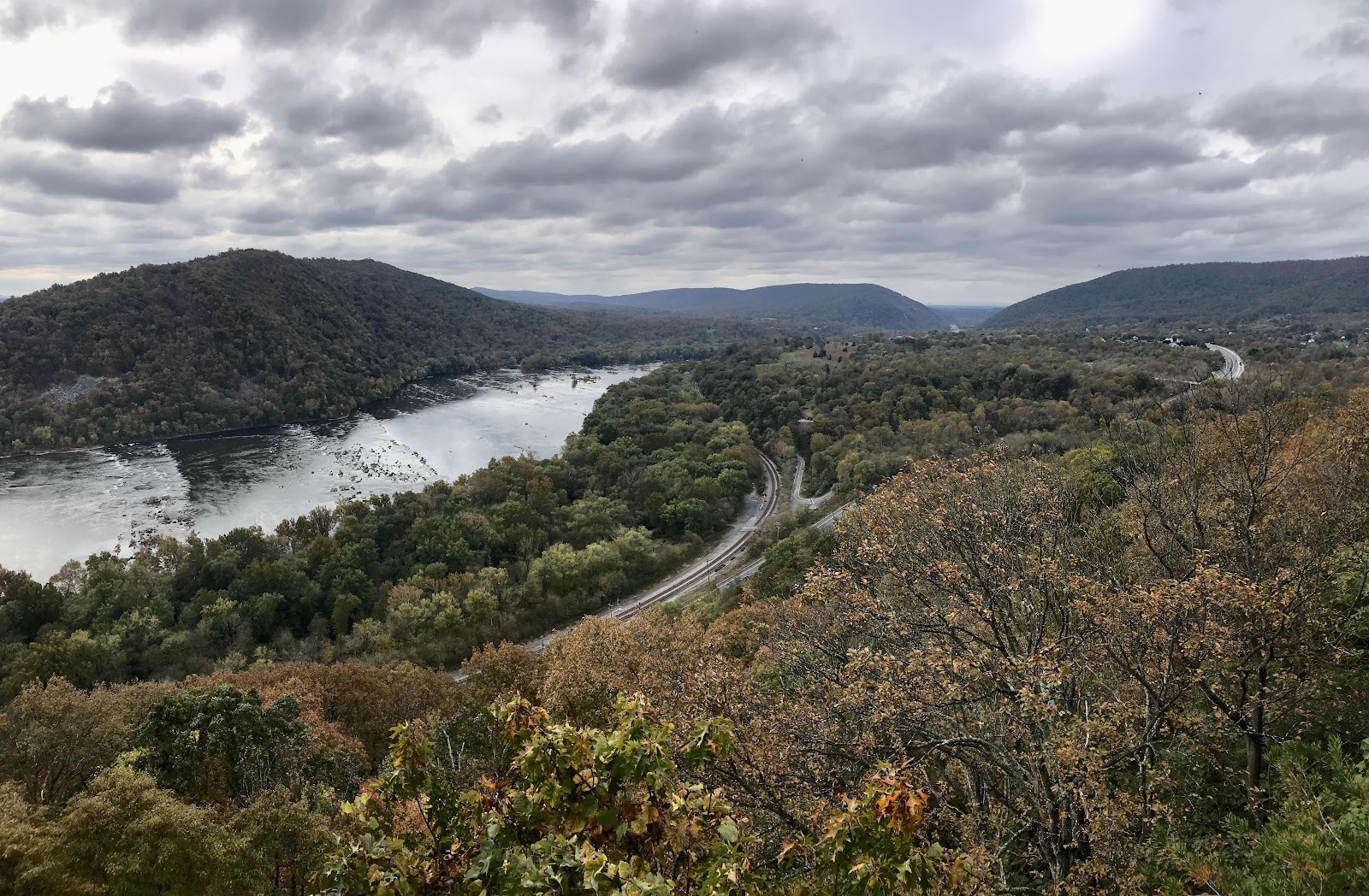
By the time we leave at 1 it’s about 72 degrees out. It’s an easy trail for awhile, but then we have a steep climb up big rocks. We get really hot and sweaty, more sweaty than we’ve been in awhile. Luckily at the top there is a nice view from a place called High Rocks! There’s a side trail to the view and we are surprised to see that there’s also a road to the view! The view ledge is heavily graffitied and slippery to walk on as a result. Part of the ledge is also the remnants of an old concrete foundation, but for what we have no idea. There is an impressive an unobstructed view to the north from the ledge. We stop for a little picnic and Jeff manages to get us some extra water from one of the people who came in a car. We haven’t been going though water very quickly recently and today we were caught off guard by how hot and thirsty we got!
In the afternoon we take another side trail to rest at Raven Rock shelter. We thought we might stop there for the night but it’s still early and nice out too, so we decide to keep going. There’s one more view ledge in the early evening. We keep an eye on the increase clouds. A storm is coming, like the forecast said, but it sure didn’t look like it earlier.
We cross the final highway of the night (Foxville Road/MD 77) and pass through and open field with lots of houses just as it’s getting dark. We can see the lights of many houses and can’t help but think it sure would be nice to sleep in a garage or even on a porch! The last 3/4 of mile we are back in the forest and it’s dark, so we use our headlamps. We arrive to our shelter for the night just as the rain is beginning to fall.
There is a group of older guys already in the shelter but they happily make space for us. It’s a 2 story shelter with a little loft. We eat a simple peanut butter and jelly sandwich dinner and sleep in the loft. Happy to be sheltered from the now heavily pouring rain.

Maryland state line. We finally finished Pennsylvania!

View pavilion at Pen-Mar park with views to the west
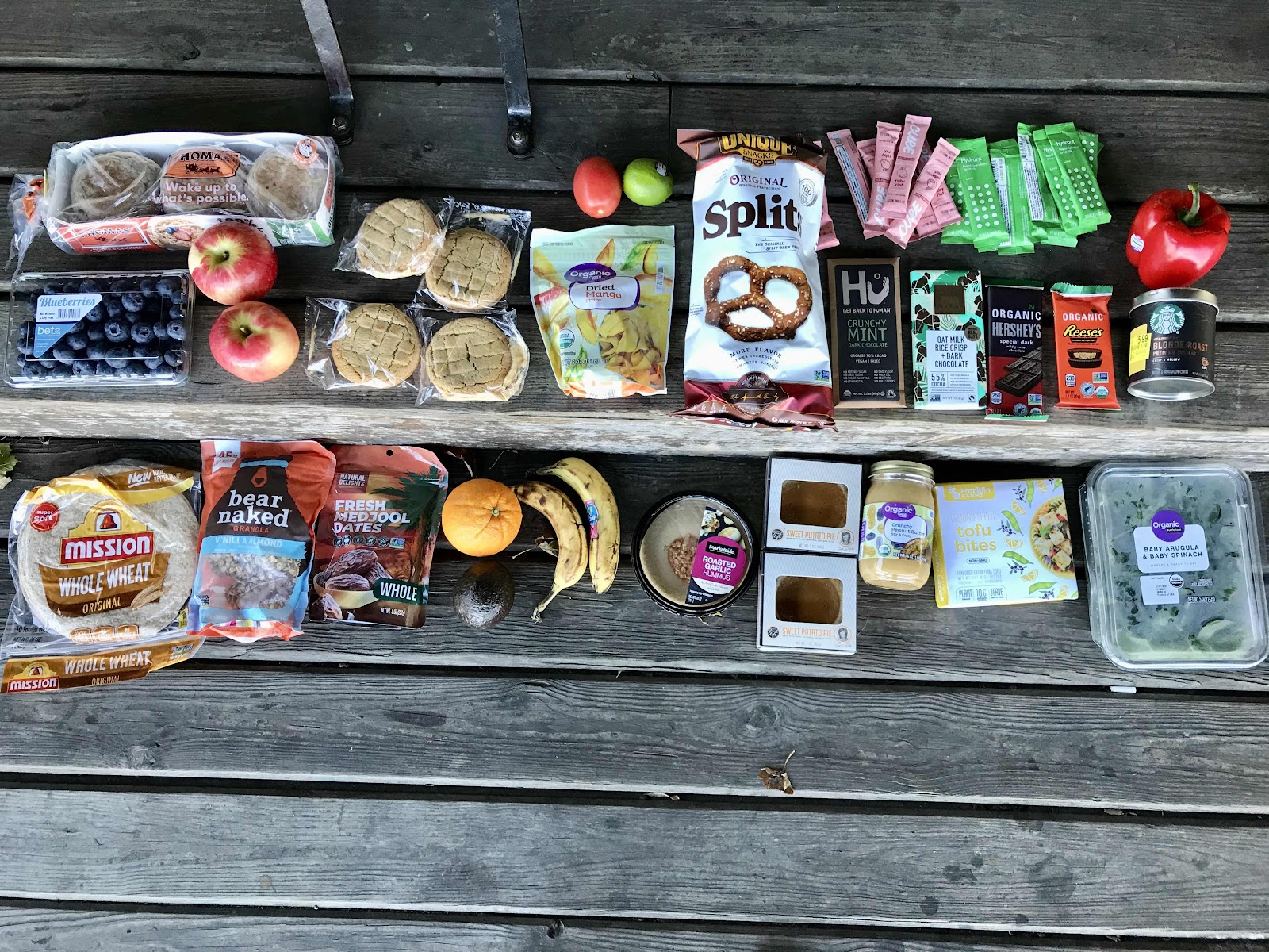
Walmart resupply. Stocking up on a new set of food is always a joy! We got some great finds, like clearance hydration drink mixes, some premium chocolate bars and I finally found the giant peanut butter sandwich cream pies!

Pen-Mar park

This sign is no longer accurate, but still neat to see. We are 1,126 miles from the terminus in Maine with 1,068 miles to the terminus in Georgia.

A cool tree with a view portal!
High Rocks

A fine panoramic view to the West. I guess this is still the Cumberland Valley we are seeing.

More views from High Rocks, looking Northwest

Quite the impressive mound of graffiti!

Raven Rock Shelter. It’s 2 stories and has nice plexi-glass windows for allowing light in.
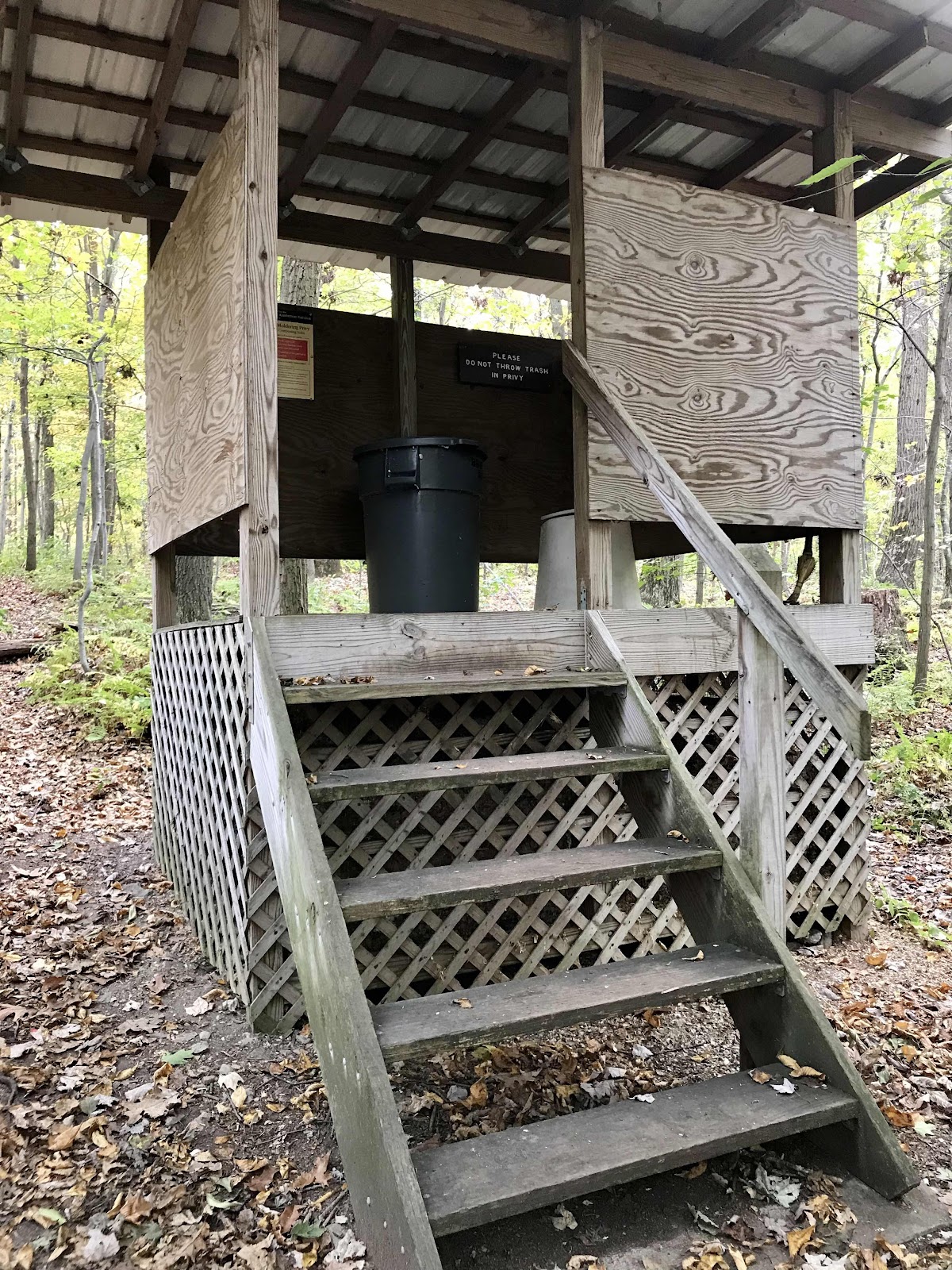
Open air toilet at Raven Rock Shelter

View West to the town of Smithsburg

Impressive wall of rocks near the view ledge
Day 108
Tuesday October 26th
Greenbriar State Park
1135.9- 1145.1 = 9.2
There’s heavy rain and white noise on our tin roof until about 11. After the rain stops it’s dead quiet until one of the old men below begins a deep rattling sleep apnea induced snore! He goes though a cycle of stopping breathing, then gasping for air and then heavy snoring. It’s the worst snoring we have ever heard! It keeps us up and eventually I can’t take it anymore and have to get out to pee. It’s not easy climbing over everyone’s backpacks in the dark and down the joke of a ladder and out of the loft. By morning none of us has slept well, so we way over sleep, not getting up until almost 7:45!! Then it’s social hour at the picnic table as we pack up and make breakfast. It turns out not all of the old men are traveling together and the two that are not are just as annoyed about the snoring as we are. One of the guys tells us he was awake counting the number of seconds between breaths for sleep apnea man, and once timed 45 seconds!! Yikes! That’s not good! People like that should have the decency to sleep in their own tent!
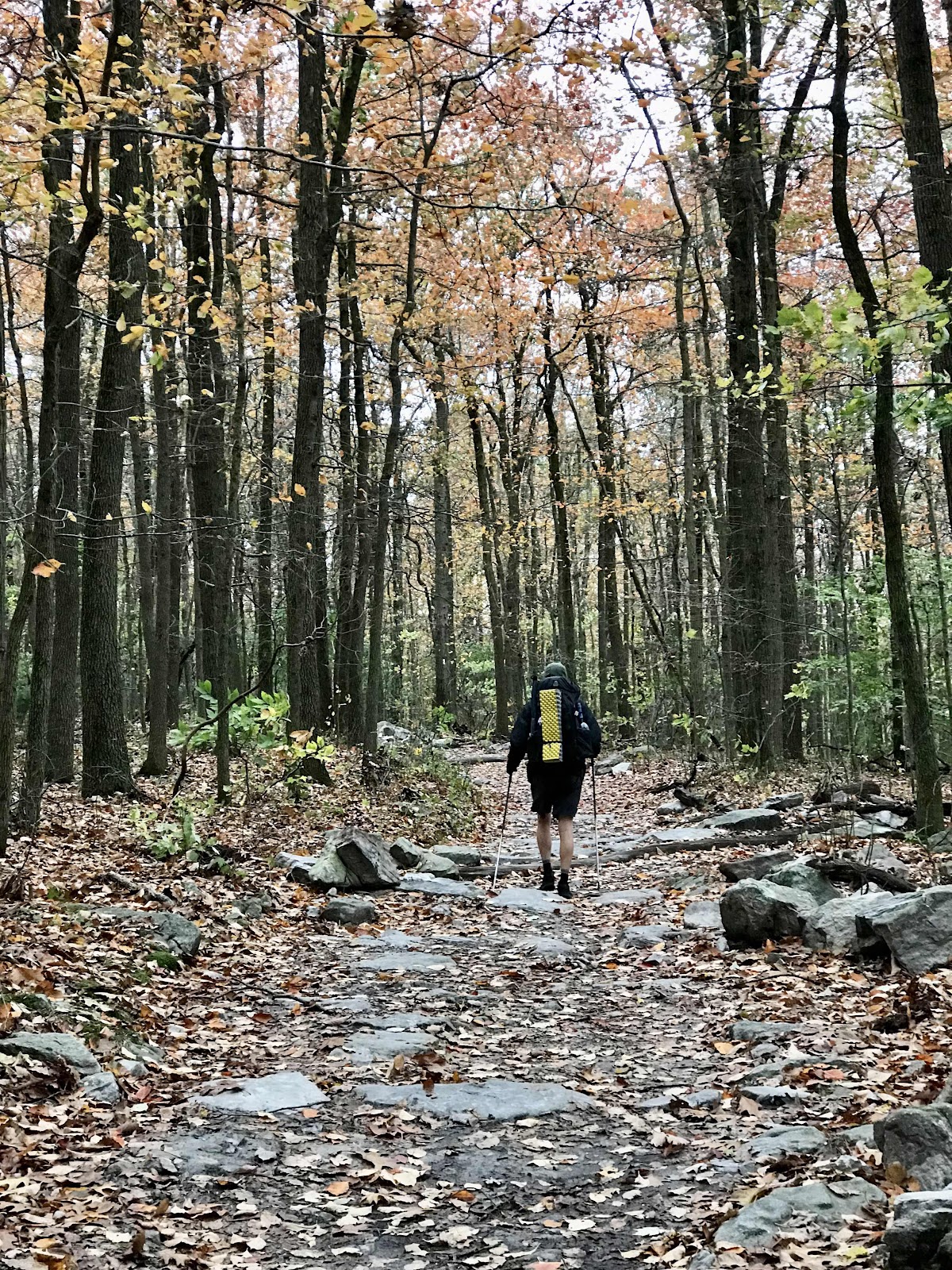
It’s 9:30 by the time we are walking. The rainy part of the storm blew through last night thankfully, but it’s cold and windy and overcast, a true blustery fall day. It rains leaves. Our progress is slow. We haven’t even made it 4 miles by noon!
We have several nice view ledges today, an unnamed and unmarked one, and the Black Rock Cliffs and then Annapolis Rocks. It’s extremely windy and cold at the view ledges but the visibility is good. We take a side trail to Pine Knob Shelter in the afternoon for a break with shelter from the wind. We debate about how much farther to go in the crummy conditions and the fading daylight. If we stay in this shelter we’ll have to deal with sleep apnea man and if we tent camp we could have falling branches from the wind.
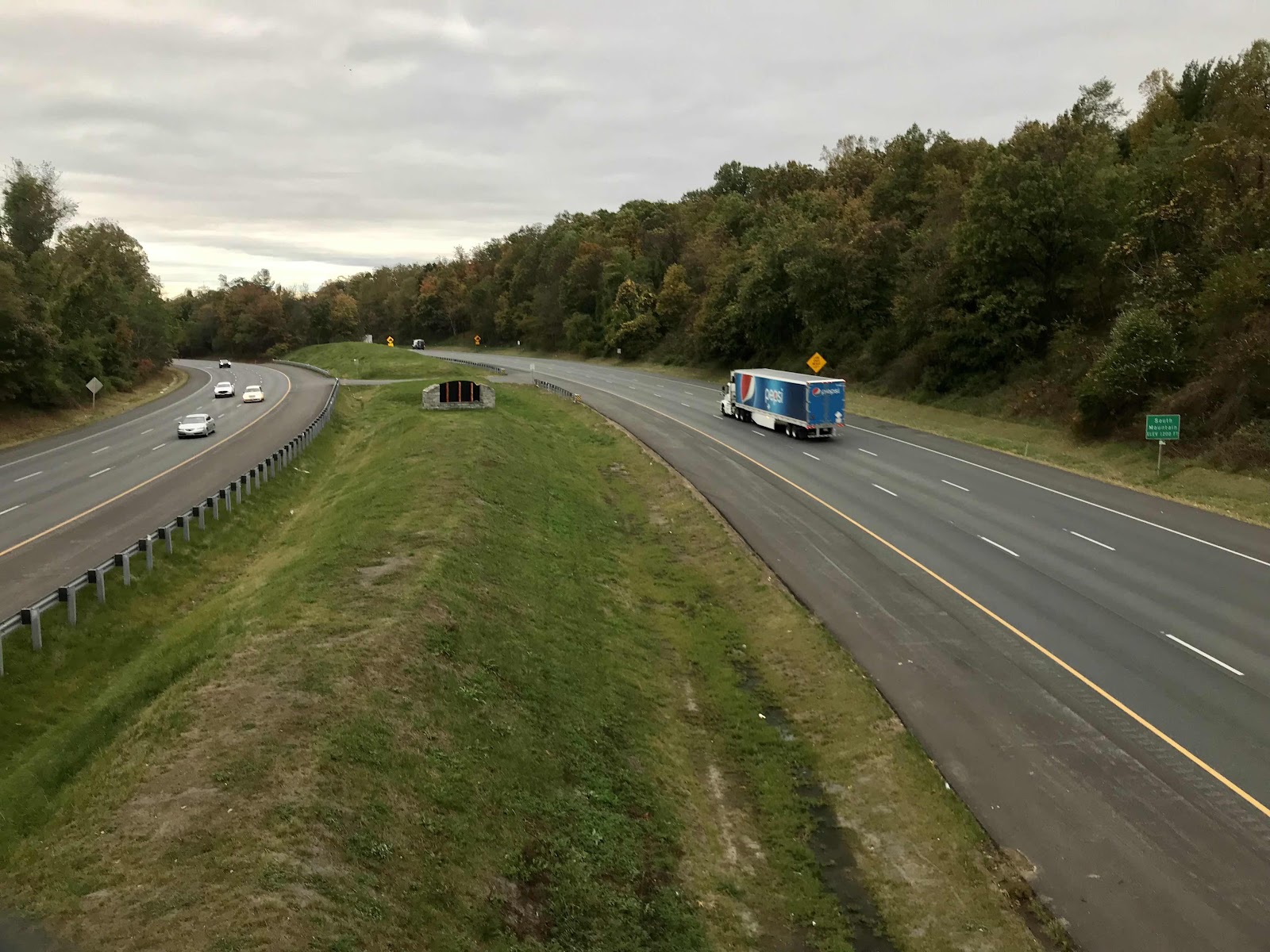
We make the decision to go just a little further to a drive up campground in a state park and end the day early and come down off the windy ridge. We cross I-70, then take a 1/2 mile side trail to Greenbriar Lake State Park. On the way Jeff is almost hit by a huge falling branch. It hits the ground and explodes right in front of his face. He’s just ahead of me and I watch as the branch is thrown down at him like a spear. It feels like watching someone get hit with lightning! It’s incredibly scary and makes us glad we’re getting out of the forest and going down to a maintained facility.
The state park has a campground and heated bathroom facilities with running water and hot showers. It’s not listed in our phone app guide, but it is listed in our paper AWOL guide. We are lucky to reach the state park just as a ranger is getting out of her truck. She drives us over to the entrance area to pay for our campsite and then drives us to our campsite, saving us at least a half hour. It’s a very large campsite with several loops and is probably full all summer long as the park has a lake and it’s a popular swimming destination.
It’s about 4:30 by the time we reach our campsite, allowing us time to take a leisure walk. We could have gone further down the AT but the windy forest is scary and we wanted to see what the state park was like. Now, instead of rushing past the Washington Monument State Park in the cold, wind and dark we will see it in ideal conditions with sun tomorrow.
We have decided to stop fighting our urge for leisure. We will no longer feel any need to rush, as we have decided to end our hike in Harper’s Ferry, West Virginia, just two days away. We will come back next year and do the rest. Harpers Ferry is an easy place to get picked up from and it is also an easy place to get back to the trail next year, thanks to the Amtrak train service from Washington DC. It doesn’t make sense to keep hiking until the last minute to some place that would require a special shuttle to get away from. It also doesn’t make sense to spread ourselves thin and not allow ourselves enough time to get back to Aspen on a stress free time line. We will have an easy last two days and a leisurely weekend in Harper’s Ferry to celebrate our end point. Then we will have time to visit Jeff’s brother in Delaware and his parents in New Jersey before flying back to San Diego.
We really enjoy the camp ground with its heated bathroom with free hot showers and warm hand dryers and electricity. We take a loop trail around the lake. It appears to be an excellent place for summer leisure, with sand beaches, picnic tables galore, gazebos, playgrounds and all sorts of facilities. There are nice fall colors around the lake and we can see back to the cliffs we were on earlier. We are below the ridges which block the wind well, making the conditions at the campground quite pleasant and much warmer!
We spot 2 black squirrels on our walk. They are the first two of the trip. We love squirrels and are entranced by them. It was worth the trip to the state park just for them! And if it wasn’t for the ranger giving us a ride we wouldn’t have been out for a leisure walk!
We have a deluxe picnic dinner in our tent as it’s getting dark. Peanut butter and jelly English muffins, dates with peanut butter and some dark chocolate. It spite of the windy conditions today we had a great day.

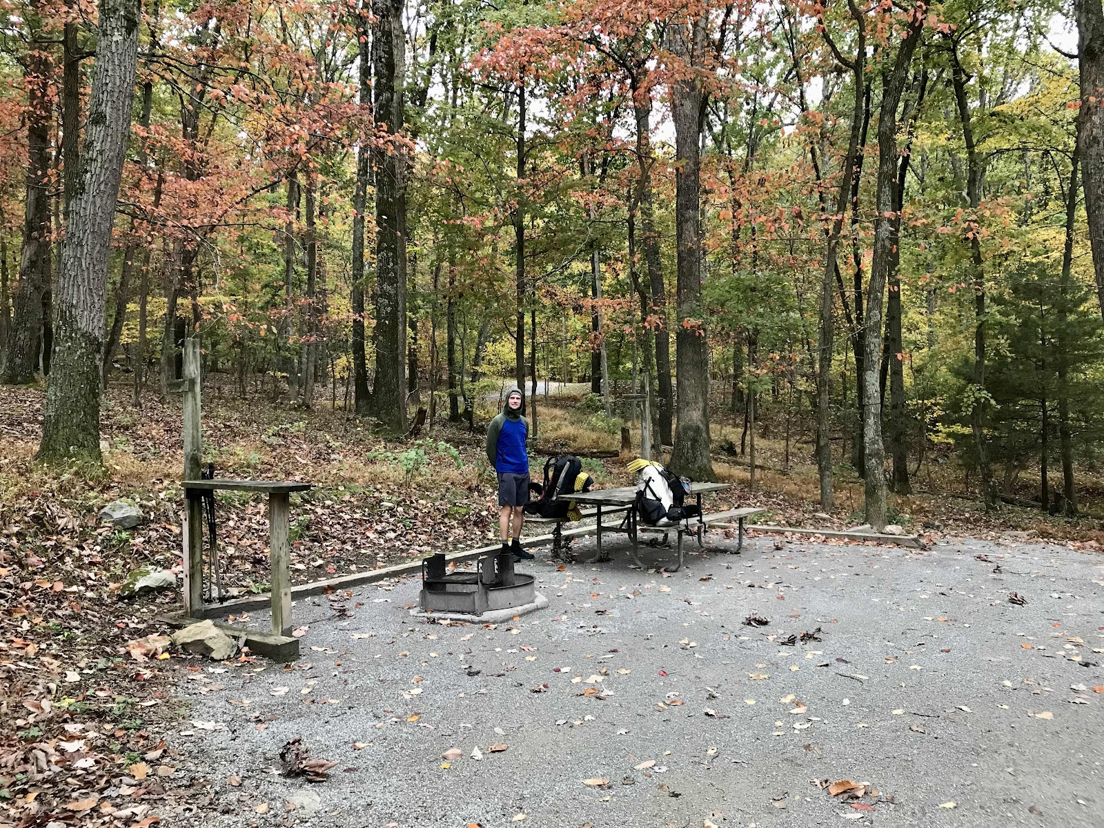
Ensign Cowall Shelter in the morning where we slept with sleep apnea man.

Black Rock Cliffs 1,732 feet. Views to the west of the Cumberland Valley.

Annapolis Rocks 1,657 feet.

Another view ledge at Annapolis Rocks. In this photo you can see Greenbriar Lake, where we camped at the state park campground.
A nice source of spring water at the Annapolis Rocks campsite.
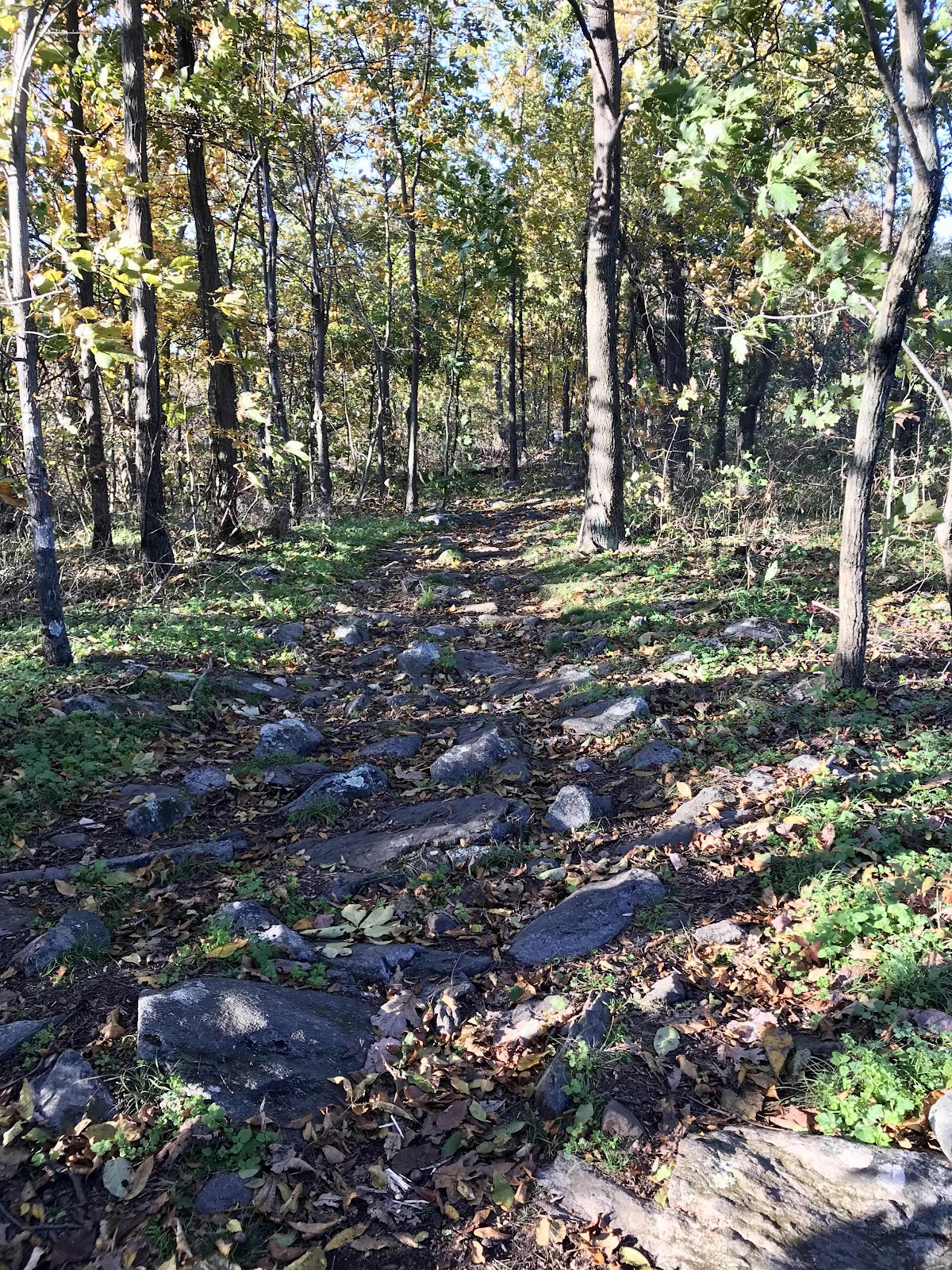
Nice road like section trail that has seen lots of trail work.
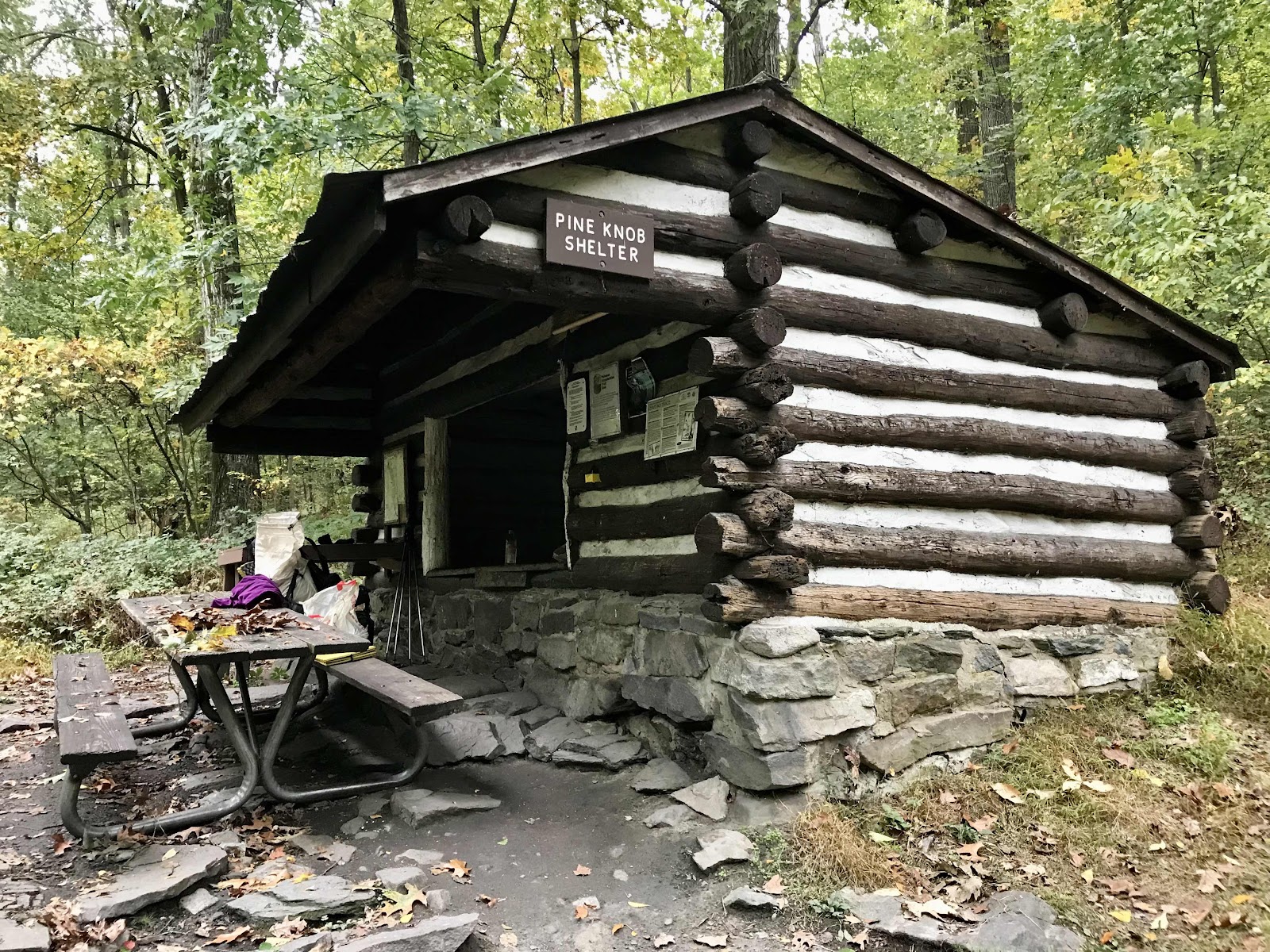
Pine Knob Shelter is a very old shelter and it’s small too, only 4 people could sleep comfortably inside.
Crossing I-70 on a pedestrian bridge.

Map of the state park. There are a few forested trails, but the main attraction is the swimming beach at the lake.
The rangers just got brand new trucks. You can see me in the background checking in at the entrance area building.

Checking out the facilities, warm and dry under our umbrellas in the light drizzle.

What a fine swimming beach! And lifeguard chairs too!
Day 109
Wednesday October 27th
Gapland Road
1145.1 - 1157 = 11.9
We sleep in until 7. We are pleased to see the sky is clear when we look out of our tent. We get up and take nice warm showers and cook breakfast at our picnic table. There are no other campers in sight. Of the 160 campsites only a few are occupied, and we can’t see them from where we are. We check out the little visitor center before we leave and learn that the black squirrels may just be a variation of the grey squirrel. We also learn that there are no natural lakes in Maryland. This lake is man made, and is only 6 feet deep.
It’s 10:30 by the time we are back on the AT. We don’t walk far before stopping for our first snack break. We eat the last of the giant peanut butter sandwich creme cookies. Oh boy were they good at 420 calories of oil and sugar! It’s good that they are gone now and we can begin the painful process of getting off junk food and quitting sugar.
Just a few miles into our day we reach the Washington Monument State Park. The monument is a large stone tower erected on a hill in honor of George Washington. It was built by the citizens of Boonsboro in 1827, almost 60 years before the more famous monument in Washington DC. We stop at the park to climb the tower and admire the fine views of Pennsylvania, Maryland and West Virginia. Shortly after the monument there is a fine picnic ground where we stop for lunch. It’s 1:00 by the time we leave from lunch and we’ve only come 2.5 miles!! That may be a new record low for us, haha!
There’s not much of interest in the afternoon, just ridge walking in the forest. Sometimes it’s smooth and easy going, and other times it’s rocky. We made it through “Rocksylvania,” but the rocks haven’t gone anywhere!
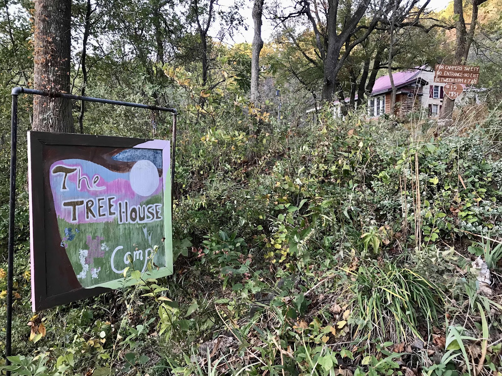
We find out about a campground just off the trail and down a paved road. It’s called the Treehouse Camp and is a privately run place. We call to make a reservation in the late afternoon when we’re still 7 miles away. They try to talk us out of coming, saying that the little houses are no better than an AT shelter, because they have no electric. We disagree though, of course they are better, we don’t have to share with anyone and they are fully enclosed!
Having our own little cabin to look forward to motivates us down the trail. We make it to the road by 5:45 and from there it’s just half a mile to the little camping village. The camp store is already closed for the night but we are left after hours check in instructions. There’s a heated indoor bathroom, an outdoor shower with hot water and sinks with running water. Our cabin is called the oriole and it just a dry cabin on stilts. None of the cabins we see are true tree houses, but it’s still a cool place. Our cabin is screened in and has a nice sleeping platform and benches inside. We are pleased with our decision to come here and have a much better evening than we would have had sharing a campsite or shelter back on the trail. Sleep apnea man is still out there, him and his friend were doing the Maryland section, from Pen-Mar park to Harper’s Ferry.

Greenbriar Lake in the bright morning light

Informational sign in the visitor’s center

Me and the last two peanut butter cream pies!

Jeff and the original Washington Mounment

A bit of information about the monument

Viewing deck behind the monument

View of 3 states from the top, Pennsylvania, Maryland and West Virginia.

A fancy historic inn on US 40 at Turners Gap. It’s too fancy to be welcoming to hikers. The town of Boonsboro is 2.5 miles west, but we don’t need anything, so we keep going.
Views south from the White Rocks view ledge

In the distance through the trees, we could see the city skyline of Baltimore.
A rocky section of trail.
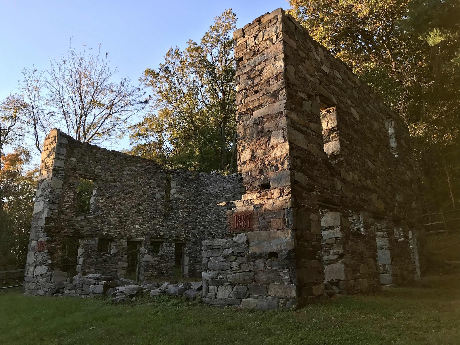
We walked past some ruins in Gathland State Park, just before reaching the road at Crampton Gap. The ruins are of a newspaper man’s estate. He was famous for being a war correspondent. GATH were the initials he used for his writing.

This is the war correspondents memorial next to the ruins of the house at Gapland Road.
Entrance sign at our campground.

Bathhouse and somehow they got their own smoky the bear sign!

The Oriole cabin at the tree house camp.
Day 110
Thursday October 28th
Harper’s Ferry, West Virginia
1157 - 1168 = 11
We have easy level ridge walking all day from our little cabin to the edge of the ridge before it drops down to the Potomac River. We take a side trail for lunch to visit the Ed Garvey shelter, a neat two story shelter with a ladder in the back for accessing the upper level. Just before the river there is another side trail to the Weaverton Cliffs with views of the Potomac River.
After a short downhill we have more easy level walking along the Chesapeake and Ohio Canal towpath. We follow the canal for 3 miles on a wide gravel path. The C&O canal is now a National Historic Park that is 184.5 miles long, following the length of the tow path. The canal and tow path were used primarily to haul coal out of the Allegheny Mountains but was a lifeline for the people of the Potomac region, as it was also used for moving lumber and agricultural goods to market. It was in operation for over 100 years, from 1831 to 1924. It has an elevation change of 605 feet and required the construction of 74 canal locks. Now it is a popular bikeway with campsites all along it’s length for people who want to bike the whole thing over a week or two.
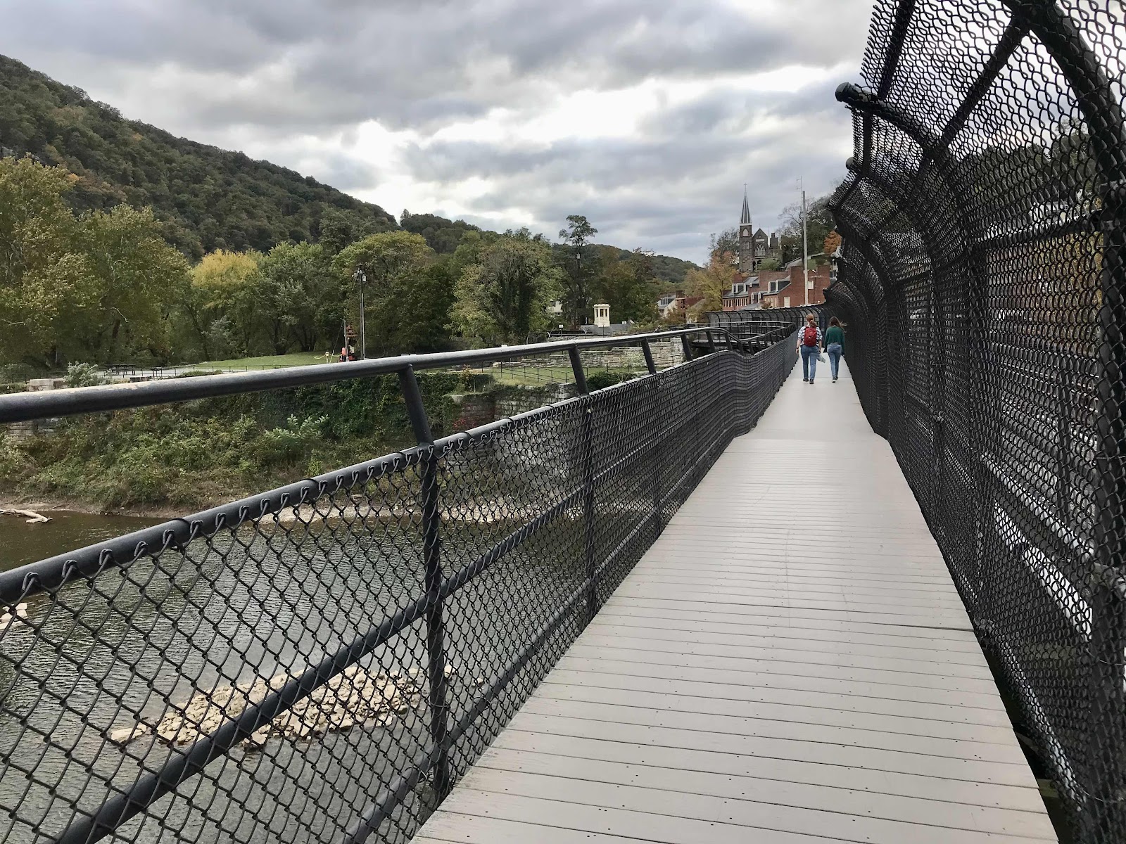
We find several nice rest areas along the river and really stretch out the day. The river valley is filled with big and beautify old trees. It’s going to be our last day on the AT until we resume next fall and we are in no rush. This chapter on the AT comes to a close as we cross the Shenandoah River on a pedestrian bridge and enter the town of Harper’s Ferry, now a National Historic Park.
We begin the task of finding a place to stay for the night. We were hoping to stay in a little B&B downtown but couldn’t reserve a bunk space. They fill bunks on a first come first served basis and they are full. We continue on and find a place in the good old Quality Inn! It’s over $100 with all the taxes but on our last night we don’t care. It’s getting late, after 5, by the time we check in and many restaurants will close by 6 or 7. We consider getting Italian food delivered but find a vegan place nearby and decide to walk there instead.
The restaurant is called Kelley Farm Kitchen. It’s a farm to table type place with a veggie filled menu. They have quite the selection of veggie burgers which we’ve been hoping for all day. They don’t have dine in, only to go and only outdoor seating. Had we known we would have called in our order in advance and taken it back to the hotel. We have to wait half an hour for it to be ready so we decide to take a walk to keep warm. We go less than a block and see a bar festively lit with strings of Edison bulbs outside. We would normally never go to a bar just to pass the time, but since it’s the last day of our hike, Jeff suggests we go get a beer. We’ve had only a few beers or wine the entire length of the trail. I agree and am glad in the end because Collette and Dakota are in there! We haven’t seen them since September when they got off trail for a wedding. We drink our beer and catch up with them. The proprietor of the bar lets us eat our take out in there, so we stay awhile. Rain is coming tonight and tomorrow and Saturday too. Collette and Dakota are having a hard time deciding whether or not to stay in town or keep going. In the end they go and we return to our hotel. They tell us they’ve been doing a lot of night hiking. That’s the difference between us and serious through hikers, we aren’t willing to walk at night or make any sacrifices that could potentially decrease our joy of being on trail.
If not for the upcoming days of rain, we may have kept going a little further. We kept thinking we would keep going to Shenandoah National Park, which is only about 50 miles away, but didn’t want to spend days waiting out the rain. In the end we decided that Harper’s Ferry was the easier place to get back on trail. It is also nice that we now have a little extra time to visit friends and family before we return to work. We now also have the time to go back for the full season in Aspen, starting before Thanksgiving, if we want to.
Tomorrow we will go to Stonybrook Farm, the 12 Tribes community in Hillsboro, Virginia and stay 2 nights. On Sunday Jeff and Terry will pick us up and bring us to Washington DC where we will rent a car and drive to Delaware and then New Jersey. On November 9th we will fly back to San Diego. We hope to come back next year in early September and give ourselves approximately a 2 month head start in finishing the trail. I had hoped we’d see more fall color and get to hike until all the leaves were down, but that will have to wait until next year. We lucked out with a late fall!

The view across the street from our camp in the morning

Ed Garvey shelter. Jeff is standing on the ladder in the back of the shelter that accesses the upper floor.

View of the shelter from the front with lots of nice sitting areas.

Weaverton Cliffs, views of the Potomac.
The view from Weaverton Cliffs. The C&O canal tow path follows the river to the notch in the mountains where Harper’s Ferry is located.

Jeff with the neat pine trees at the Weaverton Cliffs. There were a bunch of tilted rocks here with not much level sitting area.
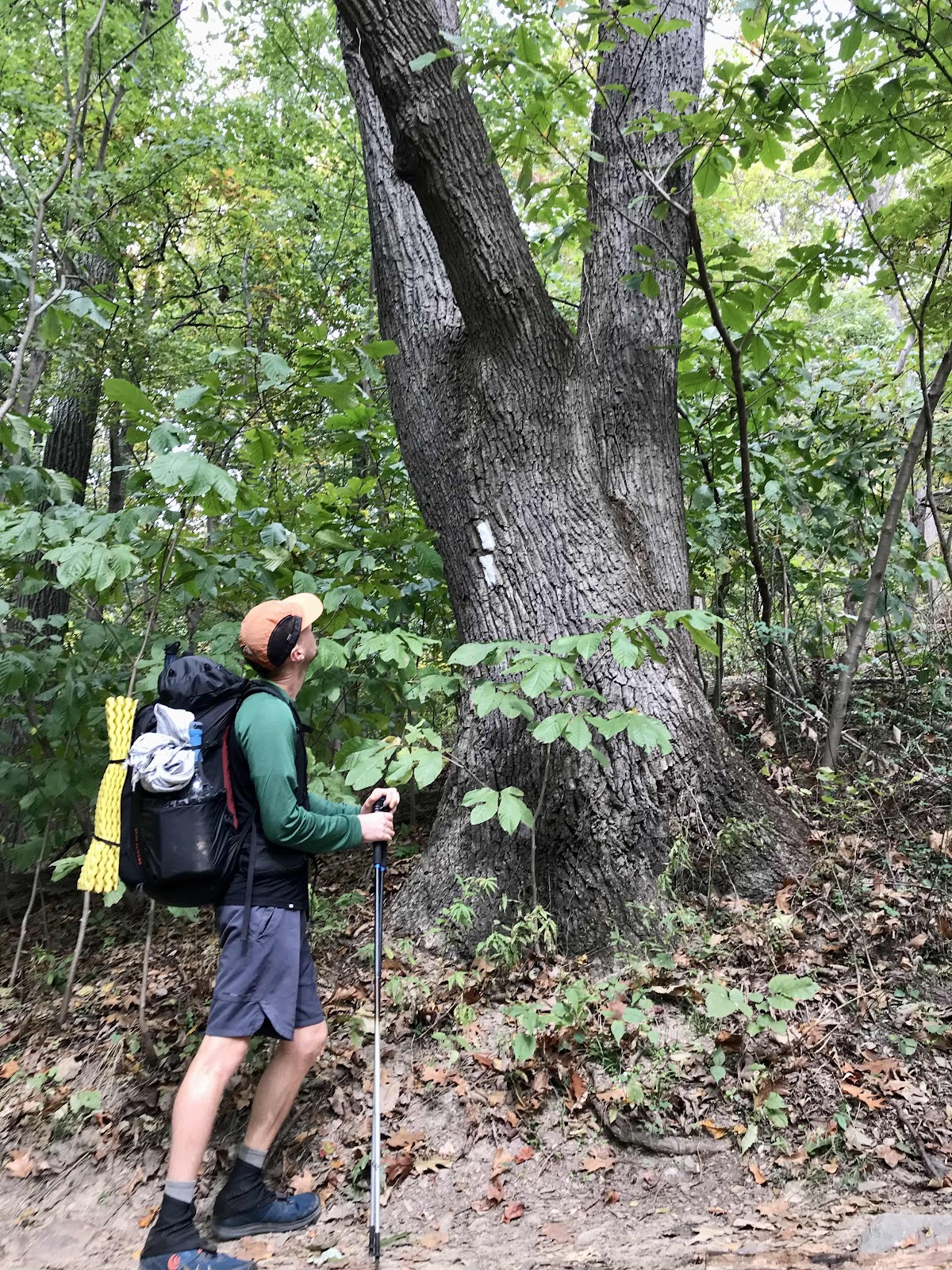
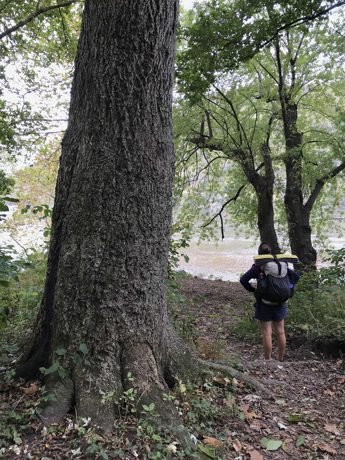
Jeff admiring a mighty chestnut oak tree

A nice map of the AT through Maryland

Crossing the train tracks along the Potomac River

The start of the walk along the C&O Canal Towpath

Really nice trees and easy walking along C&O Canal Towpath
There were ample side trail to rest areas along the river
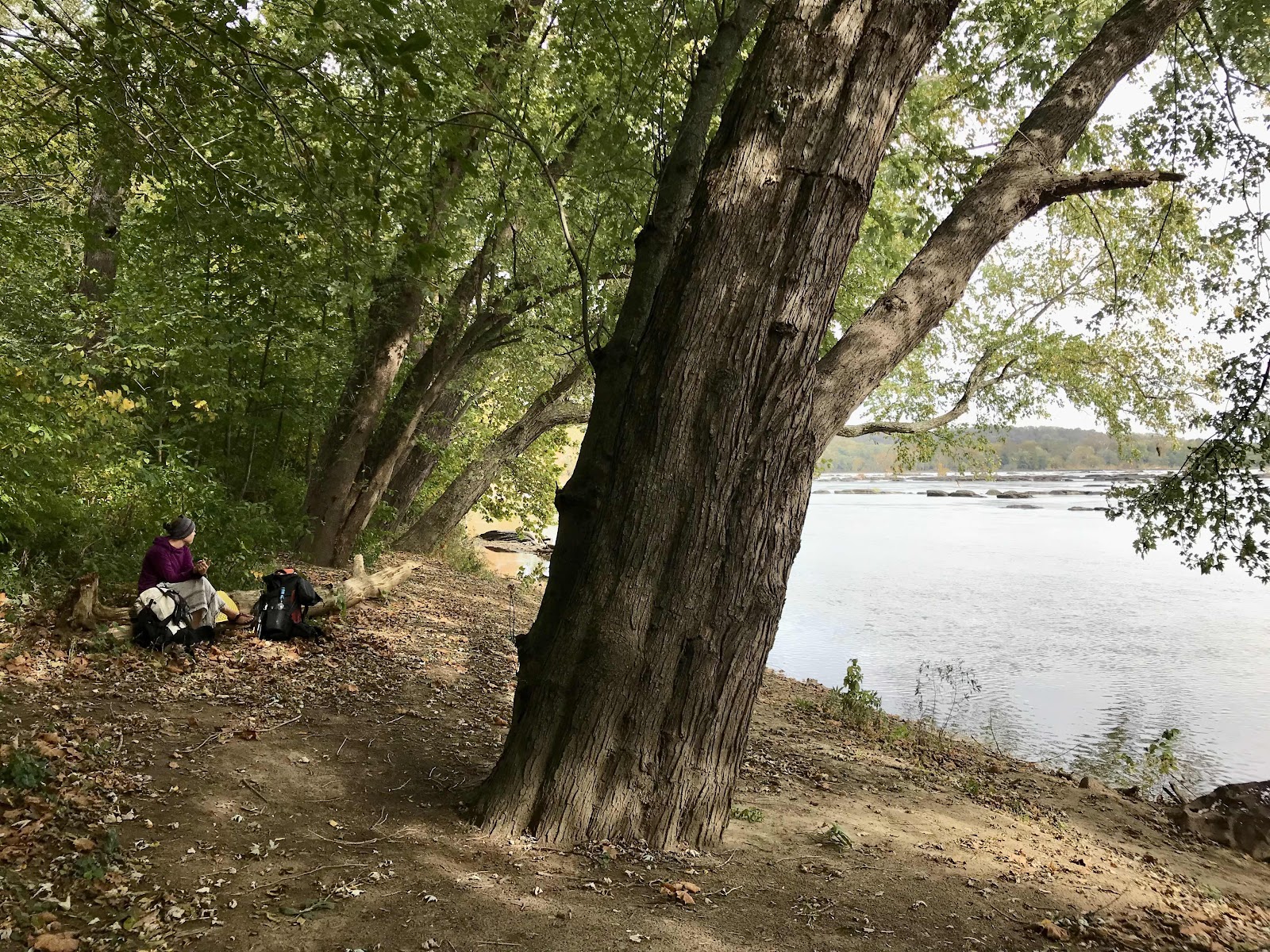
One of many breaks along the Potomac

The ruins of one of the locks for the canal towpath

View of highway 340 bridge over the Potomac. We walked under the bridge on the trail.
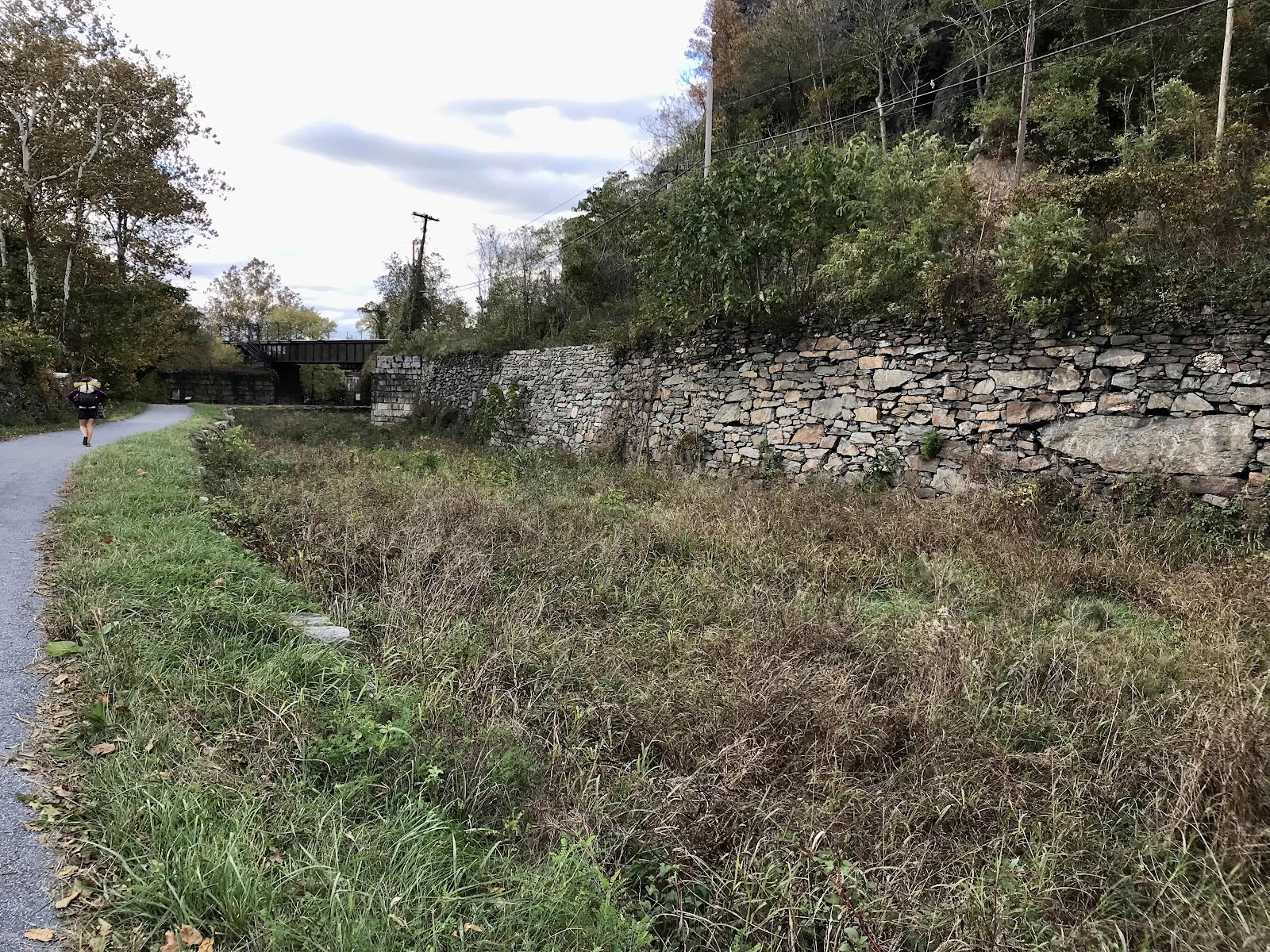
A really impressive retaining wall with one especially large rock along the canal towpath

Rail bridge over the Potomac and the path of the AT into Harper’s Ferry.

View down river from the bridge

Walking on the pedestrian walkway over the river
View into Harper’s Ferry

Looking back at the rail bridge and the tunnel through the cliff from town.
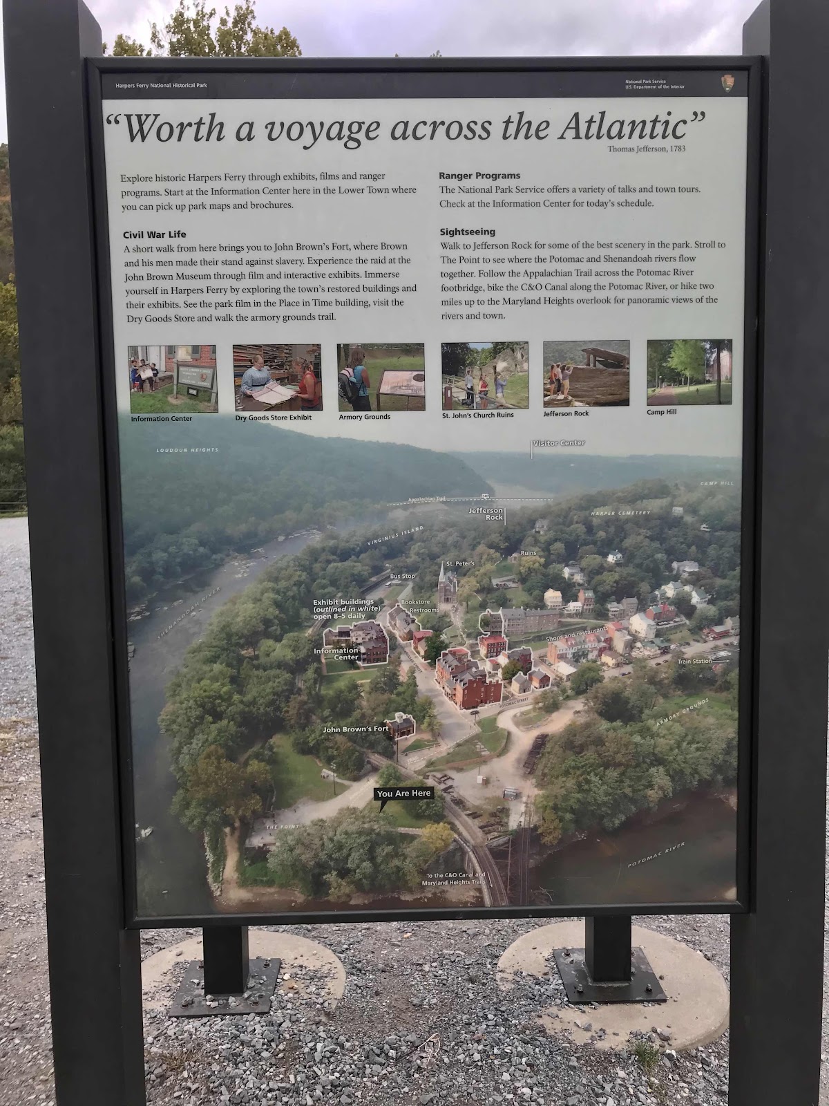
Information about town, it’s a National Historic Park. Detailed map of town.

Overview map of the area

Historic buildings and nice fall colors

Looking up High Street

Looking down High Street

The Town’s Inn B&B

Looking down on town from a hill. Can’t wait to come back here and spend more time exploring. It was getting dark soon and we needed to find a place to stay, so we hurried through.
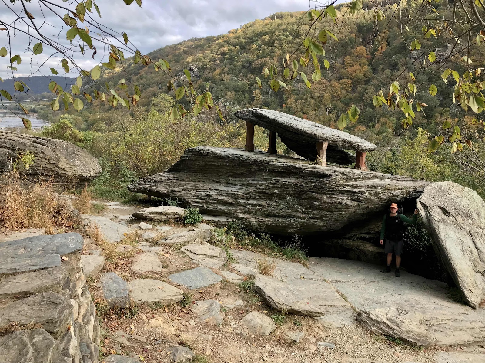
Jefferson Rock, a monument that consists of a balanced rock that was stabilized witty 4 legs.


Comments
Post a Comment