08/13 - 08/19 The White Mountains Part II
Friday August 13th
Madison Spring Hut
319.4 - 327.2 = 7.8
Miraculously the train does not come in the night. We were afraid of coming back to the hostel because of the train. We have been so tired and so desperately in need of sleep. We haven’t had a good night sleep since Gentian Pond. Which means we had 3 nights of poor sleep. As an all day hiker, sleep is very important. We had been worried we’d feel like crap again today and were also worried because we reserved an expensive stay in the Madison Springs hut for tonight, which is about 8 miles up the trail. Now we feel confidant that we will have the energy to get up there.
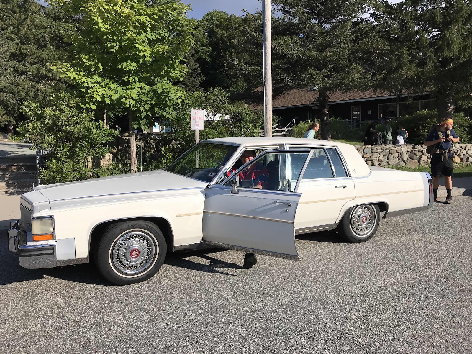
We are able to sleep in a bit til 6. We awaken feeling refreshed, having slept very deeply. We pack up quick and then I have the luxury of using the stove inside to cook our oatmeal for breakfast. The shuttle leaves at 7:30. There are a total of 6 hikers going back to Pinkham Notch, us included. Paul the owner drives us and we manage to all cram into his massive old Cadillac, 6 hikers and 6 backpacks in the trunk. Peter and Kae come too, they will be hiking the section we just did, but going northbound. They are essentially 3 days behind us now.
It’s nice being dropped off at a bustling trailhead for once, instead of the middle of nowhere. We get to use a picnic bench to finalize our packing and an indoor toilet in the visitor center before heading out.
We have an easy first two miles walking through the forest along an old road. It’s going to be another hot day, with a heat advisory in effect. With the high humidity, a sign at the visitor center informs us it will feel like 100 degrees. We have about 5 miles in the forest before we begin climbing. We’re now going into the Presidential Range, with the first peak being Mt Madison. We really take our time enjoying the cool shade of the forest and we take many breaks stream-side. There is abundant ice cold water flowing out of the mountains. We are sure to drink a ton of water, as we don’t want to be dehydrated or headachy.
Early in the day we cross over the Mt Washington auto road. It’s a toll road. Paul told us on the drive over that it costs $35 per car plus the driver and an additional $15 for each passenger. Apparently it’s an extremely expensive road to maintain. Today the “Climb to the clouds” auto race is going on. All day we hear the sounds of racing cars, but we never see them. The race continues Saturday and Sunday. Tomorrow we will be on Mt Washington, so perhaps we will see some cars then.
When we finally begin climbing, it’s steep and hot, but none of the steps require the excessive upper body work of pulling ourselves up on our trekking poles. We don’t have to squat or lunge or crawl, just normal steps up, repeatedly for a few hours. In total the climb is 3 miles and we travel at about a mile an hour with our frequent breaks. Eventually we get above the tree line and the views are phenomenal. We can see all of the mountains we hiked in the last few days, the Carter-Moriah range, Carter Notch, the Wildcats and the Wildcat ski area. We can also see Mt Washington and some of the auto road and all of Gorham. As we hike up the ridge we can identify Mt Madison and Mt Adam’s. Above the tree line we are in the alpine vegetation zone with some of the sweetest blueberries we have eaten yet, and lots of green lichen covered rocks.
We get beautiful afternoon light that makes the lichen practically glow. The trail above tree line is made up of rock of all shapes and sizes and at all angles that we must step. The exact route is not well defined, we just have to go up and along the line of rock stacks (or cairns) that loosely mark the way. It feels like we are on another planet. It’s clear, hot and sunny. We can’t believe how lucky we are.
Around 5 we reach the summit of Mt Madison. The hut sits in the saddle between Mt Madison and Mt Adam’s and it’s only 0.4 from the top to get there. We are probably the last people to check in, arriving just in time for the 6 pm family style dinner. This hut has a 52 bunk capacity! That just seems incredible to us to see so many people in one place on the trail. There is quite a network of trails in the Presidential Range, so people could have taken a number of different routes to get here. We passed many junctions on our hike today.
We are impressed by the vegan selection at dinner. There is a fresh green salad with balsamic dressing, tomato lentil soup and focaccia bread, rice, broccoli, curried falafels and even chocolate pudding for dessert. I am uncomfortably stuffed to the max after eating. We haven’t had this much volume in awhile. Hiker food is calorie dense and small. Jeff eats more than I do, and somehow feels fine.
The hut is run by college aged kids on summer break. They hike in all of the food on wooden frame carrying boards on their backs. We are very impressed with the wide array of food that they pack in.
After dinner there is a naturalist talk about alpine plants.
Before bed we take a short walk above the hut to Star Lake, an alpine pond. We can see Mt Madison reflected it in and also some neat large patches of white quartz rocks that really stand out. Before bed we take a few minutes to admire the stars, which are a rare treat for us.
Today has been an another amazing day on the trail.
Paul in his big old Cadillac
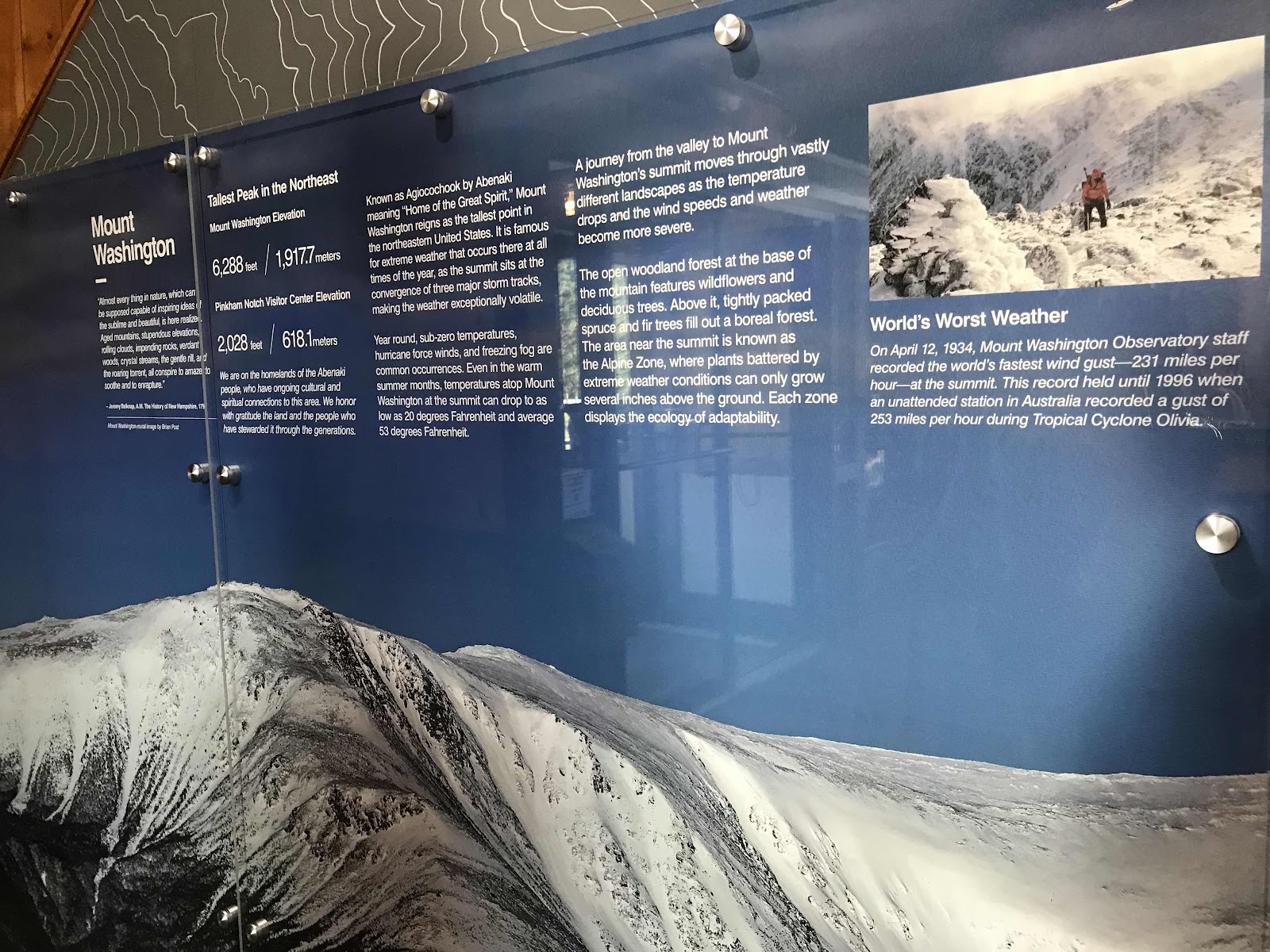
Some informational signage about Mt Washington having the “world’s worst weather.”

Mt Washington Auto Race this weekend


View of Mt Adams and Mt Madison from Low’s Bald Spot

A fine water source for drinking. We collect water in a bag and push it through our filter.
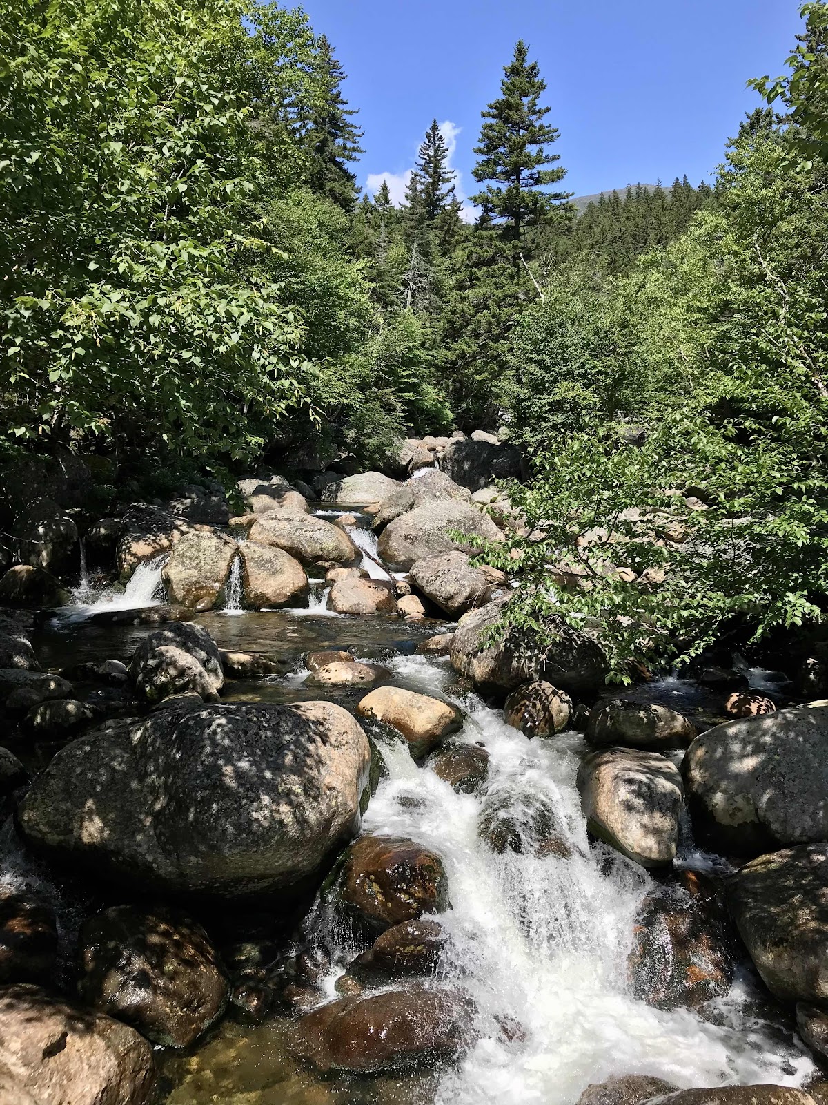
Tons of water flowing in the West Branch Peabody River. We crossed on a large wooden bridge high above the water.

View up the ridge near tree line

One of the few times we actually need our sunglasses!

Blueberries!

View towards Gorham

Rocks stacks and low growing alpine trees

Mt Washington with Pinkham Notch and Wildcat behind it
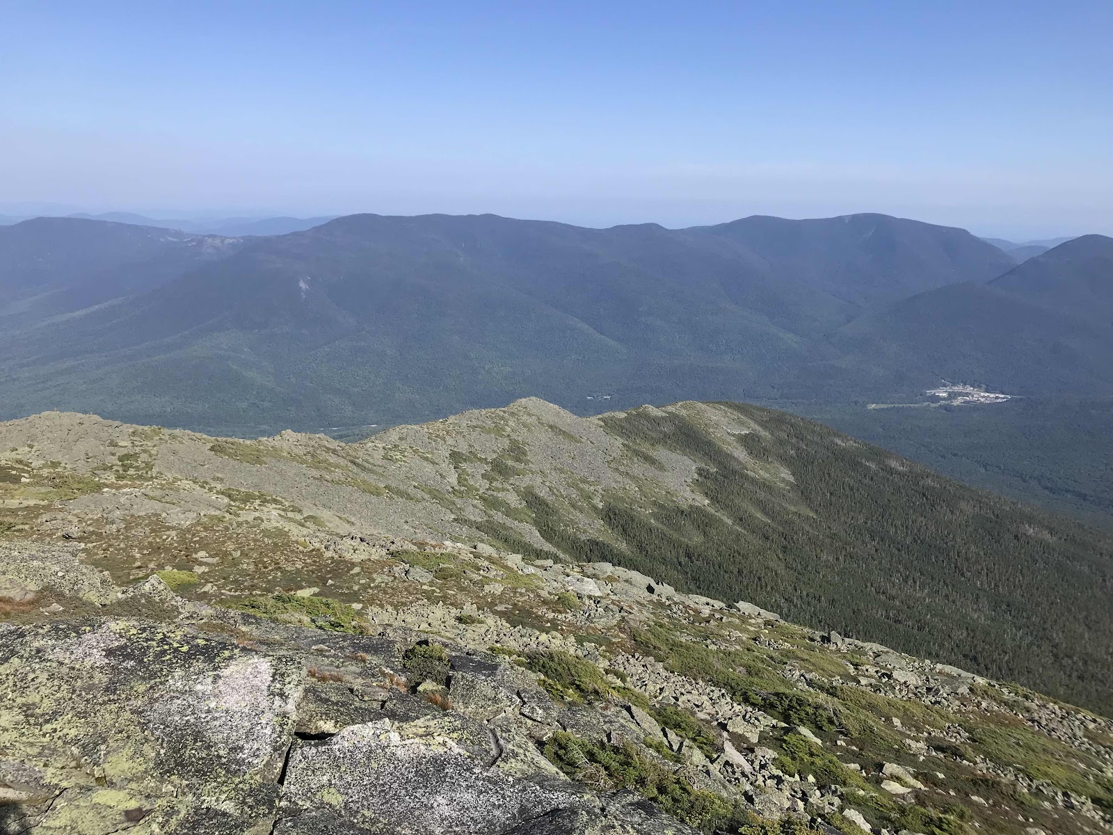
View of the Mt Moriah, the Carters and Carter Notch, where we were yesterday

Panorama toward Gorham
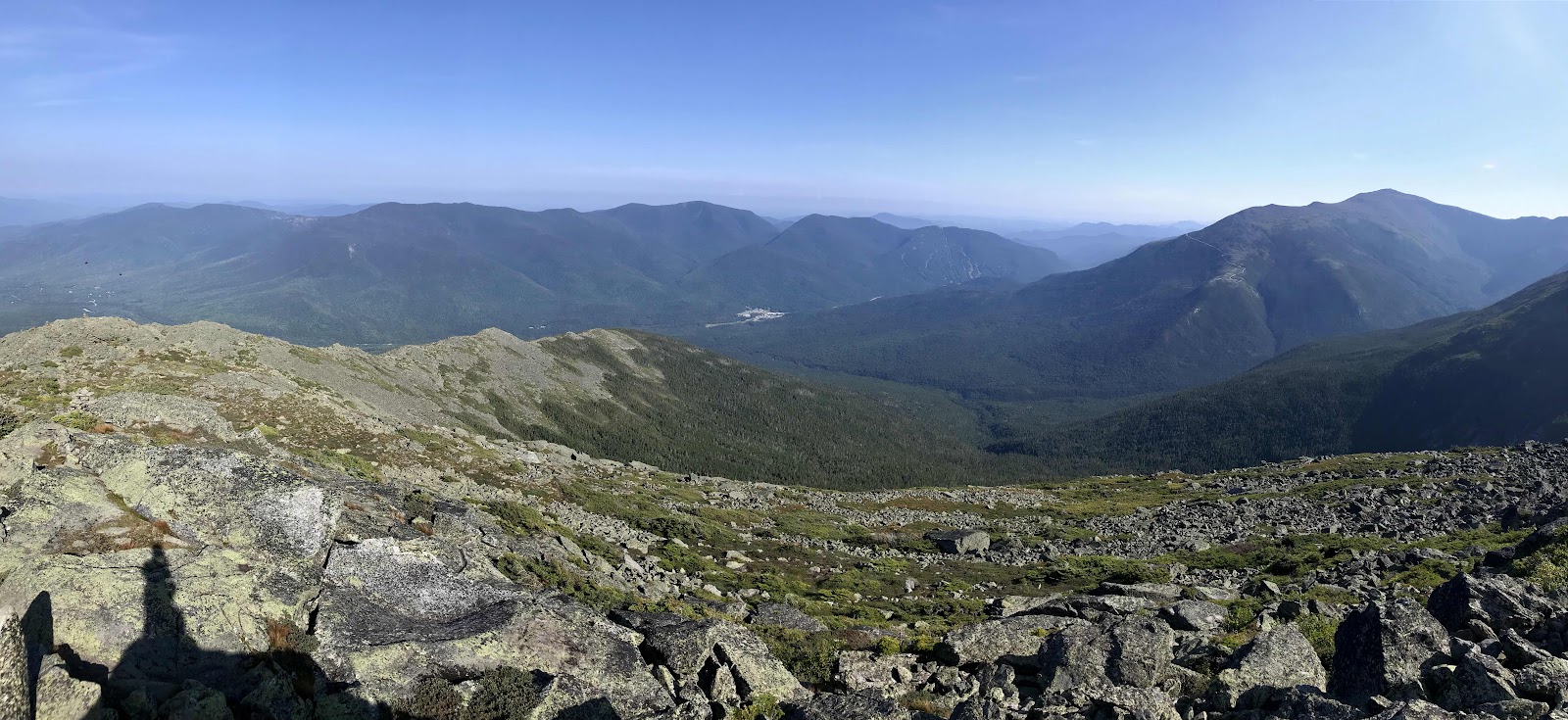
Panorama of Mt Moriah, the Carters, Carter Notch, Wildcat, Pinkham Notch and Mt Washington
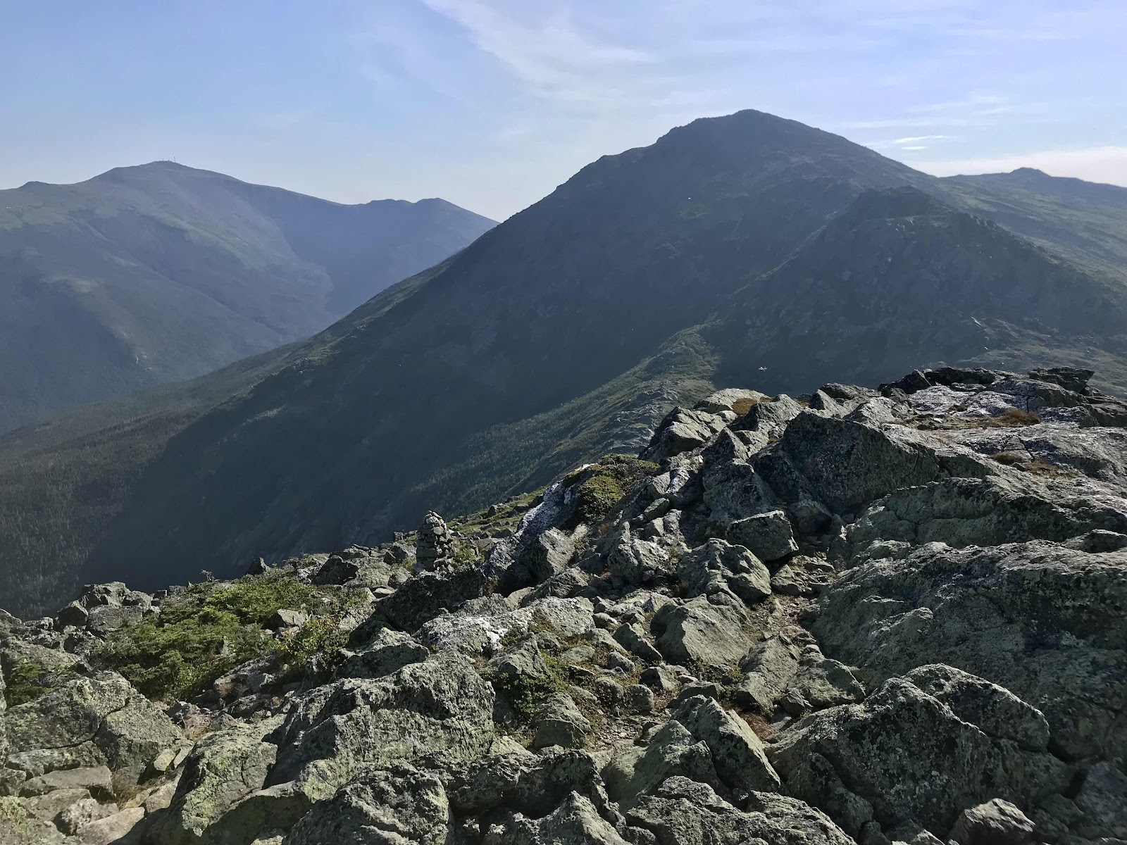
View beyond the valley containing the hut toward Mt Adams and Mt Jefferson

Madison Springs hut

Bunks are stacked three high with three stalls of bunks in a row on each side of the room. There are 18 bunks in our rooms and two other bunks rooms in the hallway outside our room. Each bunk has a little LED light in it and a ceiling light for the room that’s run on solar.
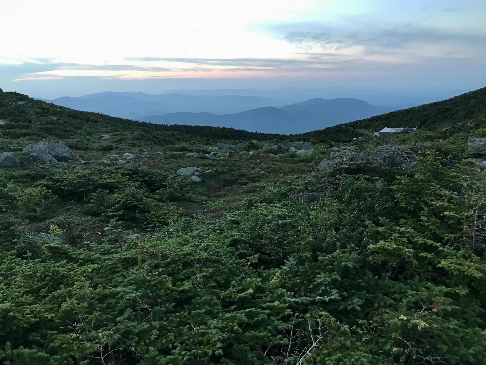
View off the mountain at sunset

Star Pond with Mt Madison reflected in it

Impressive quartz boulder. We could see it from the mountain top and it looked like a big patch of unmelted snow!
Day 35
Saturday August 14th
Lakes of the Clouds Hut
327.2 - 334.3 = 7.1
We had snorers in the bunk room and as a result didn’t sleep great. Breakfast is served family style, just like dinner. We make the mistake is sitting on the far end of the table and get passed the oatmeal bowl last, and barely get it any. The other breakfast options are pancakes, bacon and sausage and eggs made from powder. I get up to ask the crew if there’s any more oatmeal or anything else that’s vegan and they tell me the oatmeal is gone, but they have vegan pancakes and must have just missed me somehow. I am excited thinking I will get the same delicious ones we had at Carter Notch. I am sure the recipe is the same, but somehow they didn’t do a good job with them. Vegan and gluten free tend to go together by default and gluten free can be hard to do well. The pancakes are super gummy, but I eat them anyway. Breakfast is a bit of a disappointment, but oh well.
The weather report was calling for a storm today but it doesn’t look so bad out. There are clouds clinging to the mountains but they keep moving and exposing patches of blue sky. We had thought we might have to wait around the hut for awhile, but decide we don’t need to and get going right after breakfast. As soon as we climb the hill out of the valley, we enter the clouds and remain in them all along the ridge and up Mt Washington. We can see nothing but the rocks under our feet. It’s about 6 miles to Mt Washington, so it’s several hours of walking in dense fog. About an hour from the top, and without warning, since we can’t see the sky, we begin to get poured on. We really increase our pace at this time and start practically running up the stone steps the rest of the way. Near the top we have to cross over the tracks of the cog railway. You can take a train to the top of Mt Washington! The stupid train happens to be coming just as we are ready to cross. We have sideways wind blown rain pelting us and we just have to stand there and wait while the train slowly chugs it’s way along. It’s so slow!! When it finally goes past, it’s a single engine and a single car full of old folks on vacation and they’re taking pictures of us!! Finally we make it to the top, totally drenched and dripping rain.
We are lucky that Mt Washington is such a tourist attraction and there’s a warm indoor area for us to sit, complete with a snack bar and gift shop. We wore our rain jackets, but it was too windy for the umbrellas. My backpack is made of waterproof material and Jeff uses a water proof cover on his, so the contents of our backpacks remain dry. I am dry under my rain jacket, and although Jeff has the same kind as me, somehow he is soaked underneath. My sandals dry out quick, but Jeff’s shoes are completely soggy. Our shorts are both soaked and one of the first things I do when we get there is go into a toilet stall and wring out my shorts and underwear! Luckily we didn’t get too cold, since we were exerting ourselves by running up hill. We sit in the cafeteria area for three hours drying out. We take advantage of the hot water dispenser in the snack bar and make ourselves several rounds of tea and some refried bean burritos. We are hoping for clearing of the clouds. The weather report said the storm would pass by 2, so we hold out hope that it’s coming. There’s a weather observatory at the top of the mountain and they issue twice daily reports that are very detailed.
We can’t help but wish we had stayed at Madison Hut and retreated below tree line to camp. It’s always hard to decide what to do in these situations. If we had played it safe and sat in the little patch of sun there we probably would have been disappointed too, thinking we should have continued on.
We arrive to the top at 1 and wait until after 4 to leave. While we waited we watched from the windows as the wind blew the clouds around and revealed occasional clearings. It’s not raining anymore, but we are still in the cloud and the wind is howling. Our shorts never fully dried and I am worried about getting cold because we will now be descending and not working hard to stay warm. We run the short distance to the top to get a photo with the sign. While we wait our turn we see more patches of clearing, but they are not visible for our photo in which we are fully in the clouds! A wind speed of over 230 miles per hour was once recoded here, giving Mt Washington the designation of “world’s worst weather!”
It’s just 1.2 miles off the mountain to the Lakes
of the Clouds Hut, where we are hoping there may be a space for us to stay. It hasn’t been half an hour before the cloud cap is totally gone! Poof! Now we wished we’d stayed up there a little longer but we worried the longer we waited the less chance we would have at getting a space in the hut. It turns out it’s full anyway, but that we can go down the side trail below the hut just 0.3 miles to find a flat little clearing in the trees to camp. The trail is the Ammonusuc Ravine trail. The Lakes of the Clouds drain this way and eventually become the Ammonusuc River. We walk down stone slabs alongside water falls and there are beams of light filtering through the clouds and lighting up the valley below. It’s beautiful. There were supposed to be severe winds overnight and we envisioned our tent being torn apart and the rainfly whipping around all night and keeping us up. That was why we wanted to stay in the hut. It’s surprisingly calm though and we enjoy our little private camp spot with a view of the sunset and the valley and we also enjoy saving $270 by not staying in the hut. It’s been awhile since we camped alone and it’s nice! This is also probably our first campsite with a view, we never see the sun setting from within the dark forest! It would have been busy and loud in the hut tonight at the full capacity of 90 people! This is the most popular hut because you can ride the cog rail to the top and hike 1.2 down the mountain to the hut, making it the easiest hut to reach.
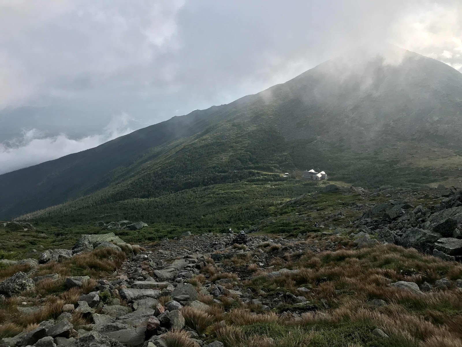
Looking back at Madison Hut as we hike out of the valley

Big rock stacks mark the way for foggy days like this

Here the rocks have been laid flat for easier walking and it is luxurious. This photo was taken moments before the rain began.

The cog rail road at the top
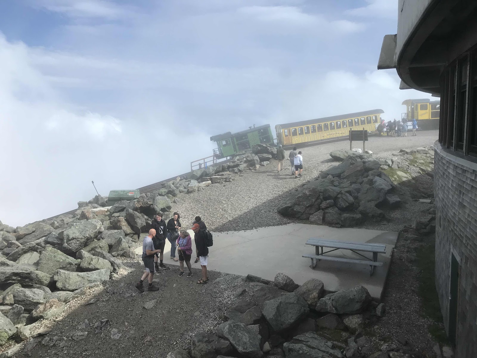
Same view a couple second later
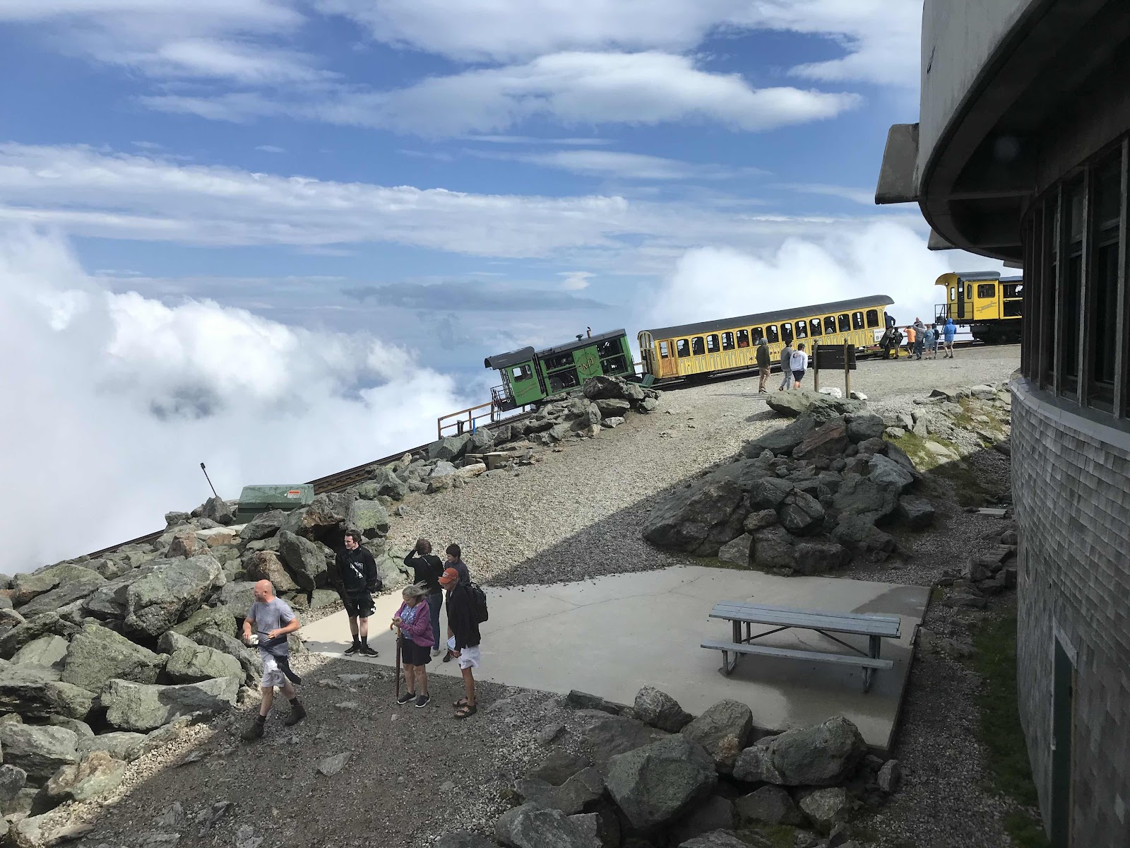
And a couple seconds more

The crowded interior of the visitor center and cafeteria where we sat for hours

Still in the clouds

Another clearing over the visitor center building. It’s built like a bunker to withstand that extreme winds.

View down towards Lakes of the Clouds as the clouds begin to break up

A clear view of the summit, exactly 30 minutes after we left

One of the Lakes of the Clouds with Mt Washington in the background
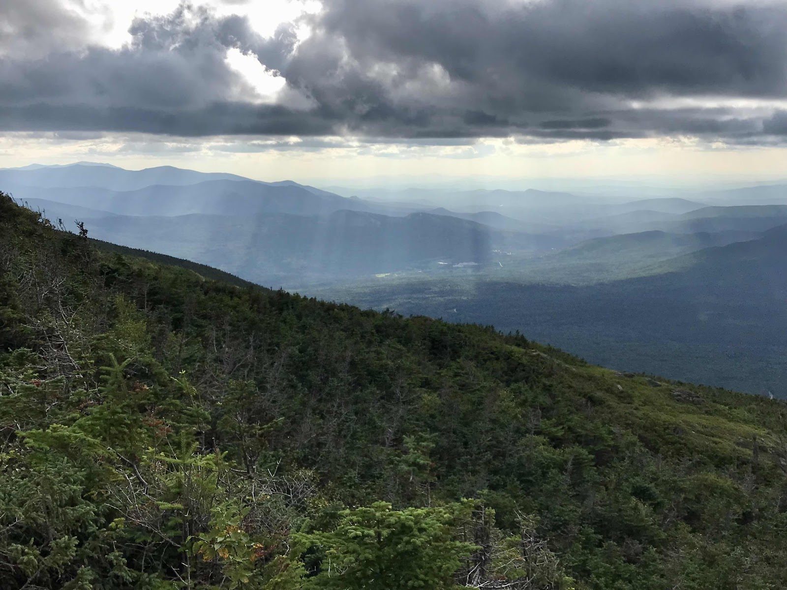
View down to Bretton Woods ski area and a valley with the giant Mt Washington Omni Hotel.

Down in the valley is where the cog rail comes from and it somehow goes up that ridge to the right.
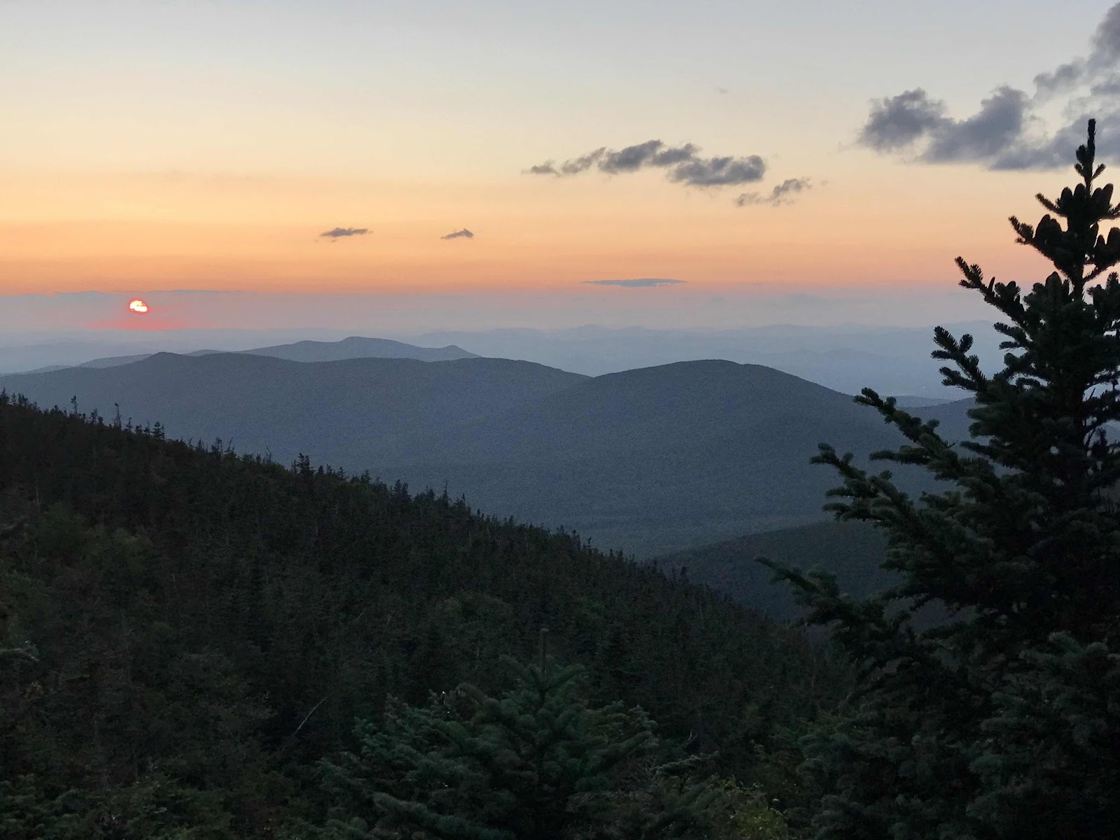
Sunset from our clearing in the trees
Day 36
Sunday August 15th
Mt Webster
334.3 - 342= 7.7
We toy with the idea of hiking the rest of the 3 miles down the Ammonusuc trail to the cog railroad station and riding the train to the top. It’s clear out today and we know we want to go back to the top of the mountain. Really it’s only me that wants to do it, Jeff never wants to do anything extra. If it were up to me, we’d take the train, it would be fun! This time he wins, we will hike back up the mountain instead. Mostly he wins because we both have to poop and we aren’t in a great place for doing so, as the woods are dense and not easy to fit through. So we hike back up to the Lakes of the Clouds hut and use the bathroom while they are still having breakfast. When we camp in a place without a privy we dig a hole with a small trowel that we carry. All backpackers should have one, digging a cat hole is the correct thing to do, but not everyone does what they should. All around our campsite there were obvious spots where people had crawled through the trees peed or pooped and left toilet paper and even wet wipes!! Gross!
We leave our backpacks outside the hut up against the building and head back for the top of the mountain. We take just my shoulder bag with a bottle for water and breakfast food. It’s only 1.2 miles and it felt short when we were coming down last night, but now it feels like a long way. The mountain clouds over on the way up and we second guess our decision to go back up, almost turning back. It’s cold and windy and the visitor center is not yet open when we get there. We have about 15 minutes to kill before we can get inside. We were hoping to warm up first, but we can’t, so we go around and look at the views from each angle and get a photo photo with the sign. Thankfully it cleared up and we can see the auto road, the railroad tracks, the whole ridge line we walked in the clouds, the valleys below and the surrounding mountains. I think the view was better on the way up Mt Madison, but I am still glad we came back up to see this.
Once we get inside, we use the hot water machine again and make several cups of green tea and oatmeal with dried cherries and cranberries and honey. It feels so nice to sit inside and eat a hot breakfast that we didn’t have to cook on our little stove and we don’t have to sit in the dirt and eat it! We feel so fancy!
We leave the top just before the first cars in the auto race reach the top of the mountain. So we never do see any of the race, even though we were around for the full weekend long event. As we hike down we see a hovering helicopter, presumably filming the cars and we can hear the cars too.
Back at the hut there’s two giant bowls of oatmeal left out on one of the tables for hikers to eat. Makes me wonder how the Madison Hut ran out. I didn’t think oatmeal was that popular! It’s one of our favorite foods though, so we happily eat more. There are dried apples and brown sugar for topping. There is so much leftover that I fill up one of my silicone bags with more for a later snack. There is also a hiker box in which we find and take a Costco sized bag of premium trail mix with dark chocolate chips in it. It’s noon before we leave there. Going back up Mt Washington was a time consuming endeavor!
We spend several hours hiking down the ridge. The AT sticks to the ridge and side trails go up and over more Presidential peaks. It was the same on the ridge yesterday. We did none of the side trails because there was no point in the fog. Today we don’t do any either because I don’t want to do just some of them and not all of them. Jeff says he’ll bring me back someday for all of the side trails! A full traverse of the Presidentials! The trail does go right over the top of Mt Pierce (4,310 feet), giving us a nice view back up the ridge. We stop to eat the leftover oatmeal with trail mix on it. It’s delicious like that!
In the late afternoon we reach the Mizpah Spring hut. The huts are spaced a days travel apart if you take the trails they recommend, which is only 7 miles, so that’s a leisurely days travel. On the AT they are not exactly 7 miles apart. They have leftover oatmeal at this hut too. Jeff doesn’t like oatmeal quite as much as me, so while I go for another bowl, Jeff eats some of his potato chips. He usually carries a bag of chips for himself as supplemental calories. I don’t eat them because chips don’t tempt me and also because I don’t lose much weight while hiking! We are able to buy $2 bowls of soup at the hut, minestrone with a slice of homemade bread and there’s enough oatmeal that I pack another bag out! It’s the day of oatmeal, we are making up for yesterday!
We make it a few more miles down the ridge and find a nice little alcove in the trees on top of Mt Webster. There is space for just our tent and no one else comes past. It’s another lovely evening of peace and quiet.

Looks inviting, but it’s freezing cold! There were people walking around wrapped in blankets. We were in our shorts because that’s currently all we are carrying for bottoms.
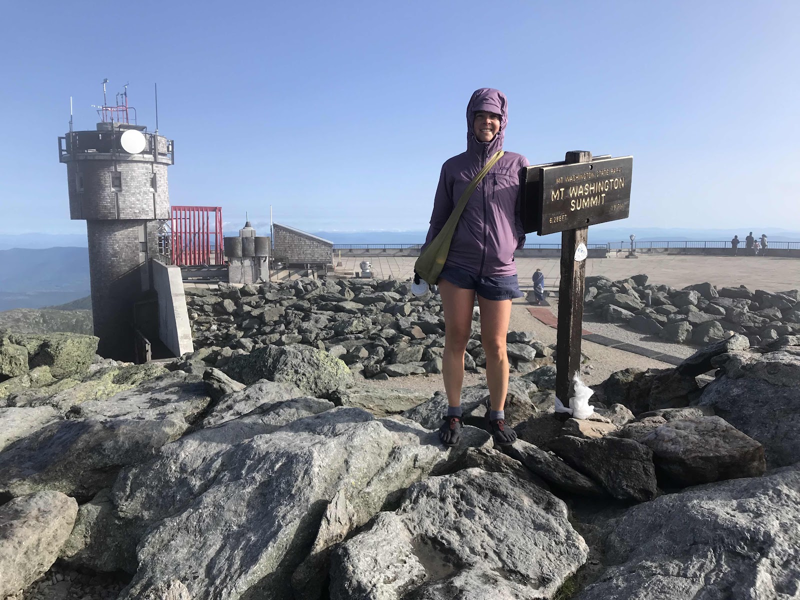
The observation deck is behind me and something to do with the weather observatory as well
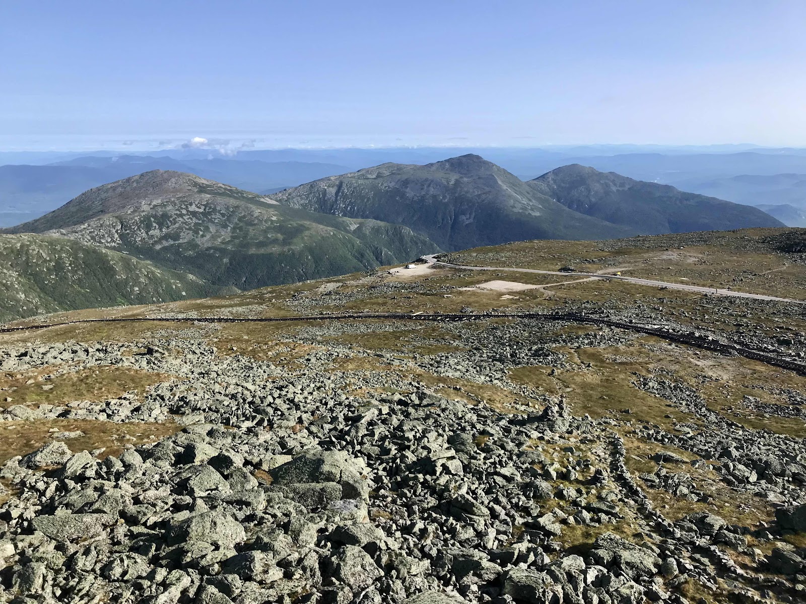
View of the ridge line we walked in the fog, Jefferson, Adams and Madison

The first train of the day reaches the top
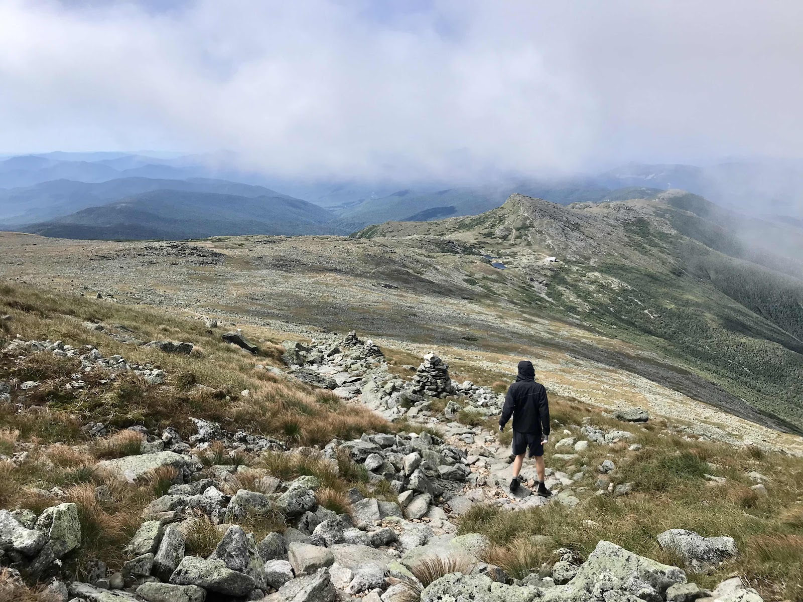
View on the way back down to the Lakes of the Clouds to retrieve our backpacks

View down to the Bretton Woods valley

Lakes of the Clouds hut
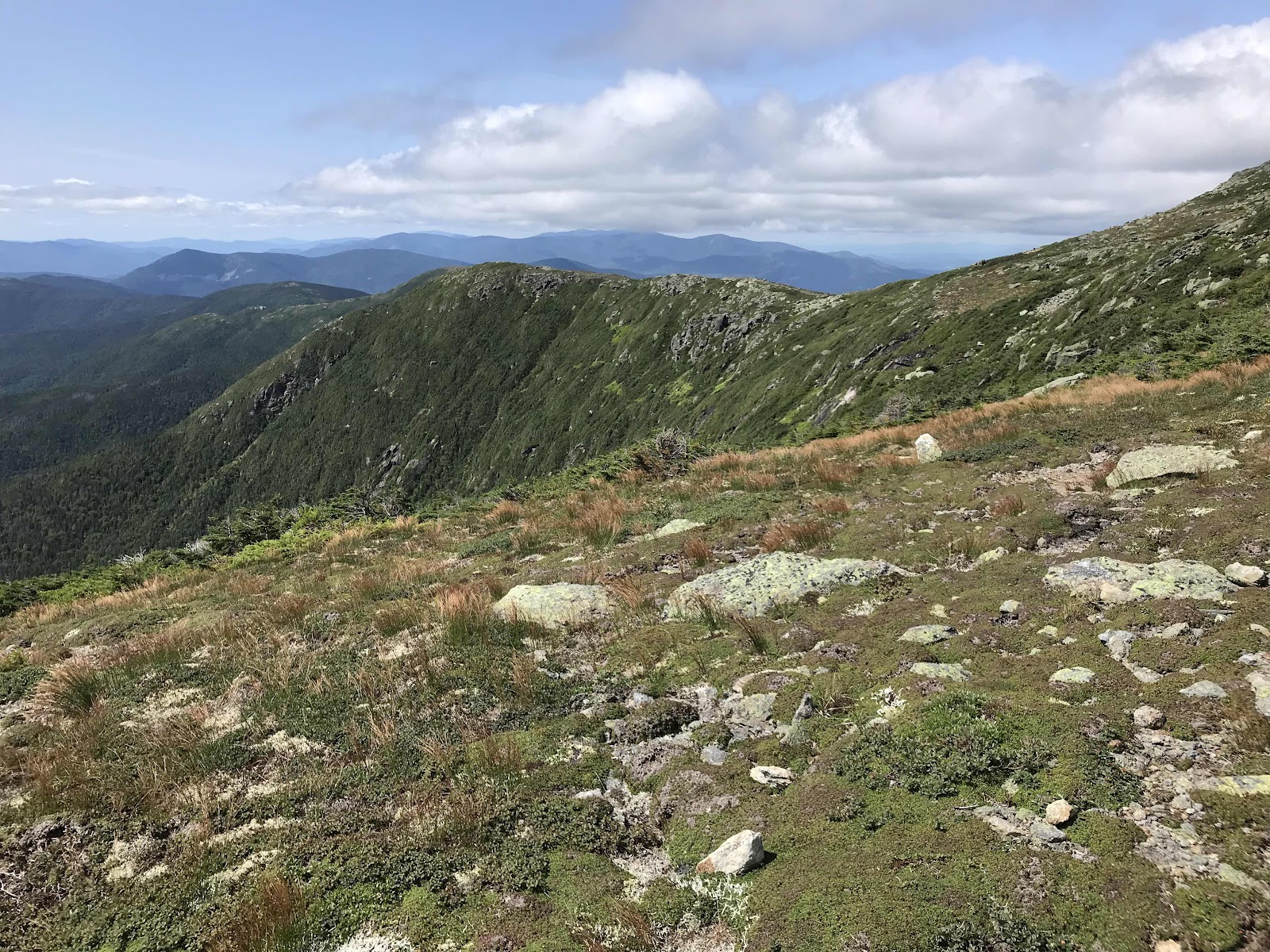
Looking down the ridge, our route for the day

Tons of day hikers take the side trail of Mt Eisenhower

View down to Crawford Notch

Looking back toward Mt Eisenhower and Mt Washington from Mt Pierce

Information about the Mizpah Hut

View from Mt Jackson, below Mizpah Hut. You can just make out the hut as a tiny dot on the nearest forested mountain.

Panorama from Mt Jackson, not named after president Jackson
Day 37
Monday August 16th
Ethan Pond Shelter
342 - 348.3 = 6.3
We get to have a leisurely morning sleeping in a little and taking our time getting down the mountain. Our friend Trevin, who we met last year on the PCT is coming to pick us up from Crawford Notch. We are lucky because although it’s a major highway down there, there aren’t any very close towns. We have to get down the Webster cliffs and we thought it would be somewhat technical climbing down walls, but it’s pretty normal trail the whole way.
We beat him to the road and sit in the dirt behind some parked cars while we wait. There is another hiker there, but we steer clear of him as we always tend to do with the NOBO hikers. The highway that runs through here is US Route 302 and there’s a state park here in the valley called Crawford Notch State Park.
Trevin shows up in his big, old and loud Caprice Classic. He immediately starts asking the other hiker what he’s doing and if we wants a ride with us. He is much nicer than we are! :) It’s a young kid, maybe 18 and he stutters badly. Trevin, aka Kitchen Sink, is load and blunt trying to figure out why he wouldn’t just at the opportunity for a ride. He’s waiting for a trail angel, but doesn’t have service to communicate with her and has no idea when she will show up. The young man is very indecisive about what to do, but Kitchen Sink practically bullies him into coming with us, and away we go! We are headed to North Conway, a tourist town about half an hour away. It’s the opposite direction from where Trevin lives. We get about 10 minutes down the road and the young man, whose trail name is Guido, gets cell phone service and sees that the trail angel was scheduled to show up at 11. It was 11 when we left there, so he starts freaking out and asks us to take him back! We also find out at this time that North Conway is a 45 minute drive, so we agree to go back and tell Trevin he can just bring us to his town, Littleton, which is only 30 minutes in the other direction.
The trail angel Guido is meeting up with turns out to be Queen Diva!! We are excited to get to see her again. Today she is doing Shepard’s pie. Jeff and Guido both have some. After about a half hour of catching up with her, we try to escape from Guido. Kitchen Sink feels bad for him though and is too nice and invites him to come with us to resupply at Walmart. So away we go again and we are stuck with Guido.
We head to Walmart first and get most of what we need. Next we go to Shaws, which is in the same parking lot. It is store that is in the Safeway family of brands, so even though the name is not familiar the inside and the store brands are familiar. We get a lot of our fresh items here. Conveniently there is a picnic bench outside where we can eat our fresh foods and repackage all of our other foods into our backpacks. I make us a really nice salad with local lettuce and tomatoes, an avocado, baked tofu and lemon juice. We also eat carrots and bananas and some vegan chocolate nut milk and chai drinks. It often seems like we can never eat enough in town, since the healthy things like salad fill us up but don’t give us many calories. I think of them as my vitamins and I must have them.
Once we are ready to go, Guido wants to get some kind of fast food for another meal. We take him to Subway and he first has to wait in line for 10 minutes to get in the bathroom. Then he orders his sandwich and eats it. Neither of us nor Kitchen Sink gets a sandwich, so we are just sitting and waiting on Guido. Our Subway stop eats up at least a half hour.
Finally we are on our way back to the trail. On the way back Guido seems a little more comfortable with us and talks a little more and seems to be talking more clearly too. He tells us weird random stories about his family. He is 19, just graduated high school last year. He was home schooled, that explains the lack of social skills. He got us trail name from his family. He says he used to call the guide button on the TV remote the guido button as a kid and also that he used to memorize a lot of the AWOL hiking guide, which made him like a trail guide. His name should have just been guide though, and not guido! He grew up getting to hike with his family a lot and I guess his dad has done some of the AT. In the end I am glad we were able to help him, but he sure was a pain in the butt!
We are back on the trail by about 5 or 5:30. We hike a few gentle miles back into the mountains, stopping at Ethan Pond campsite and shelter for the night. We get a tent platform to ourselves and have a quiet peaceful evening.

View into Crawford Notch from the Webster Cliffs looking Southeast

View into Crawford Notch from the Webster Cliffs looking Northwest

Panorama of Crawford Notch

Nice trail signage
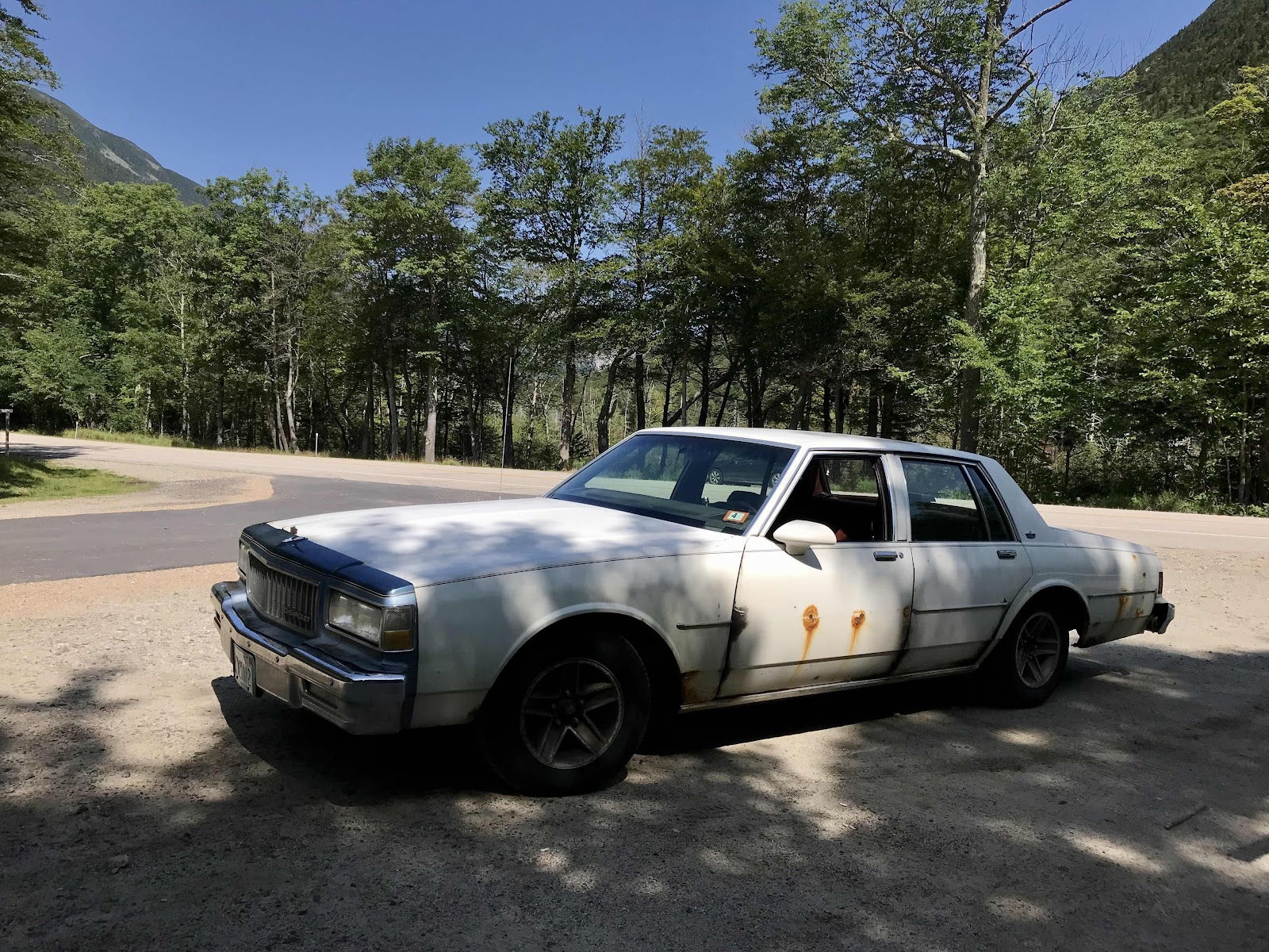
Trevin’s car
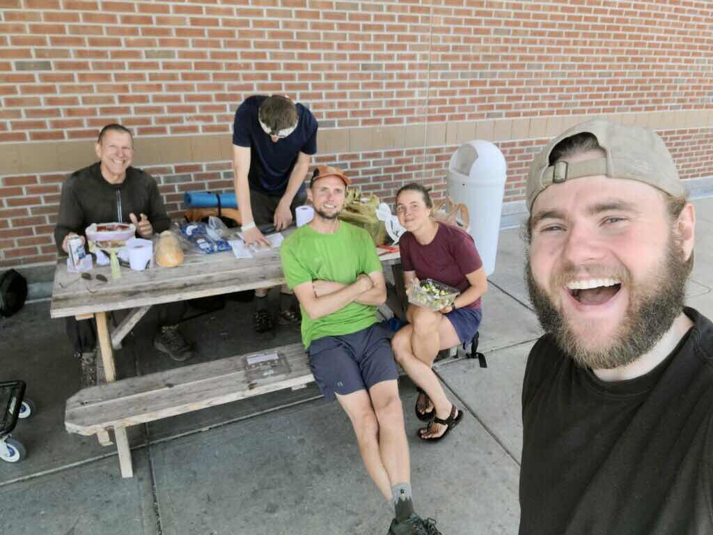
A selfie Trevin took us is all outside of Shaws, using their picnic table. A mother hiker showed up and joined us!
Day 38
Tuesday 08/17
to Guyot Shelter
348.3 - 357.3 = 9
It’s easy walking this morning down a river valley for about 5 miles. We take it leisurely and visit Thoreau Falls and Zealand Falls too, for foot soaking and swimming. Both falls are beautiful, cold clear water running over wide slabs of rock. We pass another hut around lunch time, the Zealand Falls hut. We buy soup and bread for $3. The bread is homemade in the hut and is very nice and dense for white bread. The soup is bean and veggie. We also get to finish up a plate of crumbly carrot cake that was a little burnt and not pretty enough to sell.
The summer hut crews have finished up their season and now the transition to fall crews is being made. In the meantime, alumni are brought in to take care of the huts, so there is a lady here that worked back in the late 90s and early 2000s in the huts. She has brought her family and along and they are attempting to get it all under control. I don’t know how long the transition lasts or if we will see more alumni at the next hut.
After the hut our easy walk down the valley is over and it’s time to climb again. It’s a steep trail, but with manageable steps and fine footing. We climb first to the Zealand Cliffs, with an amazing view of the river valley we just walked. We can also see back to Mt Washington and tons of other mountains around that we do not recognize yet. Next it’s on to Mt Zealand with its forested viewless summit. Finally we summit Guyot Peak at 4,580 feet, rising back into the alpine for just a short distance.
We leave the AT here and head a mile down the ridge to an established campsite and shelter called Guyot. Jeff remembers hiking here many years ago and wanted to come back and see it. We reach camp pretty early, around 4, and hurry to find an empty tent platform and set up. It’s a busy camp with some large group taking up most of the space. It’s been sunny, but the clouds increase as the day goes on. We want to take an additional little hike up nearby Bond Peak so we hurry to set up our tent and leave most of our stuff.
It’s about a mile each way to reach the peak. It has views of the mountain we have traveled over in the previous days, as well as the mountains that are still to come. We eat a snack on top and watch the clouds grow as a storm rolls in. We see lenticular clouds form, which look like flying saucers. Mt Washington gets its own lenticular around the summit. We call that a cloud hat whenever we see one form around a mountain. We can also see a mile down to the next high point on the ridge, Bond Cliff. If the weather was nicer, we’d check it out too, and the West Peak of the mountain as well, but we are limited by the growing number of clouds. We head back to camp and make it back just as the clouds and fog are closing in and it’s starting to drizzle.
We cook dinner under a tarp that’s been designated as the cooking area for the camp. You are supposed to cook in that area and store your food in the bear proof lockers to keep animals away from the tenting areas. It has been like this at all of the AMC sites we have stayed at throughout the white mountains.
We are ready for bed good and early, before it’s even fully dark. We are very happy to have gotten our own tent platform. We considered sleeping in the shelter, and might have if we couldn’t get our own platform, but we never sleep well in there. There ends up being about a dozen people in the shelter and all of the 10 or so other tent platforms have 2-4 tents on them. Most of the campers are just people out backpacking for a few days. There are only 5 other thru hikers that are going north bound. We haven’t seen any one we know in days.

Details about the fees and compost toilets. They give AT hikers a discount, we pay $10 each at the first site we stay at and they give us a pass for $5 stays at each additional site. Regular people pay $15 each!

More details

And even more!

View of the poop scooping tools and finishing bins

Ethan Pond in the morning. The campsite is in the forest, just up the hill from the pond.

Pemigewasset River

Side trail to Thoreau Falls. We will be hiking in and around the Pemigewasset Wilderness for the next few days.

I am enjoying the built in foot speaking hole just above Thoreau Falls, a natural pothole in the rock. It is created by the swirling of water over many thousands of years! Neat!

Thoreau Falls with Zealand Mountain in the distance

Some big tall larch trees. We don’t see many of these, but they sure are neat. They look like regular evergreen conifer trees, but they turn yellow and lose their needles in the fall!

An area known as the whitewall slide, a very nice flat section of trail

Looking up at the source of the slide

Nice mushroom colony

Zealand Falls. Sadly it’s not very photogenic right now. A wind storm a few years ago caused many of its bordering trees to fall.

A refreshing dip in the icy water

A more gentle stone slab waterfall right next to the Zealand Hut
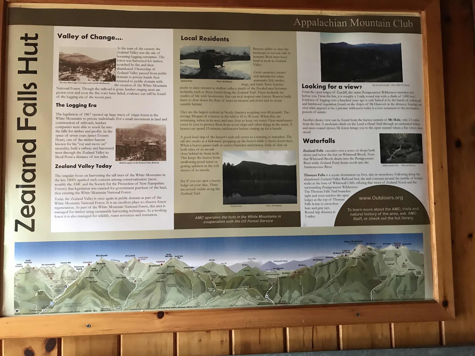
Information about Zealand Hut

Outside of the hut, with an old man glaring at us while we snap the photo.

More cool mushrooms!

View from Zeacliff, back toward the Presidentials

View from Zeacliff to the Pemigewasset River Valley and the WhiteWall Slide

View south from Zeacliff

Panorama from Zeacliff

Scenic Mt Zealand a 4000 footer. Many people challenge themselves to hike up all the 4000 footers in New Hampshire. There are many of them here!
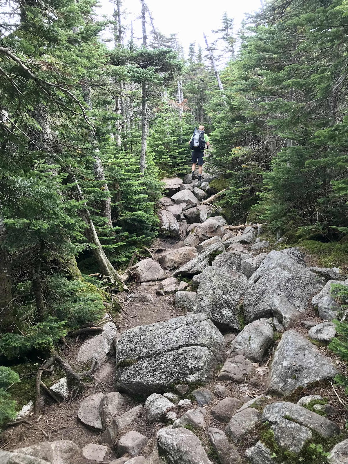
Just when the trail was getting a little too easy!

Mt Guyot Spur mountain, 10 feet shorter than the peak I am standing on while I take this photo

Looking toward Franconia Ridge from Mt Guyot 4,580 feet
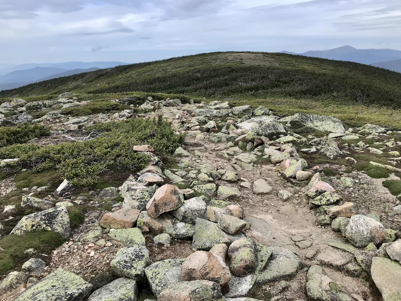
Mt Guyot viewed form Guyot Spur

View toward West Bond Mountain from Guyot Spur

View of Bond Cliff, would have liked to continue to walk the ridge, but didn’t

Lenticulars forming and a hat on Mt Washington
Day 39
Wednesday August 18th
To Greenleaf Hut
357.3 - 366.7 = 9.4
It’s foggy when we wake up and the rainfly on our tent is soaked. The rain has stopped though, and it’s warm out, so packing up is not miserable. We’re walking by 7:15 and back on the AT by 7:45. We have some easy walking on the ridge for a mile or so, then it’s a really steep drop down to the next hut, Galehead. We see lots of NOBOs go past, and it’s looking like they will have wiped out any chance of leftovers. We are pleased to find when we get there that there is still oatmeal left. I am able to fill a big bowl for us to share and there are still almonds and maple syrup left for topping as well. I bought dried currants at Walmart in hopes that I would be able to put them on leftover hut oats and I do! A lot of the food in the huts is premium local brands. The oats are from GrandyOats. They are organic and grown in Maine. The maple syrup is local too. We are also lucky to get bowls of lentil soup free of change from last nights dinner.
It’s cloudy and cool with low clouds today but we get occasional views. After the hut we must climb up Mt Garfield which involves going up many stone steps with a waterfall flowing through the trail and also a bit of climbing on slippery rock. Jeff is usually in the front and is first to see the hikers coming the other way. One old man tells Jeff it’s real slippery rock climbing coming up and to be careful. He sees me and shouts out in disgust, flip-flips!?? I tell them they are hiking sandals and he barks out a no, as if there is no such thing as flip flops. I tell him I’ve made it about 400 miles without so much as a scratch on my feet. He rudely and sarcastically tells me I must know what I am doing then! I get this sort of reaction often from old men in boots, in regards to my sandals. I try to not take it personal, but I am getting sick of it and it makes me feel annoyed for several hours after in interaction. The old men seem to think I’m reckless or something, but it’s really none of their business what I do! I have to answer questions about my sandals nearly every day and usually multiple times a day. Most of the young people are intrigued. A few days ago when we were leaving Madison Hut, a guy was fascinated, said I had such broad healthy feet, the healthiest feet he had seen! He even took a photo of my feet! Many others tell me I am brave! I have truly had no problems, no pain, no blisters, nothing.
We get a partial view from Mt Garfield. We should be able to see our next mountain, Franconia Ridge, but it’s hiding in the clouds. We were hoping it would clear up a bit more, but were prepared for bad weather. Last night on Mt Bond, we got good enough service to book another hut stay, the Greenleaf Hut up on Franconia Ridge for tonight.
We hike down from Mt Garfield and then up to Mt Layfayette (5,260 feet) on Franconia Ridge. We are fully immersed in the cloud for about the last mile and it starts to rain too. We put on our rain jackets and use our umbrellas like shields and stay dry and comfortable. We have a fine time hiking the last hour in the rain. We figure the mountain top has been in the cloud for about 24 hours now, as we watched the clouds come in last evening and they haven’t cleared yet.
To reach the hut we hike 1 mile down the ridge on a side trail that is no longer the AT. Most thru hikers never visit this hut, it’s too far away from the trail for them to even consider. This is something that we like about it! The side trail is nice, well placed stone steps.
There are only about 15 people staying in the hut tonight, so we get a whole bunk room for ourselves. It’s one large building with the kitchen and dining room in the middle and bunk rooms on each side. We actually have one whole side of the building to ourselves, with the rest of the people in rooms on the other side of the dining hall from us. Dinner is a delight, rice and beans soup, bread, salad, rice, fire roasted corn and bell peppers and BBQ lentils with shredded carrots. The meat eats get pulled pork. It’s delicious. We are the only vegetarians and they made huge bowls of the lentils just for us. It’s so much food that we can’t eat it all. They let us take our leftovers in our silicone stasher bags though and also give us an extra loaf of bread to take too! The cook tonight is the same one we had in the Madison Hut, her name is Al and she does a great job with our special veggie foods.
During dinner all of the crew introduce themselves. It’s all young girls tonight and there are 5 of them. They do this thing where they tell us which pronouns they use for themselves. They are all she/her. It must be something that AMC asks them to do, because it was the same at the Madison Hut. They also have some silly thing they tell each night and tonight it’s what animal they would like to be and then they ask the audience to share. Jeff says he’d like to be a leopard seal. Then a little girl at another table shouts out what’s your pronoun? Or something like that. Then Jeff reveals he has no idea what they’ve talking about and we then get a speech about pronouns and how each person can use which ever ones they identify with. I guess this is a new an important thing the young people do now, especially in the case of trans men and women, but we live under a rock. At least I knew what they were talking about…
Before bed we check for cell phone service and I have just enough to check the weather forecast. It looks bleak, tropical storm Fred is coming and could drop up to 3 inches of rain tomorrow. We may have to hike down the ridge and come back to the AT the next day.

Outhouse at Guyot Shelter
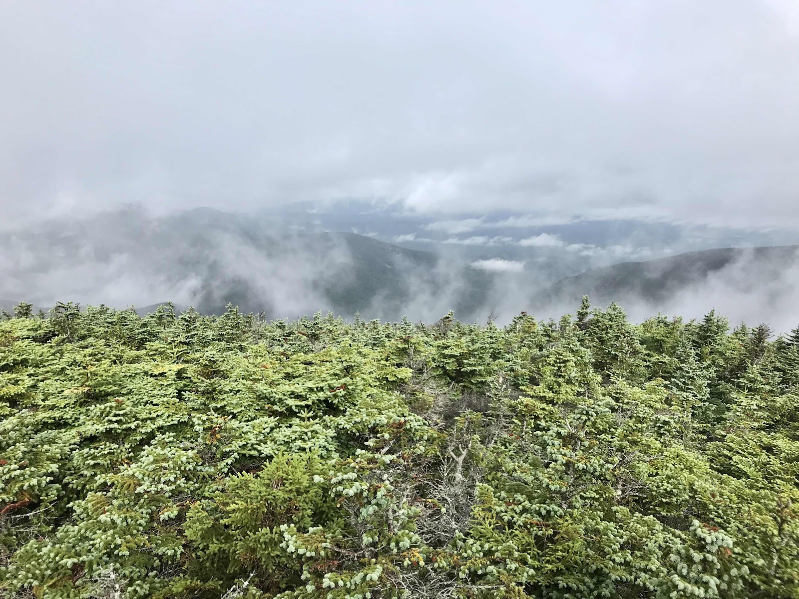
A little view from South Twin Mountain, just above the Galehead Shelter

Galehead hut in the valley below

Inside the donut hall at Galehead Hut

Outside Galehead Hut

Climbing the stone waterfall up Mt Garfield

The shelter at Garfield Campsite, we stopped here for a guaranteed dry lunchtime

View from Mt Garfield 4,500 feet looking toward Franconia Ridge

View of the Pemigewasset Wilderness and the Owls Head Mountain from Mt Garfield

Franconia Ridge clears up just a little more before we go up

Going up Franconia Ridge

View back to Mt Garfield just before we go into the clouds

View towards Franconia Notch, the highway valley below the ridge and the Cannon Mountain ski area
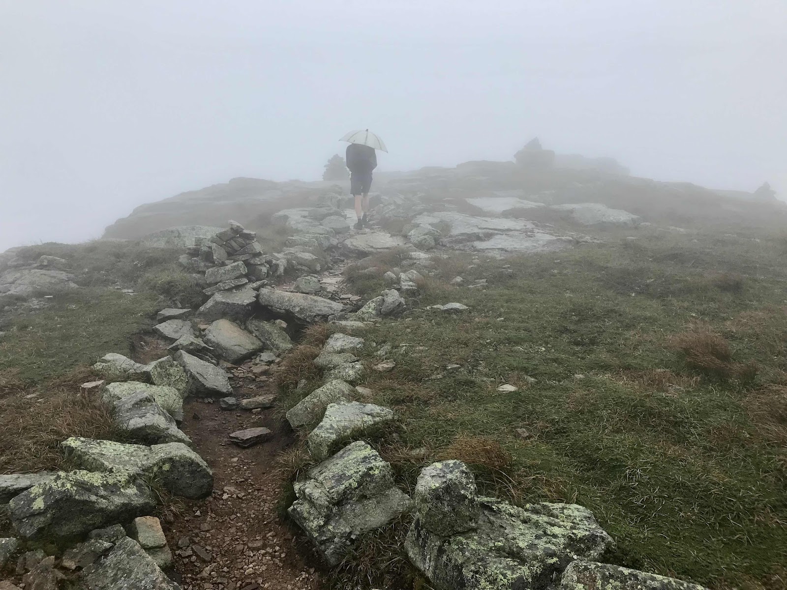
Nearing the top

Mt Lafayette 4,260 feet

Going down of the ridge toward Greenleaf Hut

First view of the Greenleaf hut

Eagle Lake viewed from the hut

During dinner it clears up for a short while and we get to see the whole ridge out the window

Then the cloud cap comes back

Sunset from near the hut

Got to watch the colors change for about half an hour
Day 40
Thursday August 19th
Hwy 93
366.7 - 373 = 6.3 miles
It’s foggy when we wake up and doesn’t look like we’re going to get to hike, but miraculously it clears out during breakfast! We eat oatmeal and vegan pancakes then rush to pack up. We race up the hill at top speed for us! I get very winded, but we don’t know how long the clearing will last. Once back on the ridge we get 360 views. There are lots of clouds around and on some of the distant mountains, but it makes the view more interesting. The AT continues along the ridge above tree line for about 3 miles as it passes over a few more peaks. The view are fantastic and it stays clear for us until we make it back into the trees. On the last mountain we watch the clouds start to blow in a get pushed over the ridge. Shortly after we get into the trees, the rain begins.
Just below tree line is the Liberty Springs campsite where we are able to stop and sit under the cooking and eating tarp and have our leftovers. They taste wonderful and it’s so nice to have a dry place to sit and eat them. From there down to the highway a few more miles, the rain continues. We have a pleasant time, remaining dry and comfortable thanks to the forest cover and the combination of our rain jackets and umbrellas.
Eventually we reach the bottom at Franconia Notch and highway 93. We take a 1 mile side trail to the Flume Visitor Center and the Franconia Notch State Park. The state park looks amazing. We’d love to one day come back. There’s so much nice recreation in New Hampshire with all of these state parks and the White Mountain National Forest! Trevin and his girlfriend Rachael come to pick us up and bring us back to Littleton. They live in a small apartment and have many roommates, so we get a room in the Eastgate Motel and they take us to the health food co-op for food. The four of us have a little party in our hotel room on lawn chairs from outside, while we eat delights from the store. Afterward they bring us to their apartment in the downtown area for laundry. The downtown is really nice and touristy and has been rated one of the best main Streets in the USA!! Trevin brings us back to our hotel just before hiker midnight (9 PM) so we can get out much needed rest.

Much better viewing of the Greenleaf hut today

Highway 93 valley

The lower part of Franconia Ridge viewed as we hiked back up Mt Lafayette

View of Cannon Mountain and the Cannon Cliffs from near the top

A better summit photo today, Mt Lafayette 5,260 feet
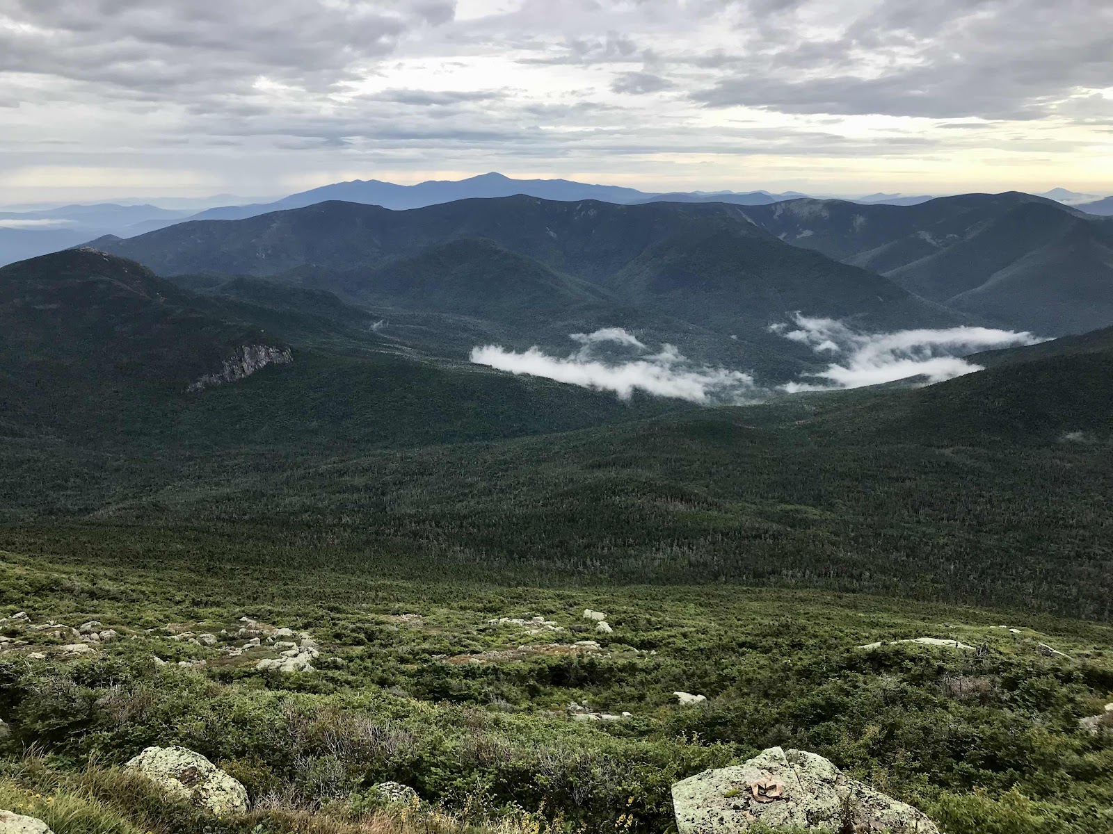
A look back at Mt Garfield, the one on the lower left, and the Pemigewasset Wilderness and the mountains we hiked on the day before, such as Mt Bond.

What we assume is an old stone foundation at the top of the mountain

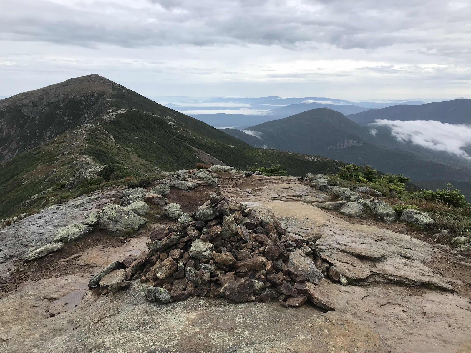
Hike down from Mt Lafayette toward Mt Lincoln 5,089 feet

Looking back at Mt Lafayette from Mt Lincoln
View back up the ridge
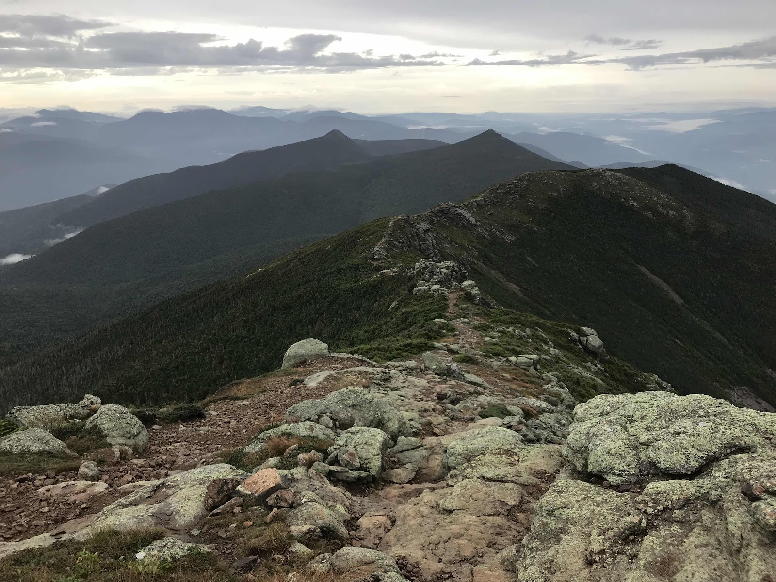
View down the ridge to the Little Haystack 4,780 feet

Clouds starting to form

Clouds on the surrounding mountains

Looking back on Mt Lincoln as the clouds come in

Walking in the rain

Nice big birch trunk

Nice recreation map of Franconia Notch State Park
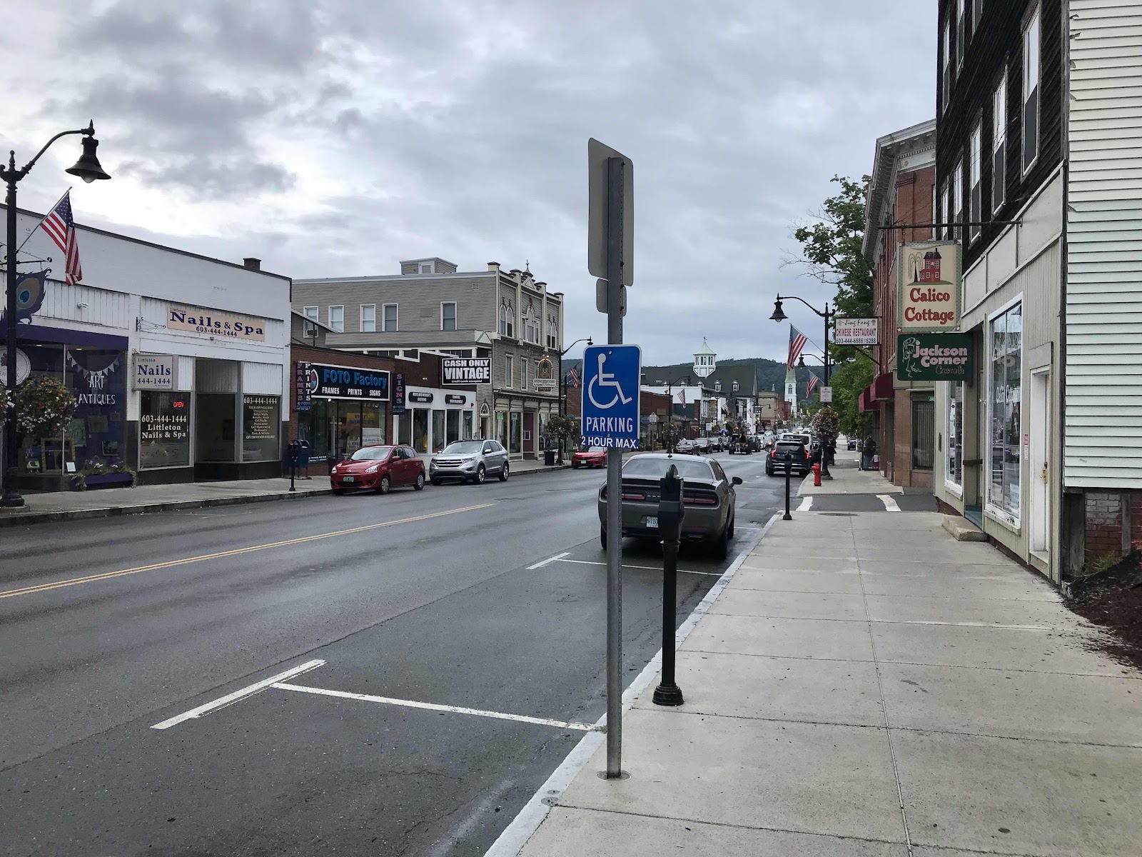
Downtown Littleton

Barley the Bernese Mountain dog, inside the beer store

Jeff is the dog whisperer. Barley is splayed out after wrestling with Jeff.


Comments
Post a Comment