09/16 - 09/21 Southern Massachusetts and Connecticut
Day 68
Thursday September 16th
North Mt Wilcox Shelter
639.9 - 655.7 = 15.8
We tear ourselves away from The Berkshire Lakeside Lodge relatively early because we have a long way to go. It’s about 8:30 by the time we are walking. We want to go 15.8 miles today and for us that takes focus. We have to stay focused on walking and not take super long breaks and not get distracted for too long, dilly dallying, looking at trees and mushrooms, etc. Dilly and Dally should be our trail names, haha. Try as we may we are not crushers of miles.
Today ends up being a particularly good day for mushrooms and they distract us. We find lions mane mushrooms and it’s the only day we have seen them. They are mesmerizingly beautiful! We stop to cook some for lunch and a cooked lunch is always time consuming. The only way we have to cook anything is boiled in the jet boil, so that’s what we do. Lion’s manes are often compared to lobster or crab meat. We eat them in our bean burritos with a luxury item, an avocado!
The forest is rather boring today, thick and jungle like and a bit dark. It’s always a challenge to feel awake when the light is dim in the forest. We pass by one of the highlights of the Maine AT, Upper Goose Pond Cabin. It is off trail about a half mile and it’s a cabin staffed by a National Park Service employee who lives on site in the cabin. Normally hikers can sleep inside in a bunk room. It was closed last year for Covid and opened this year to limited numbers of hikers earlier in the season, but it’s now been shut down again. It would be a neat place to visit when the cabin is open and when it is also warm and sunny for swimming in the lake. There are canoes for overnight users as well. Jeff remembers staying here when he hiked the Massachusetts section of the AT about 10 years ago. He even remembers the caretakers making pancakes in the morning! We don’t even bother taking the side trail.
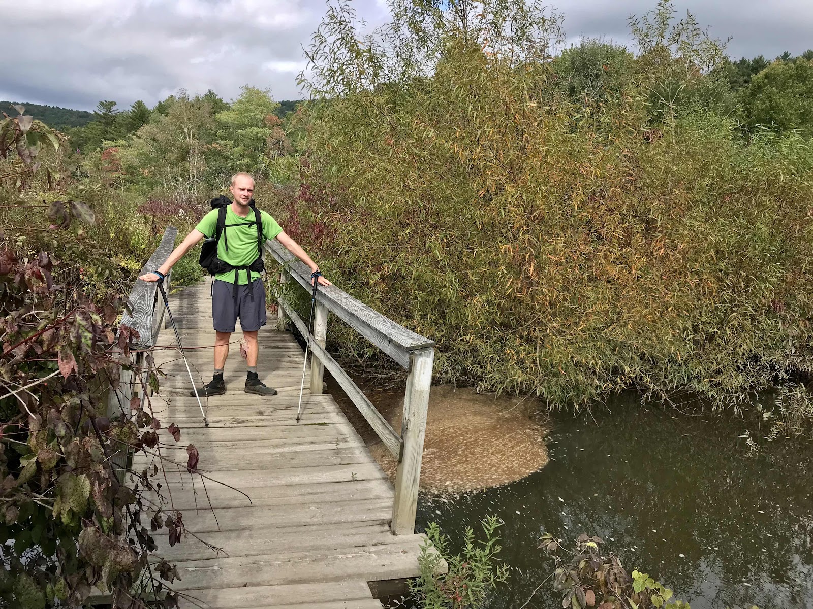
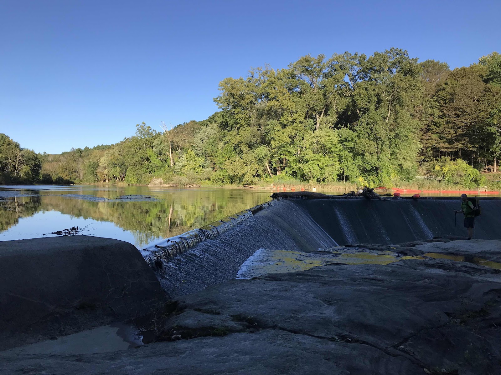
Our day gets a little more interesting when we enter a low elevation valley and pass through some meadow lands and cross some roads near Tyringham. In the afternoon we have a view of the valley from Tyringham Cobble. By late afternoon we are determined the make the miles and hike until just after dark to complete them. We reach the North Mt Wilcox shelter, which is nearly half a mile off trail, and are delighted to find that it is empty. Hikers go to bed so early because there isn’t much to do once it gets dark, so we feel bad whenever we arrive late and have to make a bunch of noise cooking dinner and setting up camp and using our headlights and lanterns. We get to sleep in the shelter and make all the noise we feel like. We have more mushrooms to cook for dinner! The woods are creepy in the dark when you haven’t had the chance to see around you in the light. Adding to the creepy factor, just after we arrive we hear an owl hooting very nearby in a tree. Then the owl starts communicating with a nearby owl and then really go at it making noises we’ve never heard owls make!

The AT crosses Interstate 90 on a pedestrian bridge

View of I-90 with a roadside sign for The Berkshires

Upper Goose Pond

Beautiful cascading Lion’s Mane mushroom


Meadows near Tyringham

The AT goes through a field near the little village of Tyringham. We often walk though private fields and are supposed to just stick to the trail and not wander.
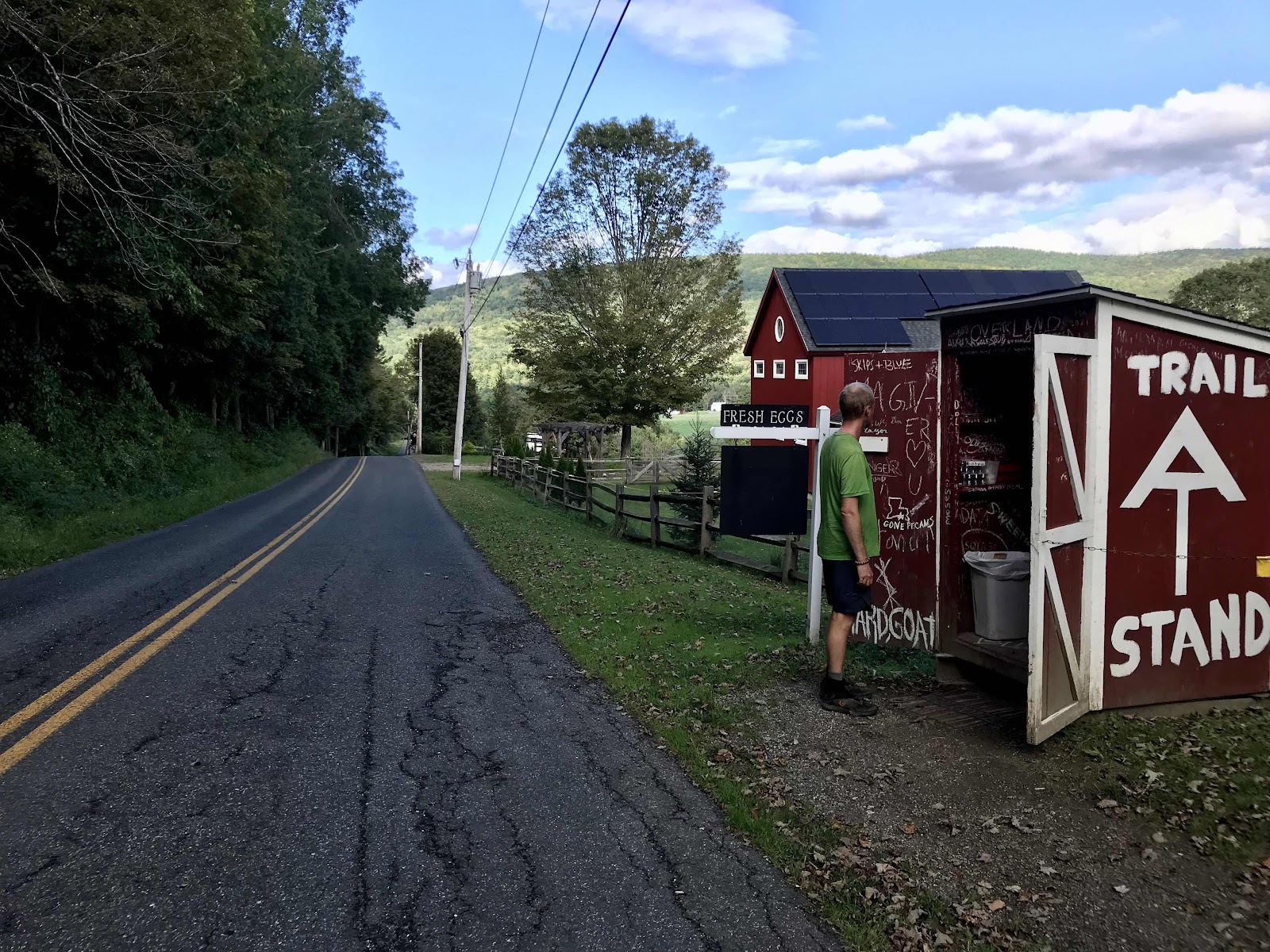
Jerusalem Road crossing. The people that live in this house where the trail crosses the road have set up a little self serve hut for hikers. They sells eggs, ice cream and cold drinks. They only had sugary drinks when we were there and I couldn’t bring myself to drink one!

Inside the roadside hiker hut. The fridge is connected to electricity and inside there was sugary tea and sodas. Too bad there were no snacks or produce when we came through.
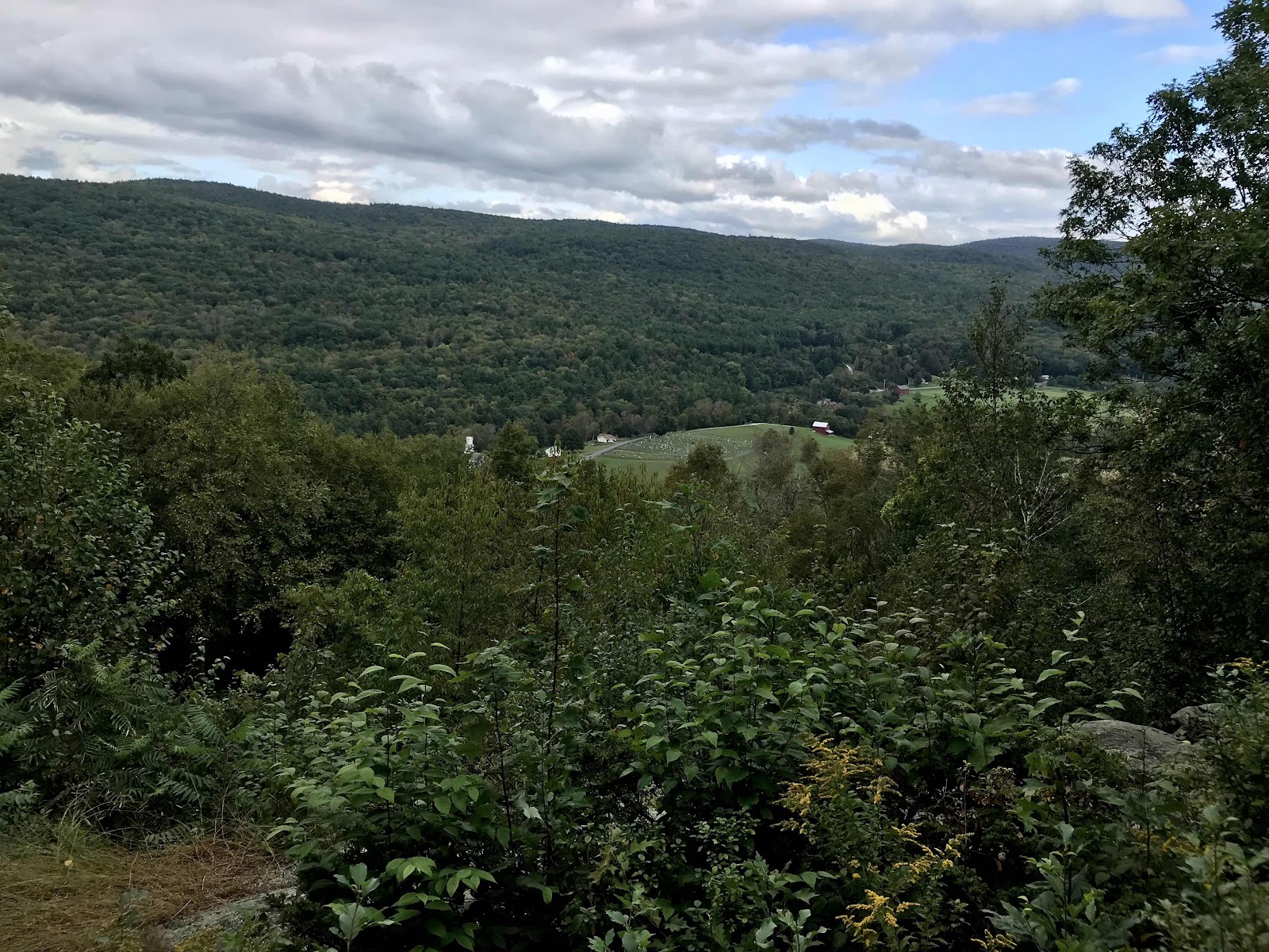
View from Tyringham Cobble

Another field and an impressive set of farm buildings in the evening near Tyringham
Day 69
Friday September 17th
Great Barrington
655.7 - 669.2 = 13.5
It rains a bit overnight but we are warm and dry inside the shelter. It sounds rainy in the morning with all of the dripping of leaves, so we are slow to get out of the shelter. We find out it’s barely sprinkling once we get walking, so we don’t need our umbrellas or rain jackets. We keep getting lucky with the rain always seeming to come overnight.
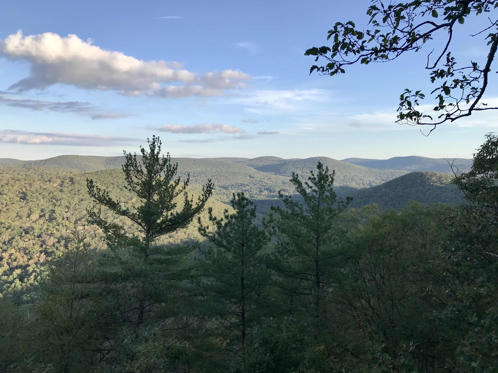
Our energy levels are a mystery to us. You would think after a big day yesterday and hiking late and not reclining for a terribly long time overnight that we’d be tired, but somehow we’re not! We have good energy all day! I think more interesting scenery helps to keep us more awake and energetic and today we have pretty open forest that lets light in and for much of the day we are walking along a forested ridge with occasional open ledges for long distance viewing.
We are nearing Great Barrington, the next town, which is known as the gateway to the Berkshires. We hadn’t planned to go to town since we have enough food, but there is a big gap in camping tonight, so our hands are forced. Really, it’s Jeff’s hand that is forced, I’m always happy to go to town! It’s a pretty easy day for us. A few miles before we reach the highway, we call a local trail Angel, Papa Joe, he gives rides on a donation basis. He likes to be done shuttling by 5, so we do a bit of trotting to make it there in time. We are glad to be running any way as the last bit is in mosquito infested lowlands, across the Housatonic River and through a no mans land of corn fields and irrigation canals. We are glad for a ride, as it’s a pretty busy highway with not much shoulder, and we don’t like hitchhiking anyway. Papa Joe is an older retired guy who has been in the area for 8 years. He says last year he shuttled about 400 hikers! Even even collected data and has neat spread sheets about the number of hikers going north, south or flip flopping, male vs female and the types of gear. Less than 10% of AT hikers go southbound like us. He gives us a little tour of town and drives us a few miles into the outskirts to the community recreation center, where hikers are allowed to camp for free in a grassy field. We are very grateful to be allowed this option, as it’s Friday night and hotel prices are double what they are mid week. We don’t need to pay $150 for a hotel, so we happily camp in the grass. Hikers in the past have been allowed to go in and pay for a day pass to shower and use the pool, but that hasn’t been allowed recently due to COVID.
We sit for a few minutes at a picnic pavilion in the field and quickly learn that it’s a mosquito haven! We decide not to linger or attempt cooking dinner. Luckily there is a little strip mall down the street with a few restaurants. We go out for a delicious Lebanese food dinner. After dinner we quickly build our tent while frantically swatting away the mosquitos and then jump inside for bed. The field outside the rec center is definitely the most buggy place we have been yet! We are camped out of view of the parking lot under a nice shade structure which will keep the dew off in the morning. We are the only hikers in the field.
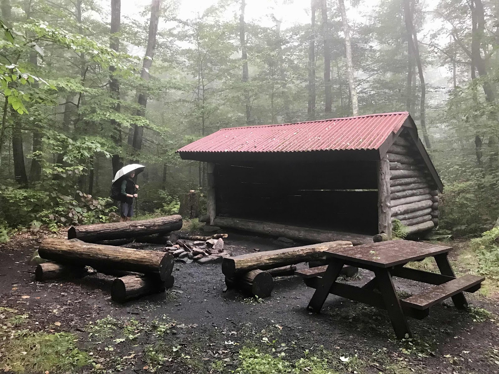
North Mt Wilcox shelter in the morning drizzle and fog

Another shelter a few miles later, the South Mt Wilcox shelter. There were two shelters at this site. This one was a historic one built by the CCC in 1939! Neat! We love CCC constructions!
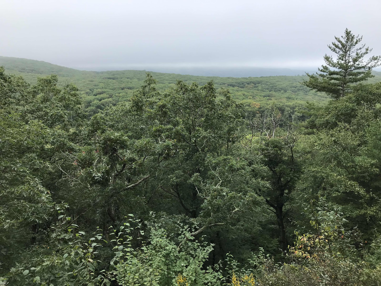
Foggy views to the south from one of a few open ledges

More views to the south

Benedict Pond at the Bear Town State forest. There was a looping side trail here and a campground for people with cars.
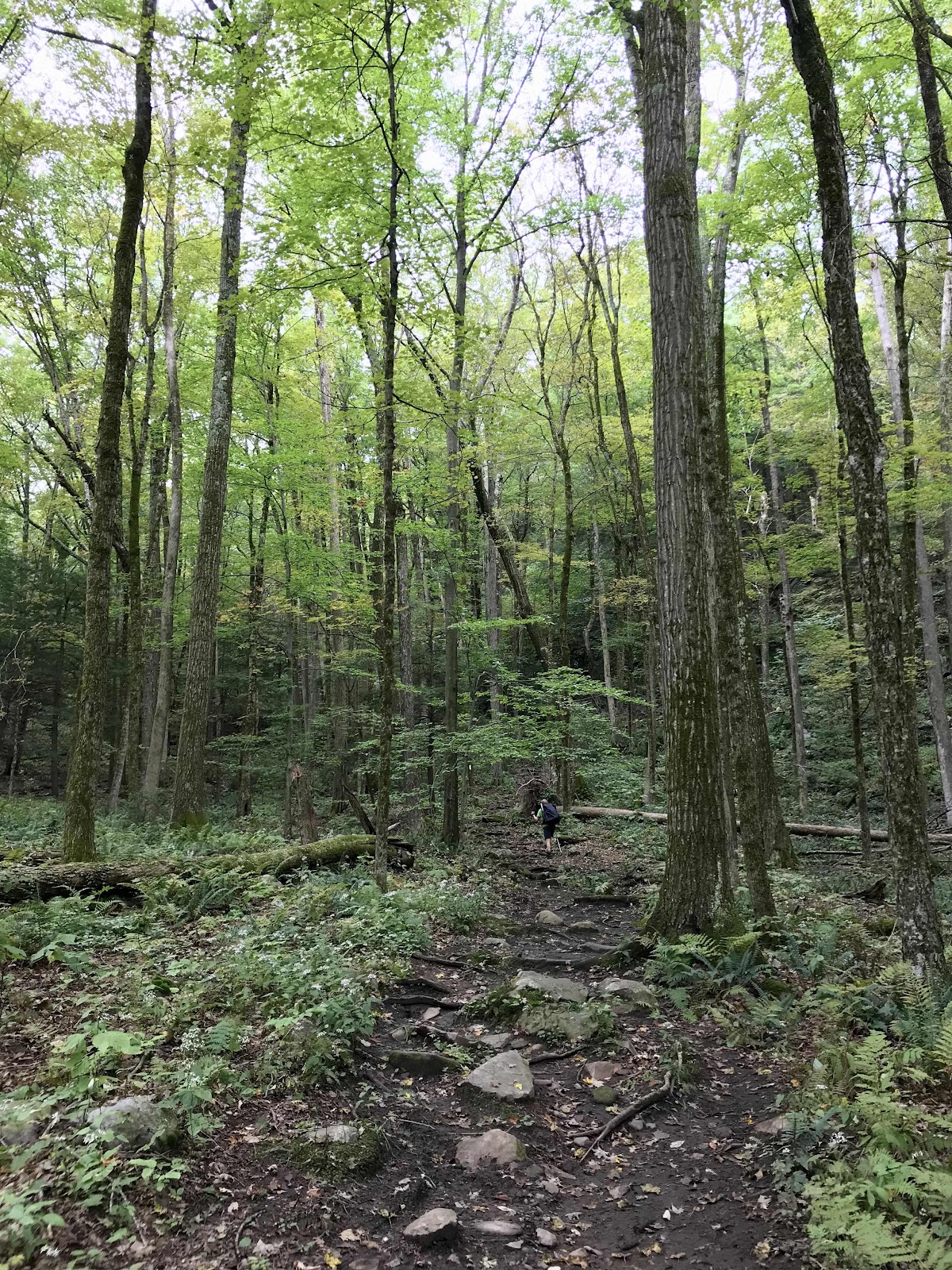
Nice forest of tall trees
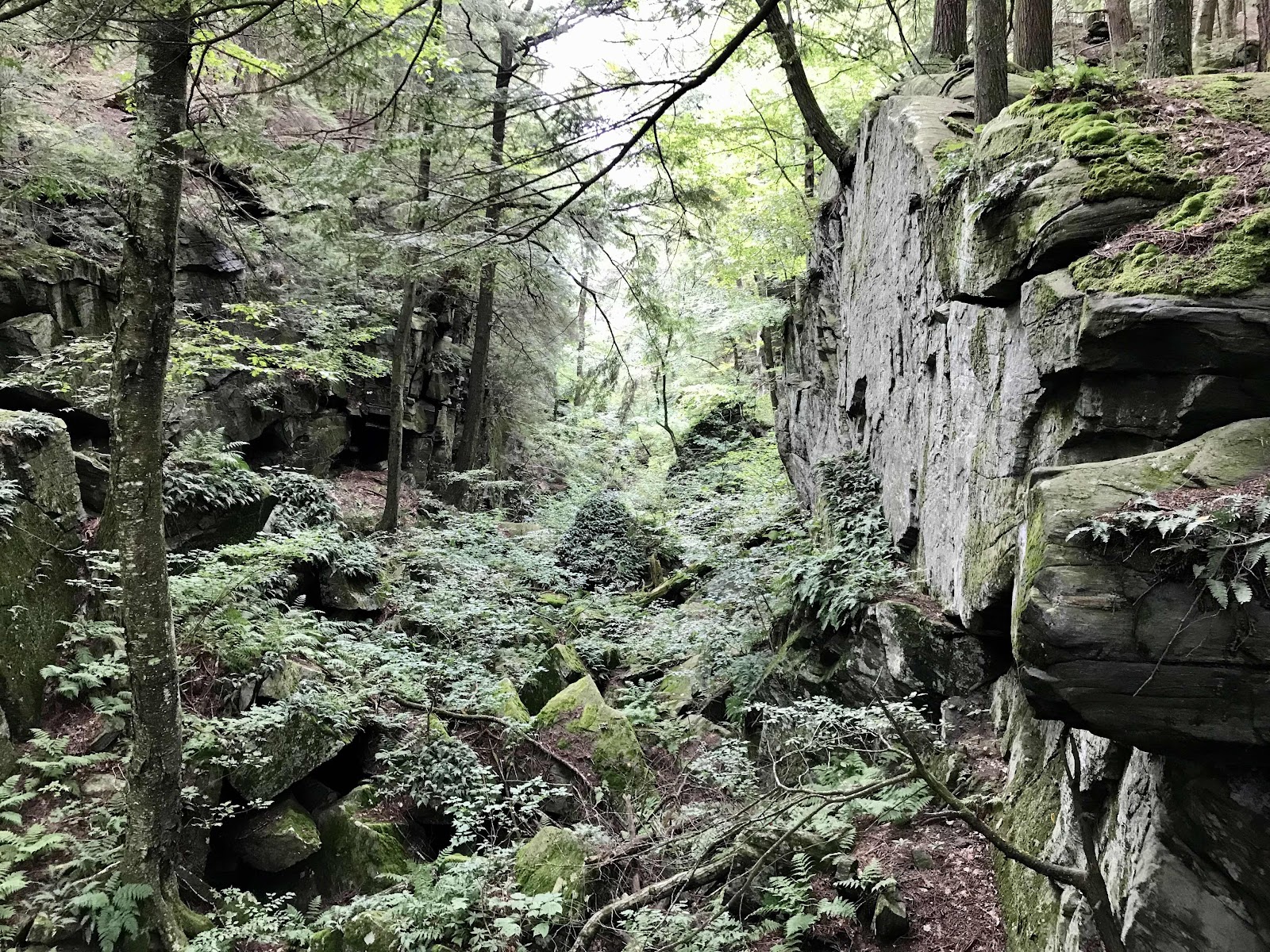
Ice Gulch, deep and rocky ravine that can occasionally hold snow and ice late into the summer

A look at some of our water for the day, it’s been dark and tannin rich recently, but we don’t mind

Forest of pine and oak along more ledges

Views to the south of the Southern Taconic Range and the Housatonic River Valley.

A fine place to rest and filter water. Take a look at the color of the water in the bottle!

View toward Great Barrington

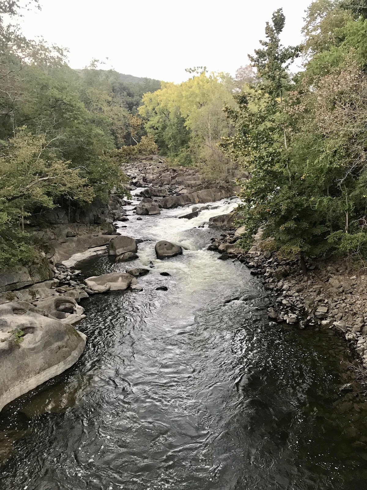
Housatonic River

Picnic Pavilion at the community center

A Lebanese feast, 6 item combo with wine! Mmm roasted eggplant, hummus, baba ganoush, beets, tabouli and salad with pita breads. We also ordered a big plate of roasted potatoes after this.
Day 70
Saturday September 18th
Laurel Ridge Campsite
669.2 - 682.1 = 12.9
We are attacked by mosquitos again in the morning as we pack up our tent. We probably break a speed record in getting out of camp. Our plan is to get grocery store food for breakfast. We walk to the Price Chopper down the street and are further attacked by mosquitos while we wait for the 7 AM opening time. We find out their bathroom is out of service and that’s going to be a problem! We also don’t want to make breakfast outside in the mosquito infested lands, so we get a few things for the trail and go out to eat again, where we can be safe indoors and have access to a toilet!
We go to Rio Café, right next door to Naji’s Mediterranean Cuisine, where we had dinner. Rio Café reminds me of the Mexican run fruit and juice bars that are common in San Diego. We get a fruit and granola bowl to share and a tofu scramble. It’s expensive for what it is, but we are in the Berkshires and we are paying for the convenience of having someone hand us food inside away from the mosquitos.
Papa Joe picks us up and takes us back to the trail at 9. There was another hiker in town that we thought would be coming back with us, but he decided to take a zero. We learn from Papa Joe that his trail name is Hotdog. We met him in Rutland when we were staying at the Yellow Deli, but never caught his name. We did learn then though that we is from Orange County, California. Hotdog got a room at the TravelLodge for Friday and Saturday night, which means he’s spent about $300 for his stay. We decide he must be a wealthy software engineer. He started the trail in June, so he’s taking it even more leisurely than we are!
Back on the trail we have more buggy lowlands and fields to go through. It’s 4 miles across the valley to the next climb. It’s really humid and I’ve started having an allergic reaction to something in the air. My eyes are watery, itchy and sensitive to light and I have a constantly running nose. I hope it goes away soon.
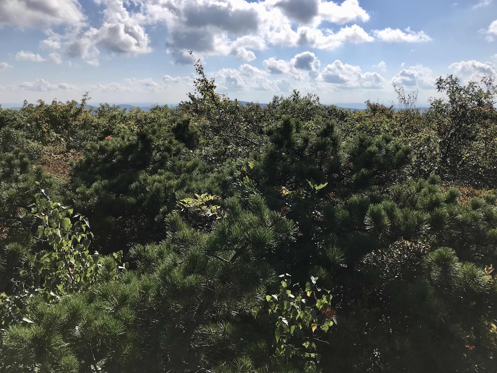
We get relief when we return to the forest and begin climbing up to the next ridge. We find a fine breezy and sunny ledge for lunch with a view of the valley. It’s the finest view we’ve had in awhile and I really enjoy the stunted black pine trees that grow on the tops of the ledges.
All afternoon we have the pleasure of walking on the bedrock spine of a ridge toward Mt Everett at 2,605 feet.
The mountain top is nothing special, it has waist high vegetation that blocks most of the view. Next up is Mt Race at 2,361 feet. There are no mosquitos up high but sadly we’re going to be going into lower elevations again after tomorrow. We have a bit of more challenging terrain today with some stairs and rocks and some big steps up and down. It’s a nice change from the super easy footing we’ve been having. It’s always nice to use different muscles.
Just before reaching camp, we meet Collette and Dakota, another southbound thru hiking couple. They are from Oklahoma and started about a week earlier than we did, July 5th or 6th. They push on past our campsite for the night, but we will probably see them again.
We have a great day today, but fall short of our goal of Sages Ravine. There is a sizable creek running through the valley there with nice swimming holes. All day as we hiked and poured sweat we dreamed of swimming there. We could’ve hiked until it got dark but then it would have cooled off and swimming wouldn’t have been as rewarding and we’d have been searching for a campsite in the dark. Instead a stop a mile and a half before at the Laurel Ridge campsite and have a nice time enjoying the evening light in camp, eating pitas and hummus and drinking tea. We camp in a forest of tall oak trees which allows lots of sunset light in to our site. One danger of camping in the oaks is that acorns keep falling all around us! Eventually one of us will be struck by an acorn and I’m sure it will hurt!
We get a text message from Jay this evening and learn that he is already a week ahead of us! He started the first day with us and we hiked the whole 100 mile wilderness with him and Peter and Kae. We haven’t seen him since about day 12. He’s younger than us and has the ability to go faster and for longer. I wonder if we will ever catch up to him again! Peter and Kae are currently a day or two behind us, they will be in Great Barrington tomorrow.

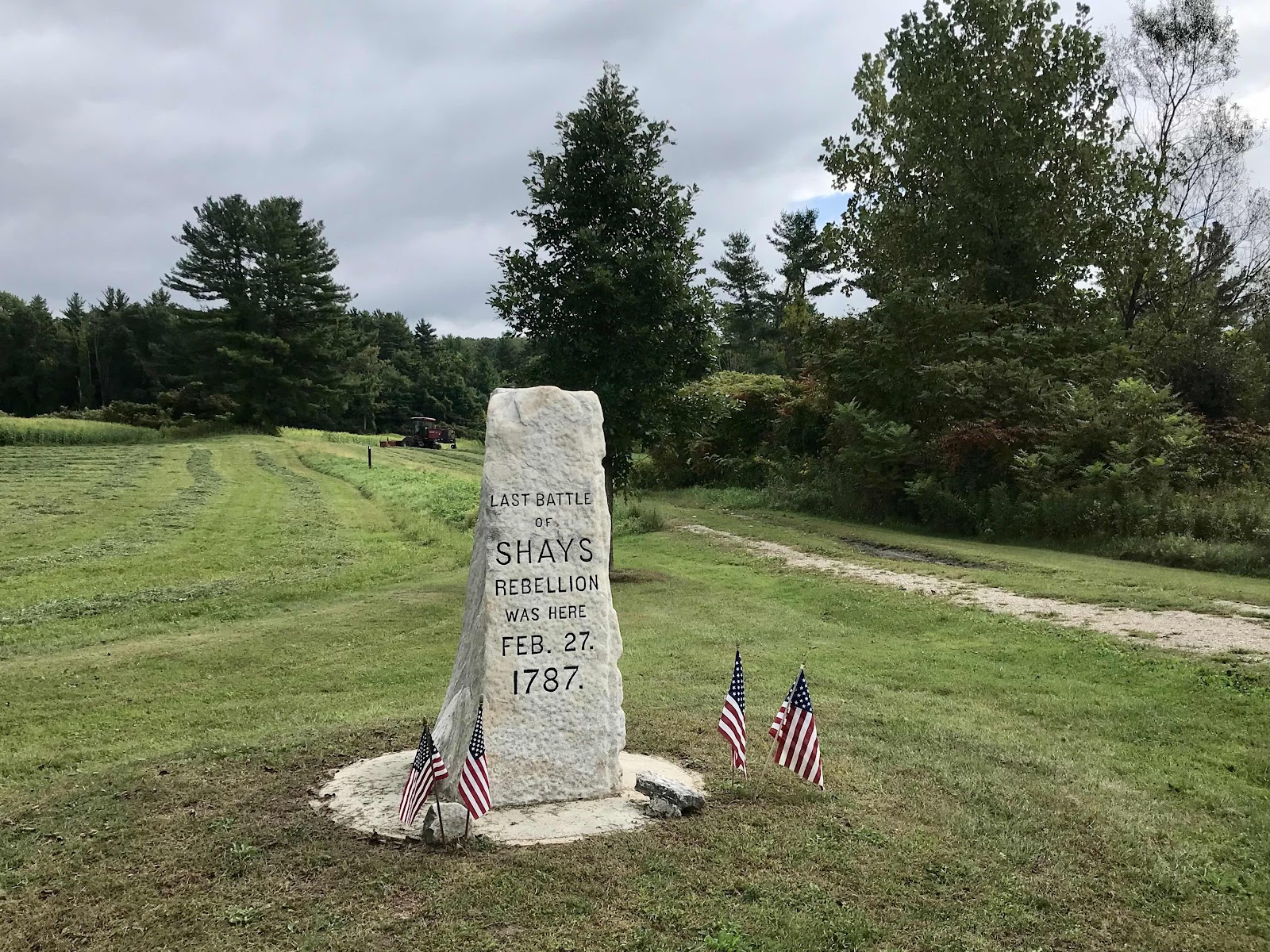
Lots of military history in the area. I took a photo of this sign because it’s my birthday, but 200 years earlier!

I took a photo of this roadside sign because my eyes were too sensitive and irritated to look at it!
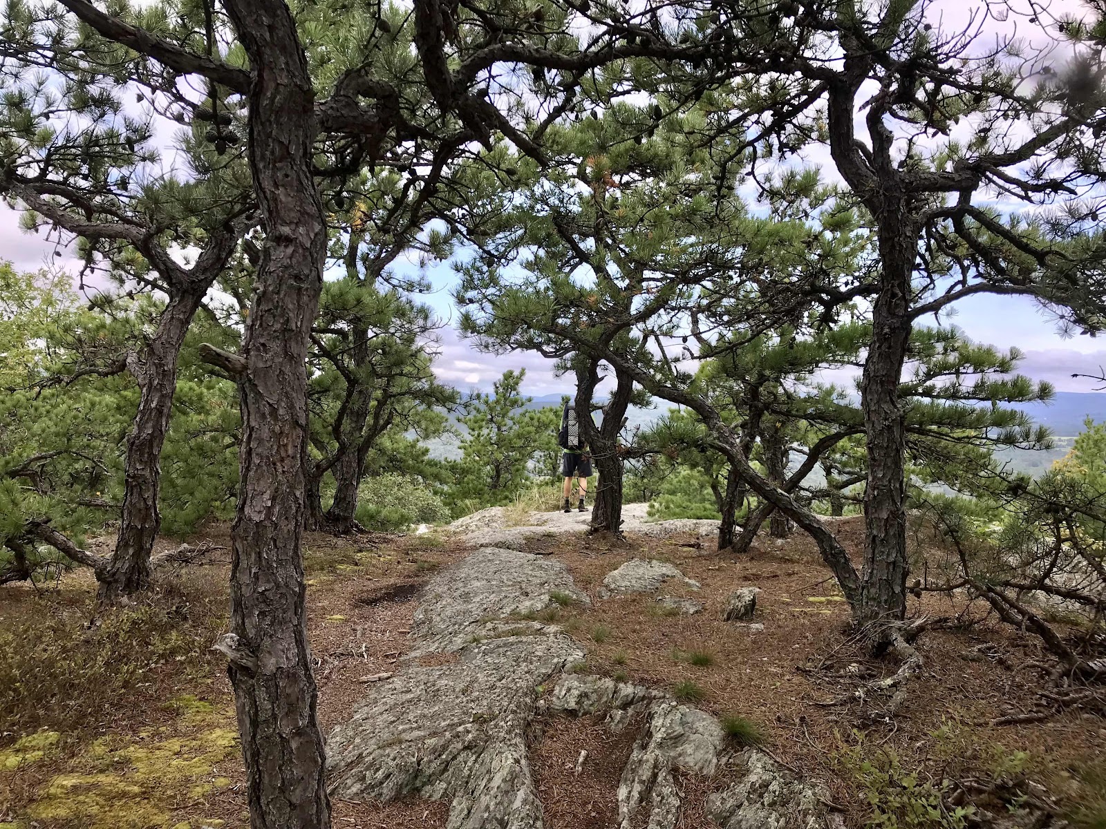
Black Pines on the ridge known as Jug End

Lunch with a view
Obstructed view on Mt Everett
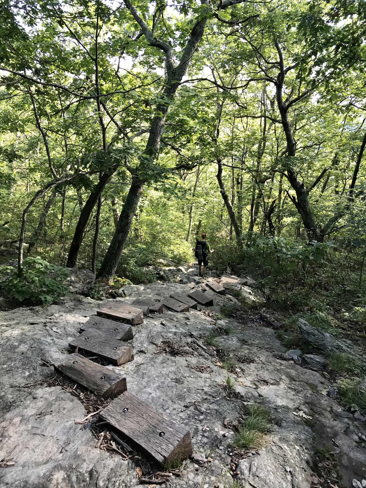
Looks like Mt Moosilauke with wooden stairs built into the rock. We could certainly get by with our them, but they are nice!

Looking back at Mt Everett from Mt Race
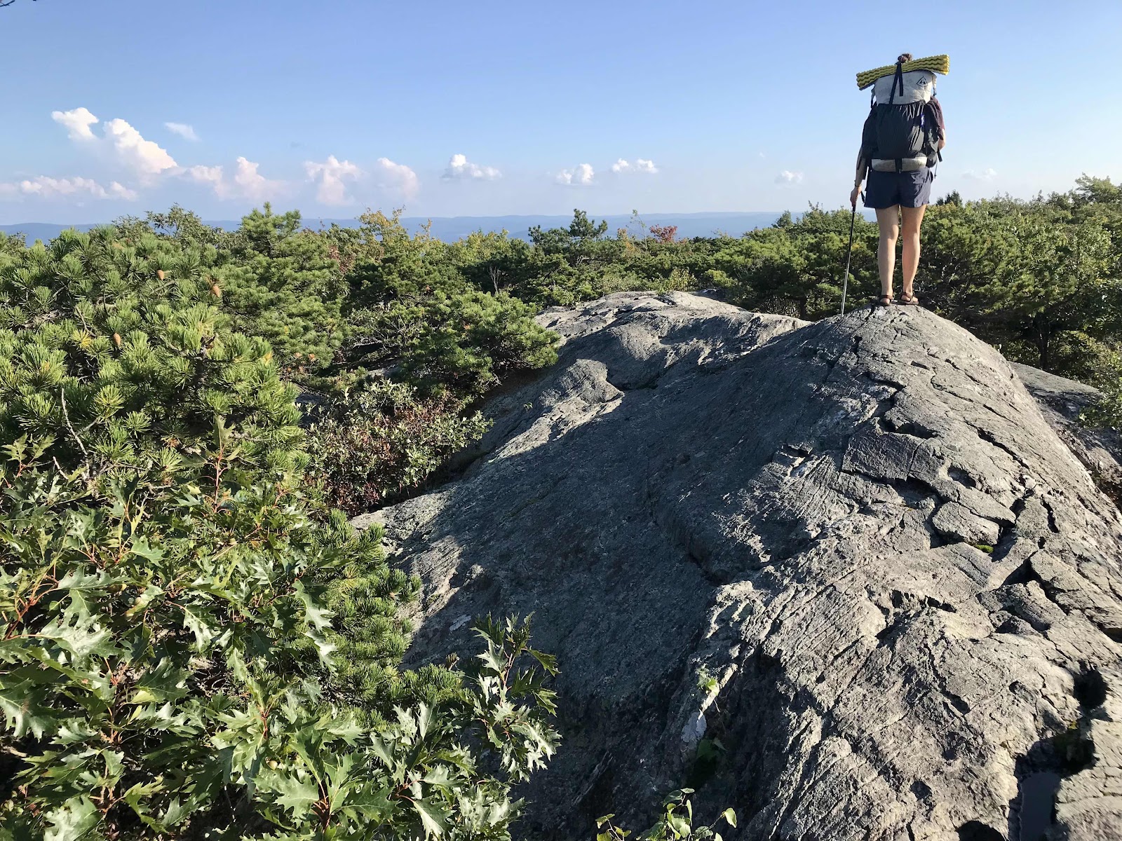
Rocky spine on Mt Race

Views to the South from the Mt Race Ledges

The trail goes right along the ledges for a rare half mile of wide open views!
Day 71
Sunday September 19th
Falls Village, CT
682.1 - 697.8 = 15.7
We get going from camp by about 7:30. We don’t have far to go to reach Sages Ravine. It’s nothing terribly exciting but it is a big mountain stream with waterfalls and swimming holes deep enough to swim in. We haven’t gone in a swimming hole since southern New Hampshire! But at 8 in the morning, it’s too cold to think about swimming.
We enter Connecticut and soon after Sages Ravine we are climbing up Bear Mountain. Since we are already on the ridge, it isn’t much of a climb to the highest peak in Connecticut. At the top there is a stone pyramid tower structure. Without the tower, the low trees would obscure the view. It’s a really impressive stacking of rocks that was built in 1885 according to the engraved slab of marble. It would have been neat to be up here at sunrise!
On our way down the mountain we see lots of day hikers. They reek of laundry detergent and other perfume like smells. Our noses get sensitive out here. I wonder if they can smell us! We smell bad. There are also lots of weekend backpackers around. There were a lot of them at our campsite last night. This has been a scenic stretch and I can see why it’s popular. To make up for the increase in hikers in the area, there have been more campsites. As has been usual since leaning Maine, the campsites and shelters are down side trails, so we don’t get to see them, just the one we stayed in. You could spend a lot of time touring all of the shelters and campsites of the AT.
We hike on the spine of a ridge as we head down the mountain toward the Lion’s Head. The Lion’s Head is the final rocky outcropping before the descent into the low valley we’ve been viewing below the ridge. There is a 3/4 mile trail from to the view from some parking lot, so there are a ton of people there. The view at the top of the mountain was better, so we stop only briefly for a snack before continuing on.
At the bottom of the hill we cross a series of roads which lead into the town of Salisbury, 3/4 of a mile away. Jeff wanted to skip town and crush miles, but I wouldn’t allow it! As soon as we turn off the trail and onto the road, a car stops and the couple inside offer us a ride. We weren’t even trying to hitch hike, but the guy was a thru hiker in 2018. He knows how it is! We never want to walk any extra on roads because it wears us out with the repetitive motions and also makes us more tired by the end of the day when we’ve walked extra non trail miles. In seconds we are getting out of the car at the market. It’s magic! We don’t really get much of a chance to talk to the guy but we are very grateful and relieved to have gotten a ride.
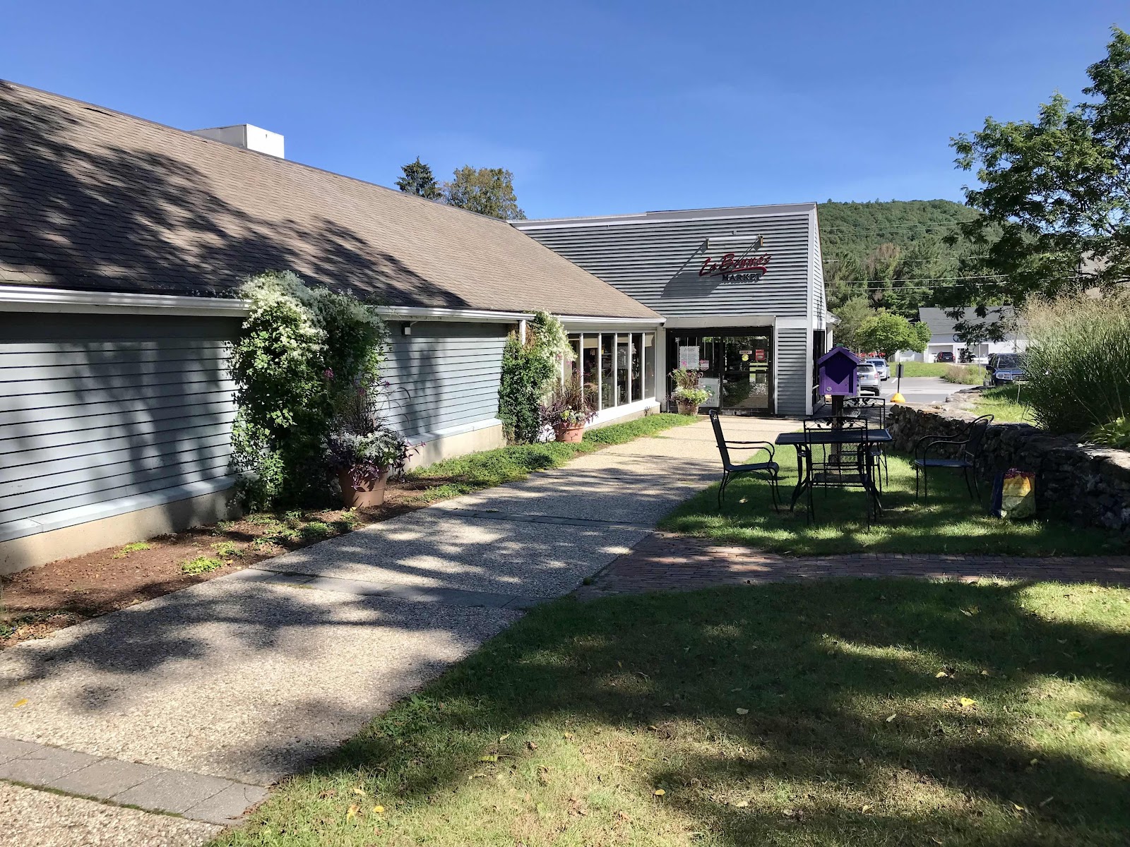
We are at La Bonne’s Market. It’s a really nice store. They have lots of premium grocery items and neat local stuff, like produce, granola, chocolate, snack bars and baked goods. I want to live in the store or at least buy enough for several meals, but as always I must settle for less and keep moving! It’s really hard not to buy too much. We get veggie sandwiches from the deli, a carrot apple ginger juice and some local plums. We pack some flatbreads, micro greens, pumpernickel bagels and bananas to go. They have nice tables in the shade outside and power outlets for us hikers to use. There is nice direct sun this afternoon which allows me to charge my luci light solar lantern. I use the luci light instead of a headlamp and with the days growing shorter we’ve been needing our lamps more and keeping it charged in the forested green tunnel of the AT has been a challenge. There is an old rail trail that takes us back to the AT, so we don’t have to walk on the road. We manage to get in and out of town in two hours. We saw Dakota and Collete there but they didn’t look like they were getting out any time soon! It’s easy to lose track of time in town.
Back on the trail we walk in a nice open forest with old stone walls. We have began seeing the abandoned stone walls in the forests again for about the past week. It’s always interesting to think that all of this land that we walk through was once totally deforested and was someone’s farm.
We go out of the valley and up onto a mountain that is mostly viewless, only to come back down to the same valley. The mosquitos that were mysteriously absent yesterday and this morning come back with a vengeance, leaving us unable to stop for a break. We hike for 3 hours straight, making it up and over the mountain and into the next town, Falls Village.
We stop a break at the Great Falls of the Housatonic River when we are finally safe from the mosquitos. We are near a power plant and dam, but the falls are pretty. We’ve been following this river for a while, it’s the same big river we crossed over in Great Barrington. After we’ve eaten we head into town. It’s getting late, almost 6 and it’s now getting dark around 7. The next campsite it 2.7 more miles, so we wouldn’t make it before dark. We planned to camp in town behind a coffee shops that lets hikers stay. Town is dead on a Sunday night. We are supposed to ask and make sure it’s ok to camp, but there’s no one around. We try calling them and get no answer. We sit at their picnic table and have another small meal.
They are in our guide book, so eventually we begin setting up. Midway through our tent build, they come back with another hiker and they are happy to have us tent, so that is a relief. We are inside our tent laying down before 8. We had a pretty long day today but we had good energy again and a great day too. The coffee shop we are camped at has drastically reduced hours since COVID and is only open a few days a week. They won’t be open while we are here. The owners live on site above the shop. A couple doors down, there is a cafe we can have breakfast in.
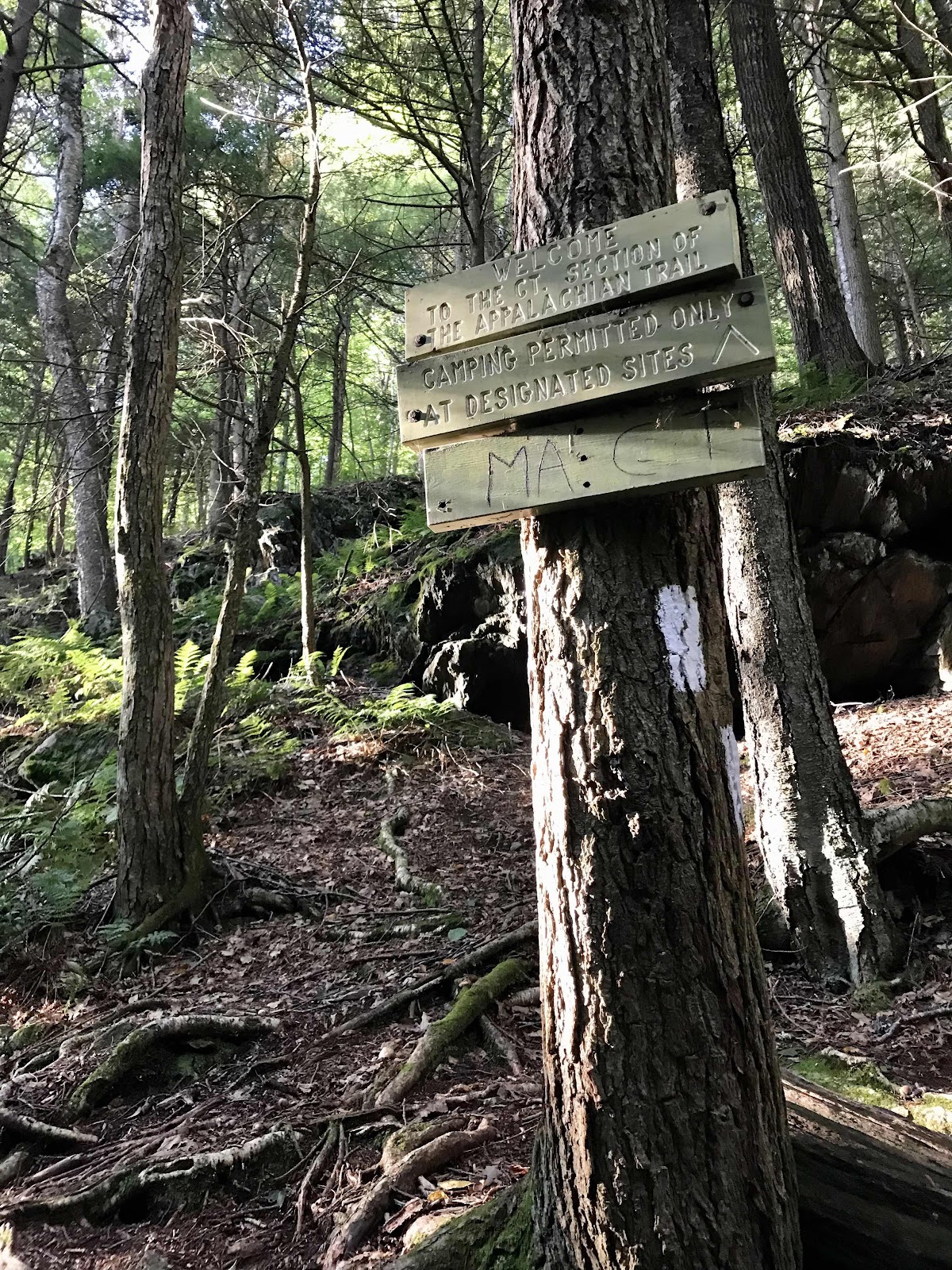
Massachusetts - Connecticut line

A waterfall and swimming hole in Sages Ravine. This would be a neat place to come back to.

Some rocky footing for a change

Stone tower at the top of Bear Mountain, highest peak in Connecticut, 2,312 feet

Me at the top with a back lit view to the East

Looking back at Mt Race and Mt Everett

Jeff of the stone tower

Hard to read: this monument marks the highest ground in Connecticut. 2384 feet above the sea. Built AD 1885. Owen Travis, mason.

Views to the south on the way down the ridge

Today the undergrowth is a jungle of laurels, without the trail, we definitely would not be able to walk here!

View down to Salisbury from the Lions Head

A fine black pine marking the Lions Head view with a wooden sign on the tree
Nice outdoor lounge area beside La Bonnie’s Market

1500 more miles for us to reach Georgia!

Some pretty trumpet mushrooms
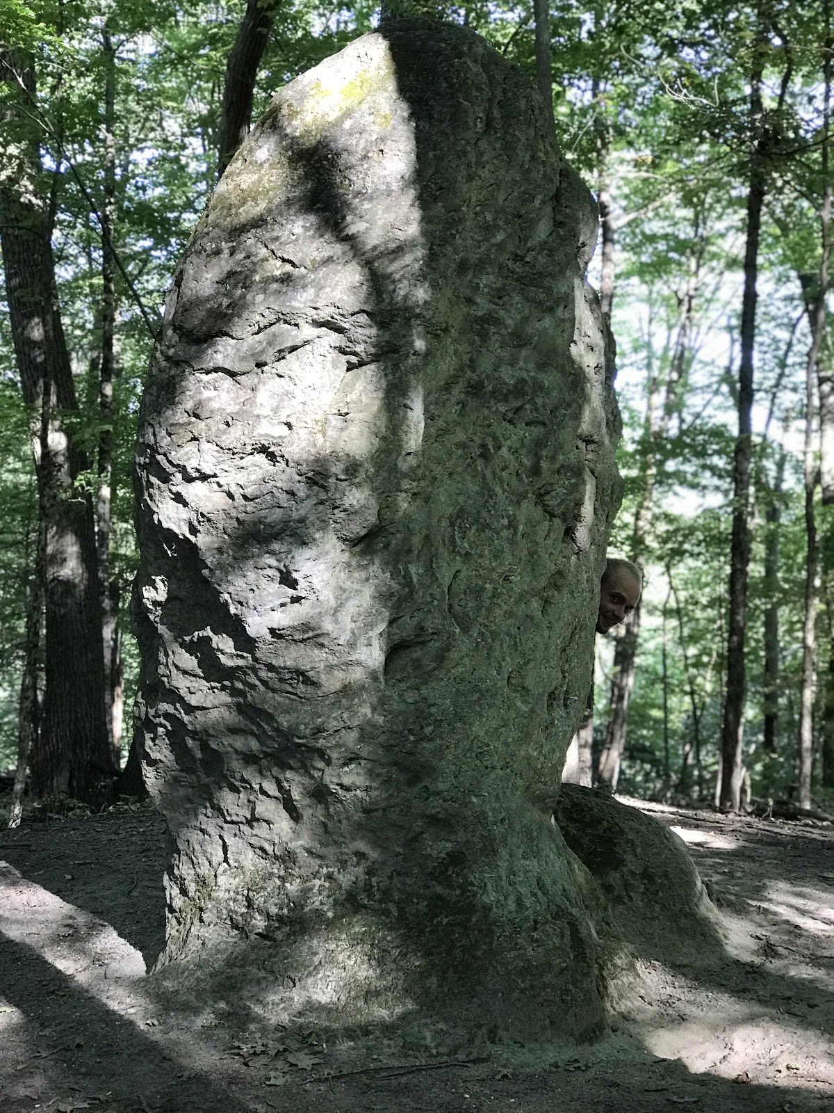
An afternoon point of interest, the Giants Thumb
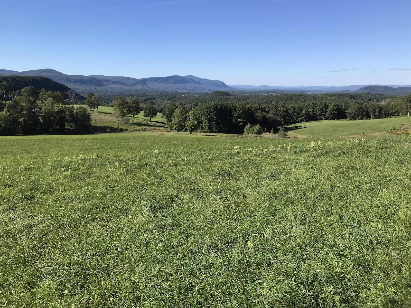
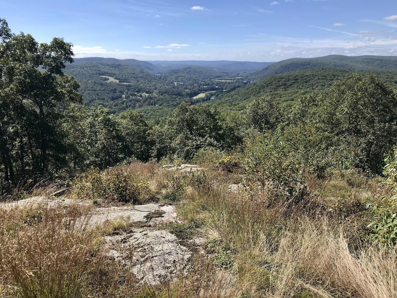
An especially scenic view from some guys field that the AT skirts along. It is known as Rand’s View. We can see the Southern Taconic, Bear Mountain, Mt Race and Mt Everett.
Dam on the Housatonic above the Great Falls
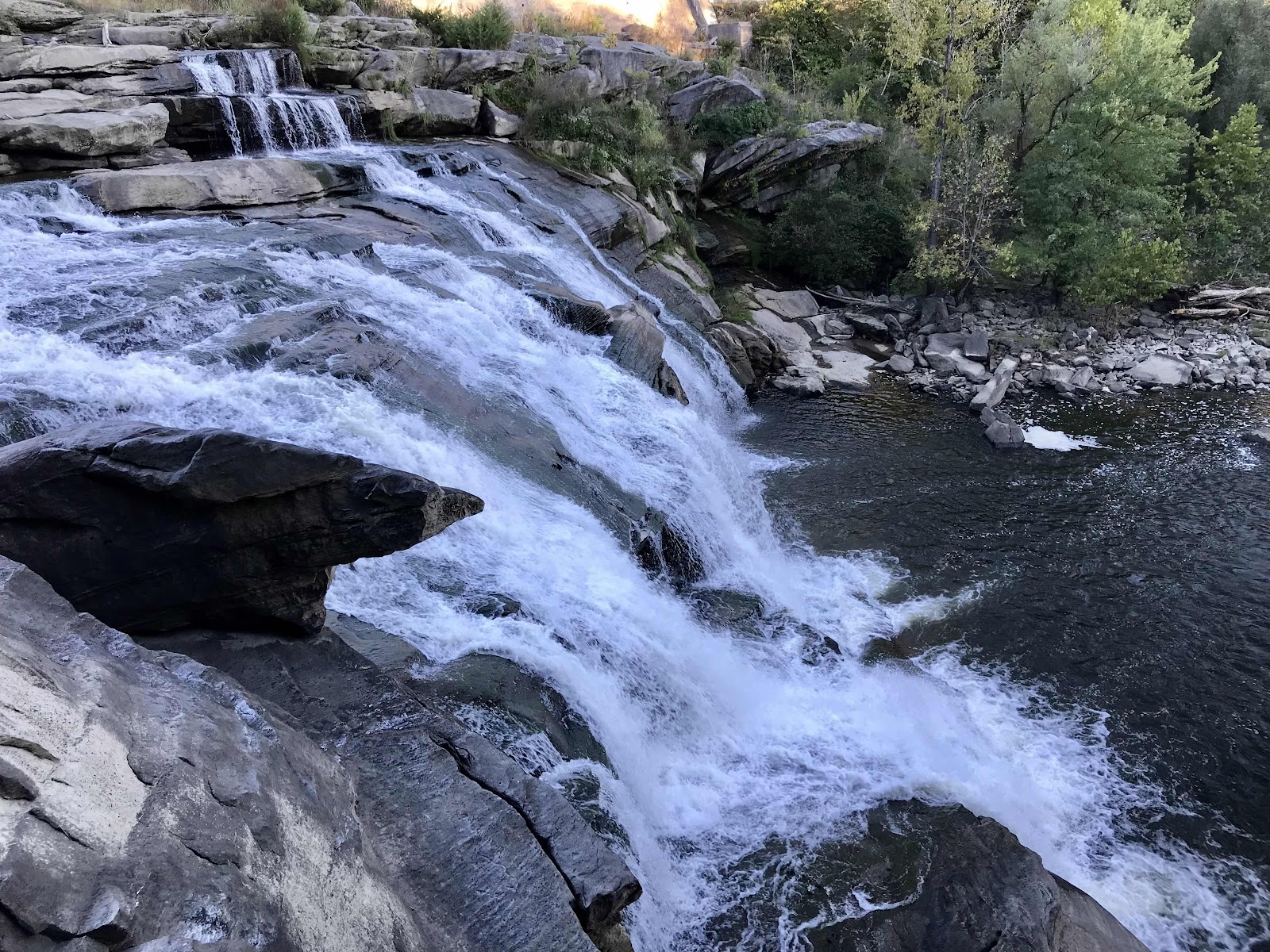
Great Falls

Road bridge over the Housatonic River

Housatonic River below the Great Falls

A history sign for the town of Falls Village. I guess it’s also known as Canaan?
Day 72
697.8 - 712.7 = 14.9
We are ready and waiting outside the Falls Village Café for when they open at 7:30. Dakota and Collette are also there, they camped somewhere in the forest nearby. The café is late to open and when they do the service is slow, even though we are the only ones there. It takes almost an hour to get our food, which makes Jeff antsy, but I don’t mind. By the time we leave it’s close to 10.
The trail takes us along the Housatonic River for many miles. Eventually we go back up onto a ridge and into a forest with a very sparse canopy. There was a gypsy moth infestation here early in the summer, and the caterpillars nearly wiped out the first growth of leaves. The second growth of leaves does not provide the level of shade that we have become accustomed to, so we need our hats and sunglasses for the first time in awhile. My eyes continue to be irritated and I have been forced into wearing my glasses instead of contacts. The excess sunlight makes my eyes even more sensitive. I wish I knew exactly what it is that gives me allergies. I have had the same thing happen to me before, but only in Fairbanks, Alaska, and only in the fall.
By late afternoon it’s quite hot and we are sweaty and worn out. The trail goes over a sizable creek that flows out of a beaver pond. We feel so gross that we do not mind swimming in the deep brown tannin rich waters. It is so supremely refreshing that we relish it. It is exactly the boost we needed to continue hiking.
In the early evening we contemplate camping somewhere near the next town option, Cornwall Bridge. There is a country store there but it’s only open 7-3. We’ve missed it for today, but could go in the morning. There’s no official camping around and we haven’t gone very far, so we make the tough decision to bypass it. We hike until after dark on ridges above the Housatonic, and make it 14.9 miles to the Silver Hill Campsite. It’s a full moon tonight and we get to watch it come up just as we are getting to camp. Dakota and Collette are there too, and have also made the decision to skip the lure of another market. The campsite is in a big meadow surrounded by tall trees. There are several picnic benches, a shade pavilion and a bench swing!

ToyMakers Café in Falls Village, CT. We camped in the yard out back.
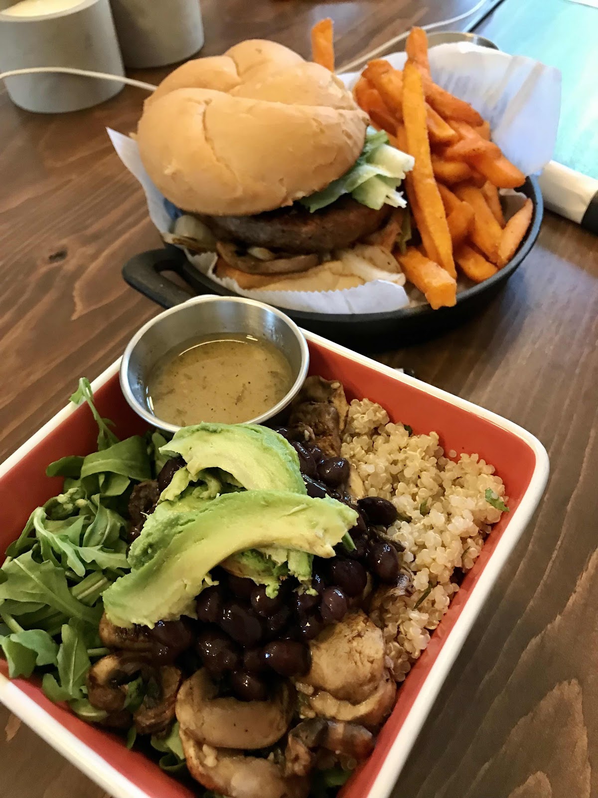
Beyond Burger and sweet potato fries for Jeff and a quinoa salad for me, a $12 quinoa salad!

Outside the Falls Village Café

Crossing the Housatonic River again

View down to Limerock Speedway. We could hear the sounds of racing cars for miles

A fantastic lunch spot with furniture in the sunny forest at Sharon Mountain Campsite

A sparse forest canopy due to gypsy moth infestation

A partial view to the valley below. West Cornwall Road runs through the valley.

The trail runs through a narrow rock passageway called Rogers Ramp

Looking back at Rogers Ramp.

A nice swimming hole below a beaver dam

Nice stone stairs. We always appreciate some quality trail work.
View down to the Housatonic River Valley from near Pine Knob
Day 73
10 Mile River
712.7 - 731.5 = 18.8
The the morning we have more than 5 miles of leisurely walking on soft leaf litter alongside the Housatonic River. We make really good time in this section without feeling taxed. Soon the joy is over though and it’s back up onto the ridges, but we continue to parallel the Housatonic and highway 7. It would be fun to come back here one day and drive highway 7 and stay in all the B&B and visit the little country markets. The markets wouldn’t be nearly as exciting to someone with a car though!
Early in the day we cross CT Route 341, it leads about a mile down to highway 7 and the town of Kent. We could go into town and visit an IGA grocery store. There is no hiker hostel, just an expensive bed and breakfast. There is also a laundromat though, and a coin operated shower in a public park. It would be nice to get clean since we haven’t had much opportunity for that on this leg, but we feel empowered to keep going to the next store! It’s hot and sweaty and humid again. We pour sweat every time we go up a hill, but we keep going.
With about an hour to spare before sunset we make it to Bulls Bridge Country store, another stop on good old route 7! The store is inside of a little house and is jam packed with all sorts of delights! We manage to buy hummus, whole wheat flat breads, apples, bananas and some of our favorite snacks, including Munk Pack Cookies. They also have a freezer full of Indian meals and a microwave to heat them up in. We are very pleased and impressed with the store. We sit out front at picnic benches enjoying delicious Indian food until it gets dark. Dakota and Collette had the same idea as us and also pushed big miles today to make it here. We have a further mile to go along the river to make it to our campsite and have to go in the dark. It’s a little spooky and also neat hearing the hum of crickets and frogs and the flow of the river as well. We camp in a field alongside the Housatonic near where another large river (the 10 Mile) flows into it.

Silver Hill Campsite in the morning
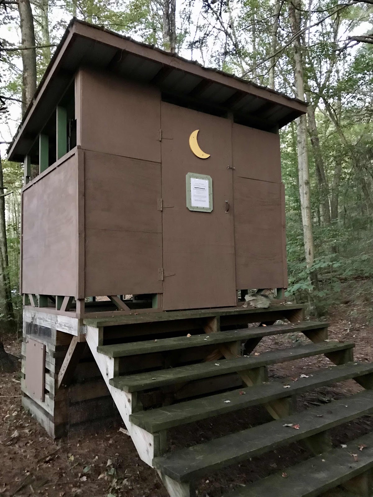
A really nice open air privy. It’s very nice because it allows light in! Normally it’s dark and spooky and spider infested inside! This has been the style for Connecticut.

A nice piped spring for our morning drinking pleasure

Many of the campsites in New York and Connecticut used to have water pump for the hikers to use, but they were all shut down this summer. We will no longer have access to water at camp and will have to carry it from a stream before we reach camp each night.

Lovely flat trail along the Housatonic for over 5 miles

Foggy river view in the morning

The trail skirts the edge of someone’s field right next to the river
St John’s Ledges for breakfast
View of Kent from rock slabs on Caleb’s Peak

Looking back at the ridge we came down from

We crossed into New York for a short distance today then went back into Connecticut

Really soft ground through a trail reroute

The trail just got rerouted and now goes away from some previous view areas called the Indian Rocks

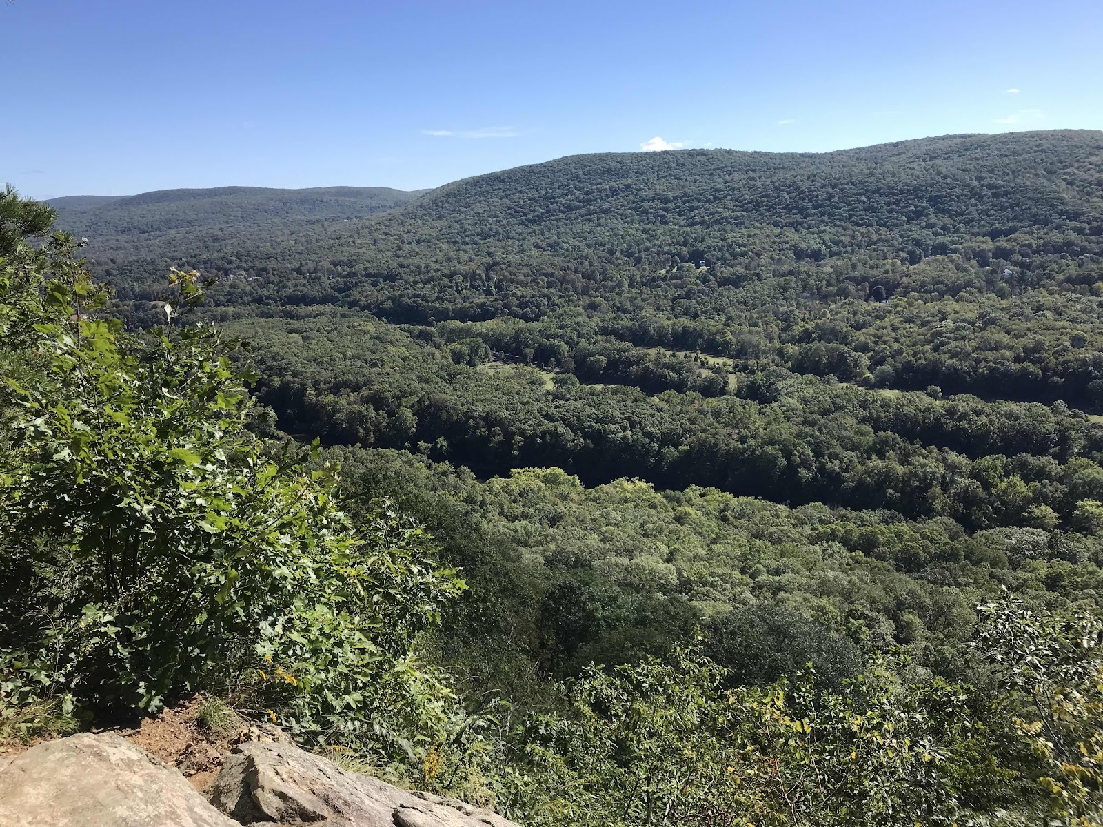
Views South of the Housatonic River Valley from the southern end of Schaghticoke Mountain
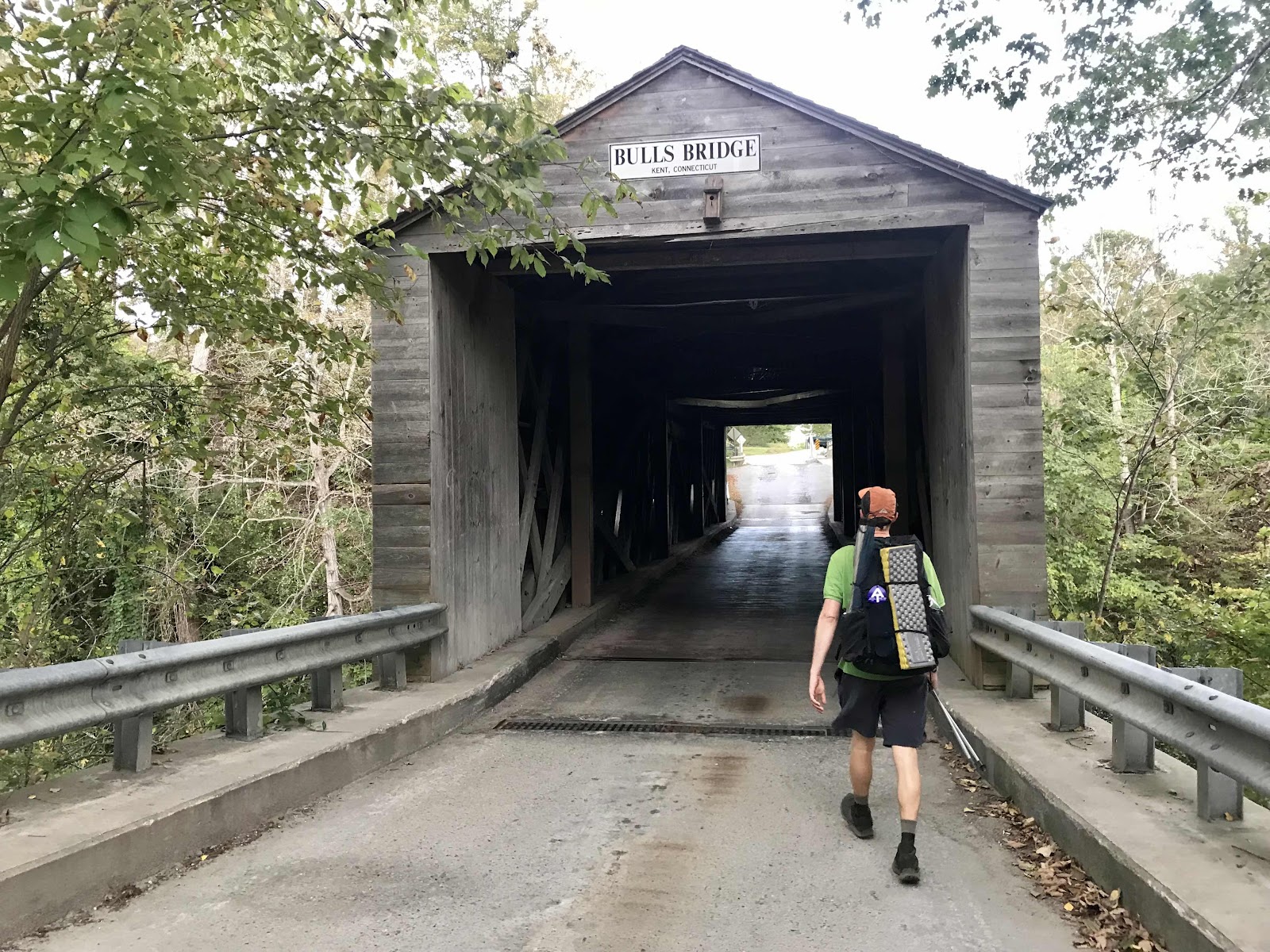
Neat old covered bridge just off trail, on the way to the country store
The Housatonic River flows under the bridge. There is a dam just upstream, but you can’t see it in the photo

Bulls Bridge Country store on highway 7, just 0.3 miles from the AT.

Comments
Post a Comment