08/28 - 09/01 Hanover to Rutland VT
Day 49
Saturday August 28th
Happy Hill Shelter
440.7 - 448 = 7.3
We walk out of the forest this morning onto the edge of the Dartmouth athletics fields. Just inside the woods and in the field are tons of tents. Lots of entitled NOBO through hikers camping right here!! We had expected to see another bubble, and here it is. There must be 20 people camped here. We can’t believe it! We would never take advantage like that.
Right at the edge of the fields is the health food co-op. The co-op opens at 8 AM and we arrive shortly after. We spend about an hour inside getting food for 3 days. We’ll be walking into Vermont today and need enough to get us to Rutland, about 47 miles away. We’re hoping we can do it in three by hiking a few of them tonight and starting to hike a little more miles each day! As always it’s a big exercise in self restraint for me to be in a store like that and not buy too much. I want to eat everything but can only carry so much!
After shopping the trail takes us Lebanon Street. We stop off at the library. They have a covered area with picnic tables and power outlets set up outside for hikers. We repackaged our food into our many ziplocs and fit it all into our backpacks. The library was closed for awhile due to COVID, but has recently reopened the lobby and we are allowed to go inside with masks. COVID is getting bad again. Masks were required at the co-op too. This is the first time we’ve been anywhere on the trail that masks were required. It’s easy to get lost in our little hiker world and forget COVID exists. I talked to my friend Kirianne the other day. She’s an ICU nurse in Seattle and says that their COVID numbers now are higher than their highest point last year! I was really surprised to hear that. We plan to be more careful in towns now.
After the library the trail takes a turn onto Main Street. We stop at one of the oldest businesses in town, Lou’s Bakery. It’s really popular and crowded on a weekend. We have to wait about 15 minutes to be seated. They have some pretty good vegan options, tofu scramble and black beans and sweet potato hash. We try both and they come with a vegan earth muffin too, which is whole grain and has shredded carrots, raisins and walnuts in it. They give a free baked good to hikers as well. Jeff gets a donut and I get an oat bar. As we sit at our table on the side walk, we get to see all the fancy people walk past. It is indeed a fancy little downtown, with a J.Crew on the corner and some other designer store down the block and lots of fancy restaurants. There are so many nice restaurants in town that I’d be happy to stay a few days and try them out. There’s bubble tea, Thai, Indian, Nepali, pizza and more. The desire to retreat back to the woods for a zero is appealing, but we tear ourselves away from the restaurant feeling nice and full and continue walking.
After just one block on Main Street the trail takes another turn and heads out of town of Wheelock Street toward the Connecticut River. Just before we leave, we take a tiny detour over to the park in front of Dartmouth University. I had no idea we’d be walking past here until I read ahead in the guide a few days ago. It’s neat that the trail goes right through town. It is strange to be here though, I have always held this university on a pedestal in my mind as a big important ivy league school! The last 50 or so miles of the trail have been maintained by the Dartmouth Outdoor Center. I bet they had a say in getting the trail to come through here.
We cross the Connecticut River on a big 4 lane road bridge. Right in the middle is the New Hampshire and Vermont state line. The river is wider and calmer than I expected. It is lined with stately old trees.
Across the river we stop at Foley Park and enjoy nice views of the trees and of kayakers and paddle borders. We learn in the Guthook guide that this is another place that entitled through hikers camp! It right next to the railroad track. I hope they get woken up in the night.
We have another mile of road walking past the bridge and up into Norwich, VT. There aren’t many hiker amenities in this town, but there is a gas station and market. We go inside and get a kombucha and a pear to enjoy before we go off into the woods. Right next door is an old B&B and tavern called the Norwich Inn. It’s supposed to be really nice and even has a hiker rate! We are already feeling the weight of our heavily loaded backpacks, so I tell Jeff we could be done for the night and sleep there! I say it jokingly because I know he’ll never go for it! But I would in a heartbeat!
We continue on for our last little stretch of the approximately 4 miles of road walking. We go up Elm Street. First it’s a lovely neighborhood and then we begin climbing steeply. Soon we are back in the forest and climbing some more. We make it about three miles to the first shelter. The forest on the way is just a narrow ribbon between the highway on one side and private property on the other. At several points we can see houses or fields. It’s neat that this narrow ribbon of nature exists.
We are done by 7 and have made it just over 7 miles. That’s pretty good for a day spent mostly in town. During luxury dinner our backpacks lose a lot of weight! We have bagels and wraps with baba ganoush, a bell pepper, a tomato, lots of arugula and some carrots. I even packed out a quart of soy milk, so we get to have a decaf London fog tonight and matcha latte in the morning!

Tents in the grass right behind the Dartmouth athletics fields. The AT disappears into the woods right at the edge of the field

The trail along the field to town

The first thing you come to in town the health food co-op!

Some of our resupply from the co-op laid out on the table outside the library. The foil bag on the left is the organic peanut butter sandwich creme cookies that we love so much!

It is so nice that the library has made this special area for hikers!
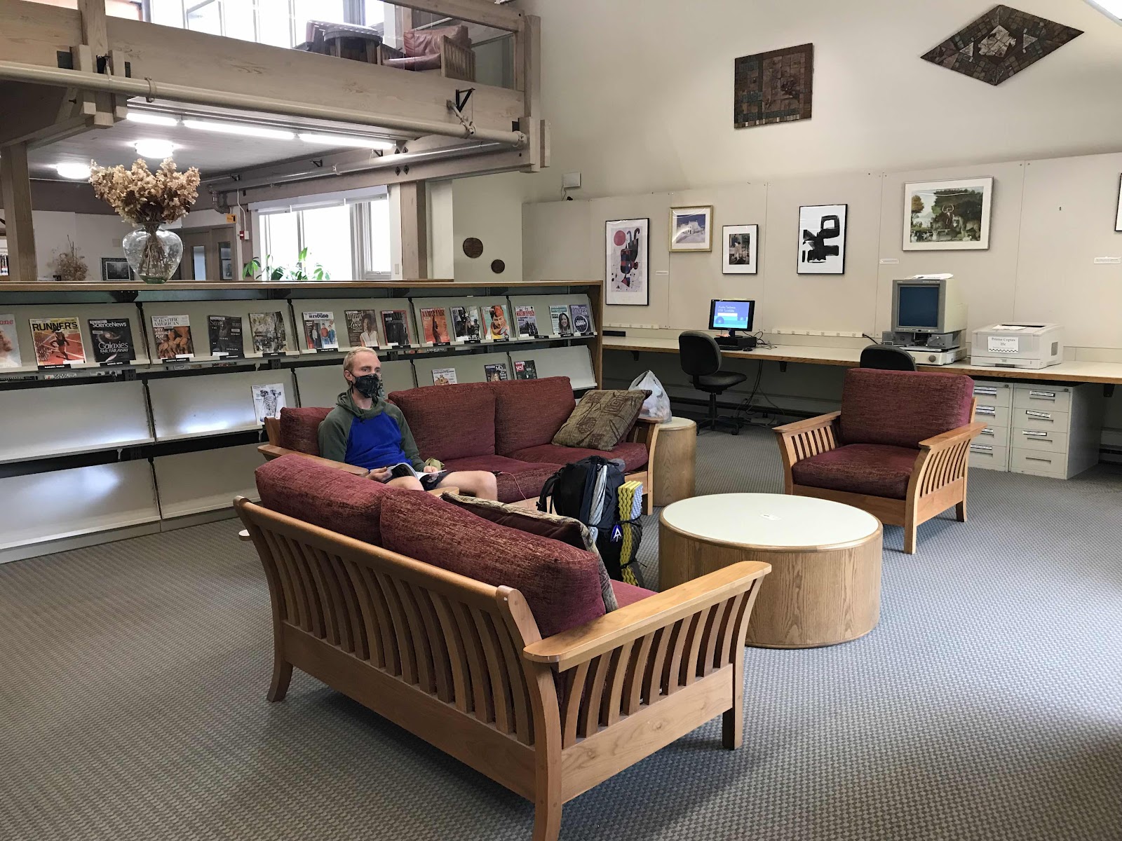
Pure luxury inside the library with power outlets in the floor in front of our couch

Pesto tofu scramble, baked beans and a vegan breakfast cookie at Lou’s
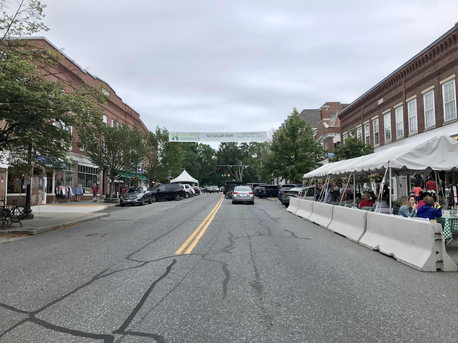
Downtown Hanover

Lou’s bakery, very busy on a Saturday

Dartmouth Library

Crossing the Connecticut River into Vermont

Vermont - New Hampshire border over the Connecticut River

Foley Park on the Vermont side of the river. There are entitled thru hikers that camp here too!
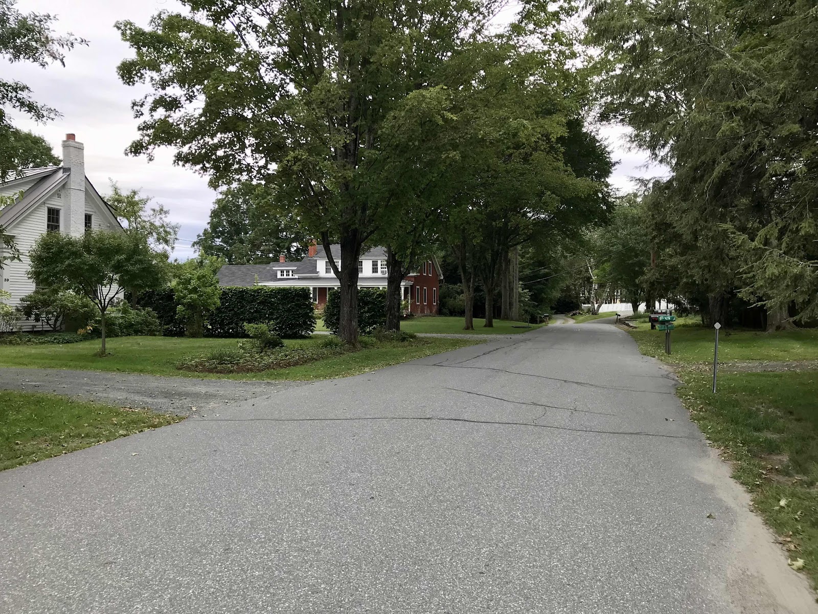
Walking down Elm Street on the AT on the way out of Norwich, VT.

Happy Hill Shelter
Day 50
Sunday August 29th
Pomfret Road
448 - 460.6 = 12.6
We walk down off the hill we’re on and go back into a valley, crossing under highway 89 and into the town of West Hartford. There used to be a general store in town, but it is now closed down, out of business. There is also a library in town, but it’s Sunday, so it’s not open. There are no other businesses, just a mixture of fancy retirement homes and crumbling old barns. We walk past a house with a sign on the street that says Captain Stashes on the AT. We are allowed to fill up our water bottles at that house. We walk about a mile through town, crossing over a major river on a nice big road bridge. It’s the White River, and it’s apparently tradition for thru hikers to jump off the bridge into the water. It’s about a 30 foot drop that looks rather dangerous and it’s cool and cloudy today so we pass on the jumping into the river.
We are in rolling hills all day. We are once again walking through forest that was once deforested for farming. We see lots of old stone walls and various side paths and overgrown roads. We are in the forest all day, with barely a view. When we do have a view it’s because we are in a field. We find blackberries in the fields and old apple trees too. One field has so many apple trees it must have once been part of an orchard. We eat several varieties of apples and I take a few for oatmeal tomorrow. We also see lots of maple syrup tap lines, which we’ve been seeing for the last few days. It seems strange to us that they are so close to the trail.
In the afternoon we run into a north bound hiker that we recognize from the PCT last year. His trail name is Spice Rack because he likes to cook more elaborate foods on the trail than most hikers will bother with. We stop and chat with him for a short while. He thinks his group may be back of the pack and that we won’t be seeing too many more NOBOs. We had been wondering about that. It seems that all of the people we’ve been seeing recently won’t finish until last September to mid August and that’s pretty late considering the potential for early fall bad weather in Maine.
Up and down the rolling hills, we do a lot a climbing, over 3,000 feet through out the day. We never get over 2,000 feet above sea level and there are no mountain top view, only forest. We had hoped to make it 15 miles today, but stop early at 6:15. Maybe we’ll do better tomorrow. We always seem to get more energy the closer we get to the next town, because that is always when our backpacks are the lightest.
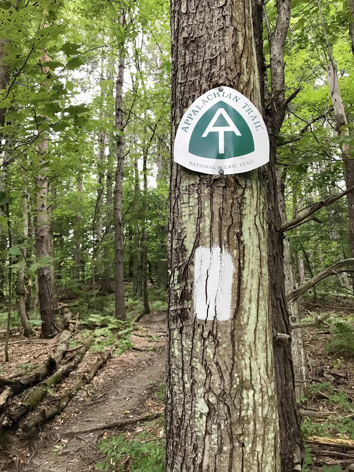
Now the trail is maintained by the Green Mountain Club and we have started seeing trail emblems at road crossings.

A fine rest area under an apple tree, up on a hill with a view.
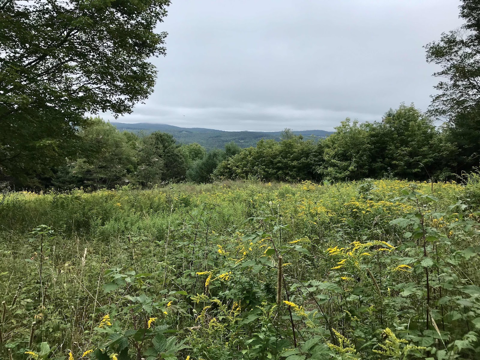
The view from the bench

Hiking near the maple tap lines

Blackberry patch

Sometimes we walk through tree farms, here it is densely packed Norway Spruce

We walk on the edge of a meadow up in the mountain here. It is surrounded by forest, but you can see the ruts from tires running through the middle of it. Someone comes and cuts the grass every so often.

More meadows in an area that must have once been an apple orchard

Eastern Red Spotted Newt, we have been seeing quite a few of these recently
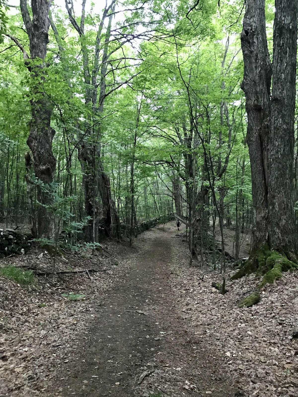
Walking along an old road that runs along the ridge top

Walking past farm fields

Chicken of the woods mushroom, you can eat this one, but we didn’t harvest it. We look forward to finding more.

A new type of fern that we haven’t been seeing until now
Day 51
Monday August 30th
to Chateauguay Road
460.6 - 474.4 = 13.8
In the morning we cross 4 roads each leading about a mile to a general store. Two of the roads are rather busy and it’s supposed to be easy to catch a ride to the store, but we already have more than enough food. I’d go but, as always Jeff cannot be convinced! Each road is in a valley and we have a hill to climb each time we cross one.
After yet another hill, we reach VT Route 12. This isn’t considered a common resupply point, but the town of Woodstock isn’t too far down the road and it’s a busy road and probably easy for hitchhiking. Just 0.2 miles down the road is a farm called On The Edge, they sell pie and produce, but sadly they aren’t open today. We didn’t know about any of these additional resupply options before we left Hanover, we’ve been learning as we go. We packed 3 days of food from Hanover and plan to make it to Rutland. There are a million ways to do a thru hike and always many options for resupply. It’s hard to do it perfect the first time!
There is a little trailhead and information kiosk right at the highway where we stop for a break. There is a cooler there with sodas in it. Soda is definitely the most common trail magic. Soda doesn’t appeal to me at all, but there is also a box of tomatoes! We sit and have a break and eat 4 tomatoes, one of which is a huge heirloom! They are delicious! What an excellent and unexpected trail magic! It’s almost as good as getting to go to the farm.
After the highway, there’s more climbing. The trail continues to have excellent footing on level leaf littered dirt, but that doesn’t mean it can’t be steep! We seem to have much more energy today and make better time. We take lunch at the Thistle Hill Shelter. It’s 0.2 miles off the trail which wouldn’t normally be worth the trip in the middle of the day, but it has water, and we need water. Water hasn’t been super plentiful in these lower elevation mountains the past several days. The shelter is occupied by 3 smelly smoker NOBOs. It’s annoying when other hikers don’t share the space that we are equally entitled to. Luckily this shelter has a bench along the back side. It’s the first one we’ve seen like this and it’s nice because it doubles the seating capacity of the shelter.
After lunch we are on the ridge top and it begins to rain. Rain was in the forecast for the whole day, but it’s been surprisingly sunny most of the day. It begins to thunder and it’s gets windy and the rain falls heavily. Luckily there is another shelter and we only end up getting rained on for about 20 minutes. Even with the wind blowing the rain around, we remain pretty dry with our umbrellas. We make it to the shelter, which is actually a private cabin and spend an hour taking a break and drying out while the storm passes. It goes pretty quick and then afterward there is a view. The roof of the cabin has a crows nest viewing platform which allows us to see the rolling hill country all around us. Without the platform there would be no view. The cabin is on private property, belonging to the Lookout Farm. The shelter itself is known as the lookout. The owners let hikers use it as they would any other shelter. We are the only ones there for awhile, then one other guy joins us for a drying out period. It’s tempting to want to stay, but we know better and decide to move on to find a good campsite.
We make it another few miles and are glad we did, as at least 6 people going the other way were likely headed for the shelter. We make it over 13 miles and do so in about the same amount of time we spent hiking yesterday. We climbed even more today too, but somehow it felt easier.

Our view for the day, across the field and to the mountains south of us
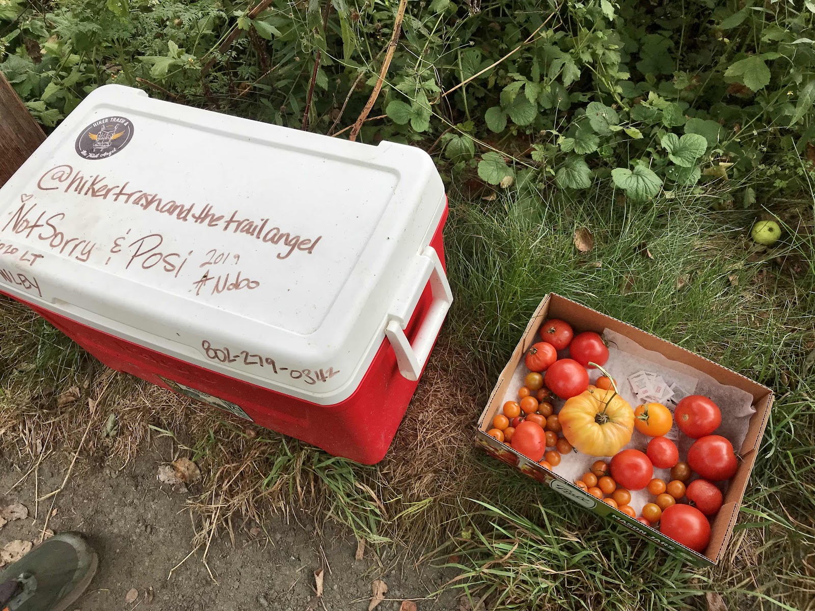
The best kind of trail magic!

Informational sign at the trailhead built by volunteers. This was at the VT Route 12 highway crossing.

We’ve seen a lot of overgrown meadows recently and the flowers usually are taller than us and we have to push our way through.

We saw lots of monarchs there and have been seeing them in all of the flower fields!

The blackberries are small but tasty and nutritious too!

Walking past another farm near VT Route 12

The trail follows another old road alongside a stone wall. Back when the trail was first completed in the 30s, this probably was still in use and someones farm would have been behind the wall. Now the forest has grown back.

A huge burl on a birch tree!
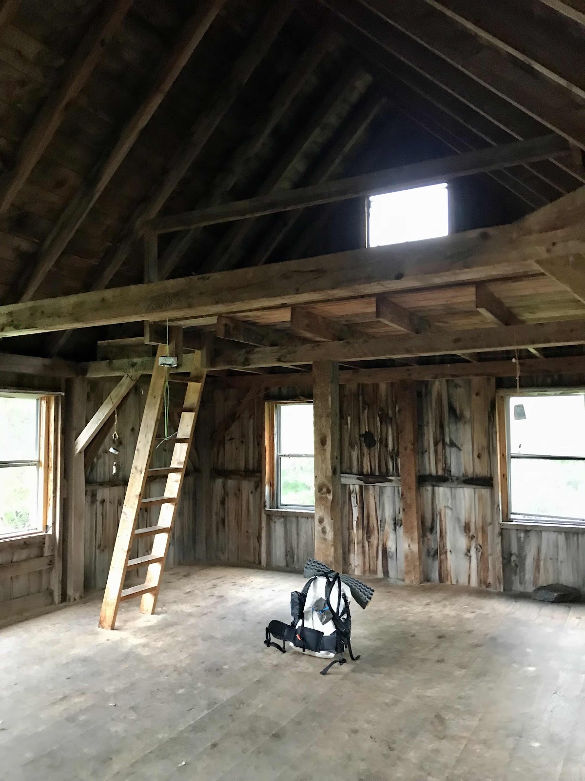
Inside the lookout cabin

Safe inside from the downpour

The lookout cabin, a private cabin owned by a nearby farm. They are nice enough to let hikers use it.

View north from the crows nest above the cabin
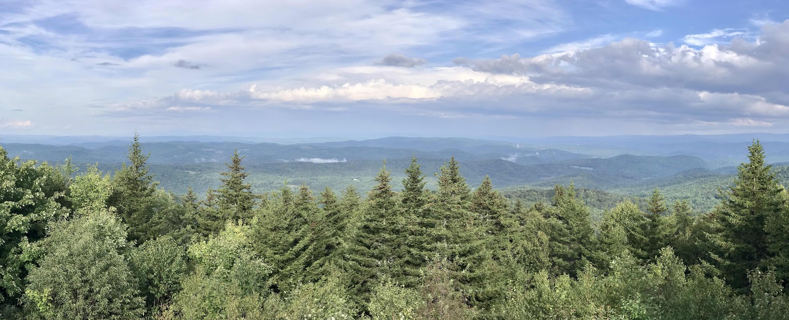
Panorama from the top of the cabin
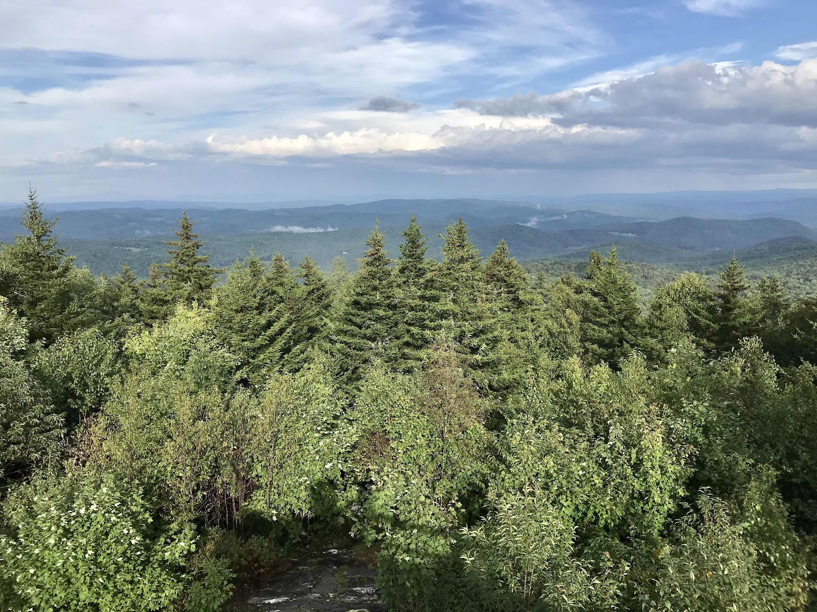
View south west from the top of the cabin.
Day 52
Tuesday August 31st
Inn at Long Trail
474.4 - 487.6 = 13.2
In the morning we are only a few miles from civilization. We are in the vicinity of the Killington ski area. There are many roads and highways that the trail crosses. At our first road crossing of the day, River Road, there is a large tour bus as soon as we walk out of the woods. We enter a popular day hiking area where the tour bus passengers are walking from one road and being picked up at the next. It’s lots of old people just like it Alaska. The trail is great for us, but for them it is hard. The main attraction in the area is Thundering Falls, there is also a fancy lodge on a big pond called Kent Pond.
Next we pass Thundering Brook Road and then Vermont Route 100. There are many resupply points here. We had planned to camp in Gifford Woods State Park, next to VT Route 100. The trail goes right through the campsite and they have a special site set aside for hikers. From the campground there is a trail into the little resort town of Killington which is about a 15 minute walk away. If we stayed there we could have access to a deli if we took the trail into town. We saw it might rain Thursday with the possibility of bits of another tropical storm coming our way, so we decide to go a little further. Our next mountain is Mt Killington and we want to do it in good weather.
We make it to Vermont Route 4, where the Inn at Long Trail is located. The AT used to go right past the inn, but the trail was rerouted 12 years ago, and now we must take a side trail to reach it. The old route seems more scenic to us, so we will continue on the old route when we go up Killington. There is another long distance trail that still comes past here and it is called the long trail, it’s over 200 miles of just Vermont, all the way up to the Canadian border. Someday we’d like to come back at do that one, as it travels past the more scenic parts of Vermont. On the AT we will see only the southern third of the state.
We chose to stay at the inn because it gets us closer to the mountain and also because we saw they have an Irish Pub restaurant for dinner and an included breakfast. If we are to keep going on the trail instead of going into town for resupply, we need more food, so dinner and breakfast is a must! The highway is the same one that would take us into the town of Rutland, where most AT hikers go to resupply in the area. It is one of Vermonts largest cities.
We are glad we came to the inn. It’s a really cool old ski lodge with a lot of character. It’s Vermont’s oldest ski lodge! The lobby lounge area is full of neat furniture, antiques and old photos. The Irish pub downstairs is also full of decoration. We get a room on the third floor facing away from the highway, which we are grateful for.
We are given loaner clothes and get to do laundry too. There is a good hiker box from which I get lots of nice oatmeal and snacks. In the restaurant we have nice veggie burgers, a hummus veggie plate and Guinness beers. We’ve been craving a good veggie burger!

A pretty section of Stony Brook where the water passes through some near rocks. This is our morning water source.

Stony Brook shelter. This is the new style of shelter we have been seeing, looks more like a barn with flat pieces of wood instead of whole logs. There is also a bench running across the back, which we think is a great idea, it doubles the seating area!

A view of Mt Killington, but only because of the clear cutting needed for the powerline.

We’ve started seeing cherry trees. They have a really pretty bark. This is a pretty big one of at least a foot diameter.

Coming from the forest and into tour bus land

Boardwalk leading to Thundering Falls.

Looking back to River Road where the tour bus passengers eagerly await their chance to board! These were the fast ones, we kept seeing more and more walking that way.

Thundering Falls on Kent Brook, which flows from Kent Pond

Kent Pond
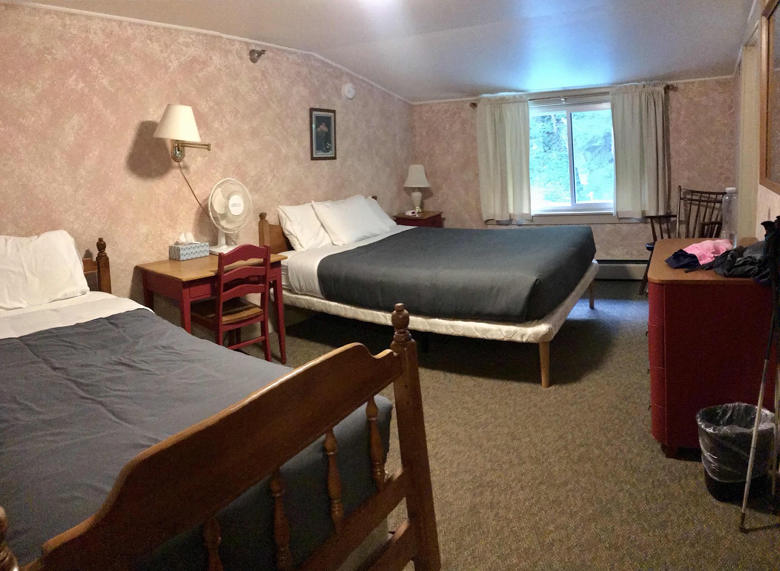
Our 3rd floor room in the Inn at Long Trail. One day we’ll come back to Vermont and hike the Long Trail in the fall and stay here again.
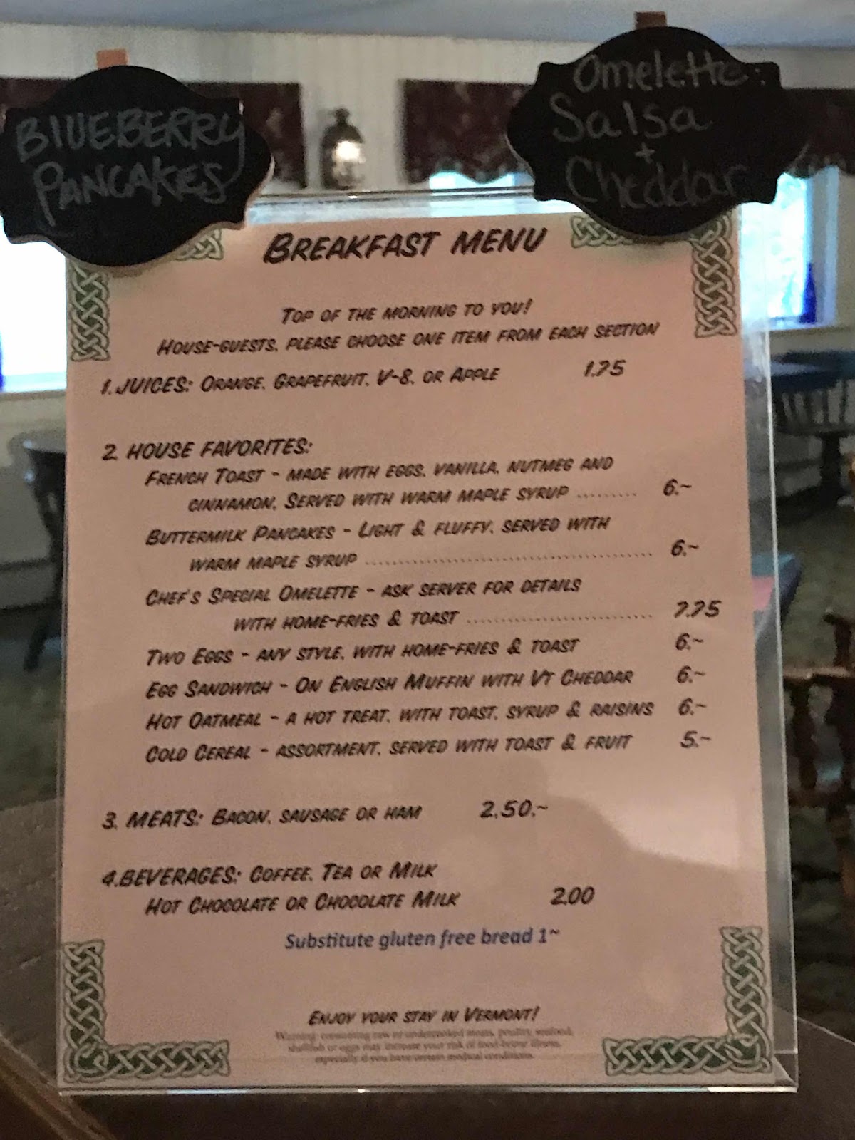
Menu in the restaurant
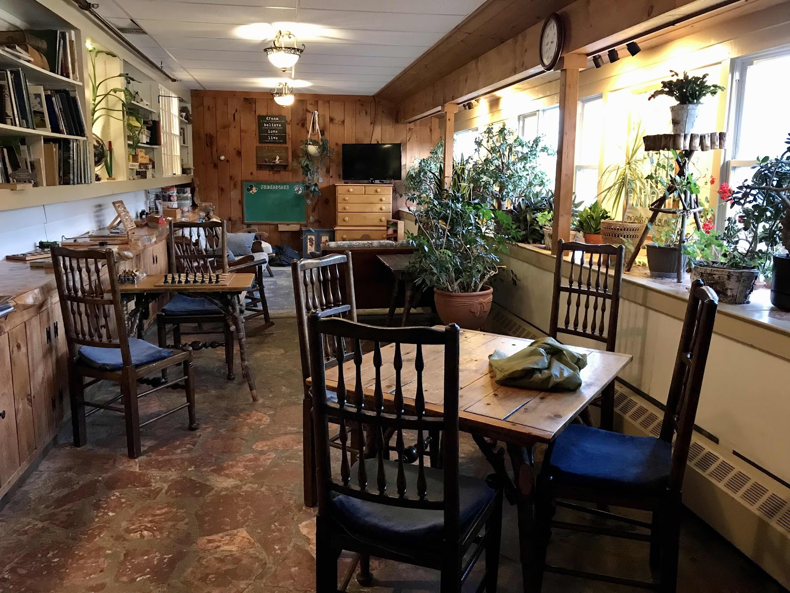
One of the lounge areas

Main Lobby lounge area
Day 53
Wednesday, September 1st
Zero in Rutland
495.3
Today is September 1st. Between the beginning and end of August we have lost 45 minutes of day light on each end of the day. That’s 1 1/2 hours and really makes a difference for a full time hiker!
Breakfast is included with our stay at the Inn. We get to order off the menu in the restaurant and it’s set up in a way that’s easy for me to order vegan, which is nice. The dining room had a piece of bedrock as the back wall and we get to sit next to it. It’s pretty neat. I have oatmeal, potatoes and Irish soda bread.
We stay in our room until 10 trying to decide what to do. We’d planned to hike up the mountain, camp near the top and take the gondola down tomorrow when it starts running. We though today was going to be nicer than tomorrow so that’s why we planned to go today instead of going for a zero in town like we originally thought we would. We see the weather isn’t necessarily better tomorrow and decide to go into town after all. There is a free bus that picks up on the highway right out front of the Inn and goes to Rutland. We are in no rush, so we enjoy the lobby areas and catch the 11:15 bus.
We ride all the way into downtown Rutland to the transit center. Our hostel for the night, the Yellow Deli, just happened to be located right there. We arrive before noon. It wasn’t a long bus ride. There will be a free bus back to the trail hourly starting at 7:15 AM and going until 5. It’s a really nice service to have! It’s so nice not having to arrange a shuttle and not having to hitchhike either. We haven’t had to hitchhike anywhere on the trail yet.
We are warmly greeted when we go inside and then quickly separated, as a lady shows me to the women’s only area and a man shows Jeff to the men’s dorm. This place is run by the 12 Tribes religious group. We don’t really know what that means, but they are nice and they take in hikers at no charge. They all have Hebrew names. They were given those names if they were born into the community, but most of the members joined as adults and had to be renamed. We wonder how the renaming process works. Every one of them we encounter tells us their name, but we remember none of them! They are all such strange names!!
Downstairs is the Yellow Deli café which they also run. Hikers get a 15% discount. We head down right after we drop off our back packs and finish our little orientation tours.
We both recognize the interior design of the cafe as matching a place we visited in Manitou Spring, Colorado. It was called the Maté Factor Café and it had a fine corner lot of the Main Street of the touristy little downtown there. The Maté in the name caught my eye so we had lunch there and I was surprised by the pretty good vegan and vegetarian options. They also had many nice drinks made with maté, both iced and hot. This place is exactly the same, same menu and everything. It turns out they own them both as well as many other locations across the world, including two in San Diego, which I will now have to visit! When I looked up the Maté Factor Café at the time, the only other location I could find was one in Asheville, and I thought it would be neat to one day go to that one too! They sell a brand of maté that I recognized, and have bought before at Jimbo’s. I guess it’s their own brand too. They have lots of businesses.
I order a veggie burger and it turns out to be the tastiest veggie burger I’ve ever had! The patty has a meaty, jerky like texture and is made is brown rice, veggies and nuts. It remind me of a brand called Sunshine burgers. Maybe they own that too!
After lunch volunteers are recruited to harvest chamomile at their garden. We go with two other hikers and pick chamomile and other herbs for an hour or two. Their garden is about a mile away at their houses. They have bought up several adjacent properties and taken down the fences so they now have one big communal back yard. They give us a free maté iced tea drink for helping and let us eat as many herbs, tomatoes and peppers as we want. They also give us some delicious grapes too. Later when we’re back at the hostel and eating dinner in the deli again, they comp our meal for having helped out! We can’t believe how nice they are. The hostel is totally donation based or you can work for stay. We wonder if the hikers tend to be reasonable with their donations. We sure hope they are!

Sitting by the bed rock wall in the restaurant at breakfast
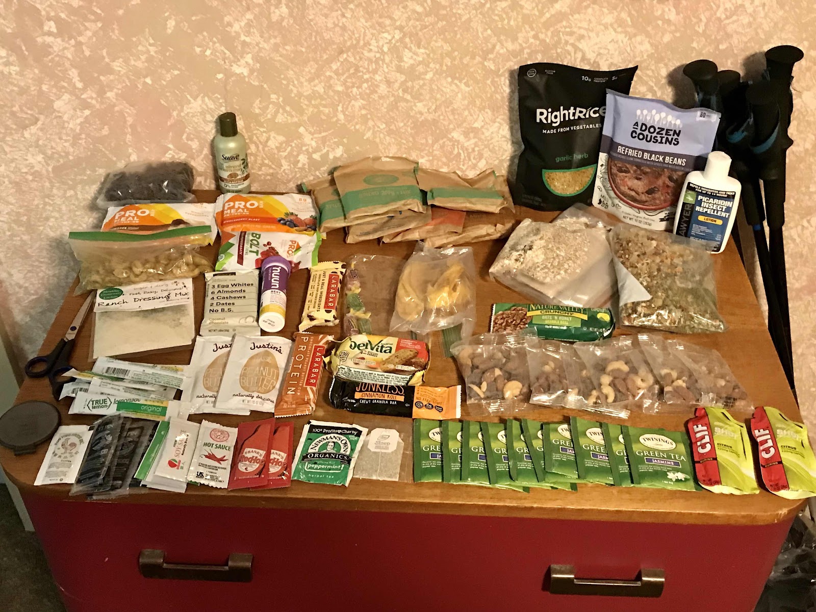
Look at all the food I got from the hiker box!! We also got a little mirror and found scissors to use for me to cut Jeff’s hair!

The lady at the front desk let us get a photo of the bar in the morning. On the lower left is more bed rock that is incorporated into the building.

The bars area in the Irish pub

The view out front of the inn, with Deer Leap rock in the background. You can hike to the rock for fine views of Pico and Killington ski areas. We did not hike to the rock, but would have liked to!

Our little nook inside the Yellow Deli

The best veggie burger ever and a maté and oat milk latte with maple syrup!
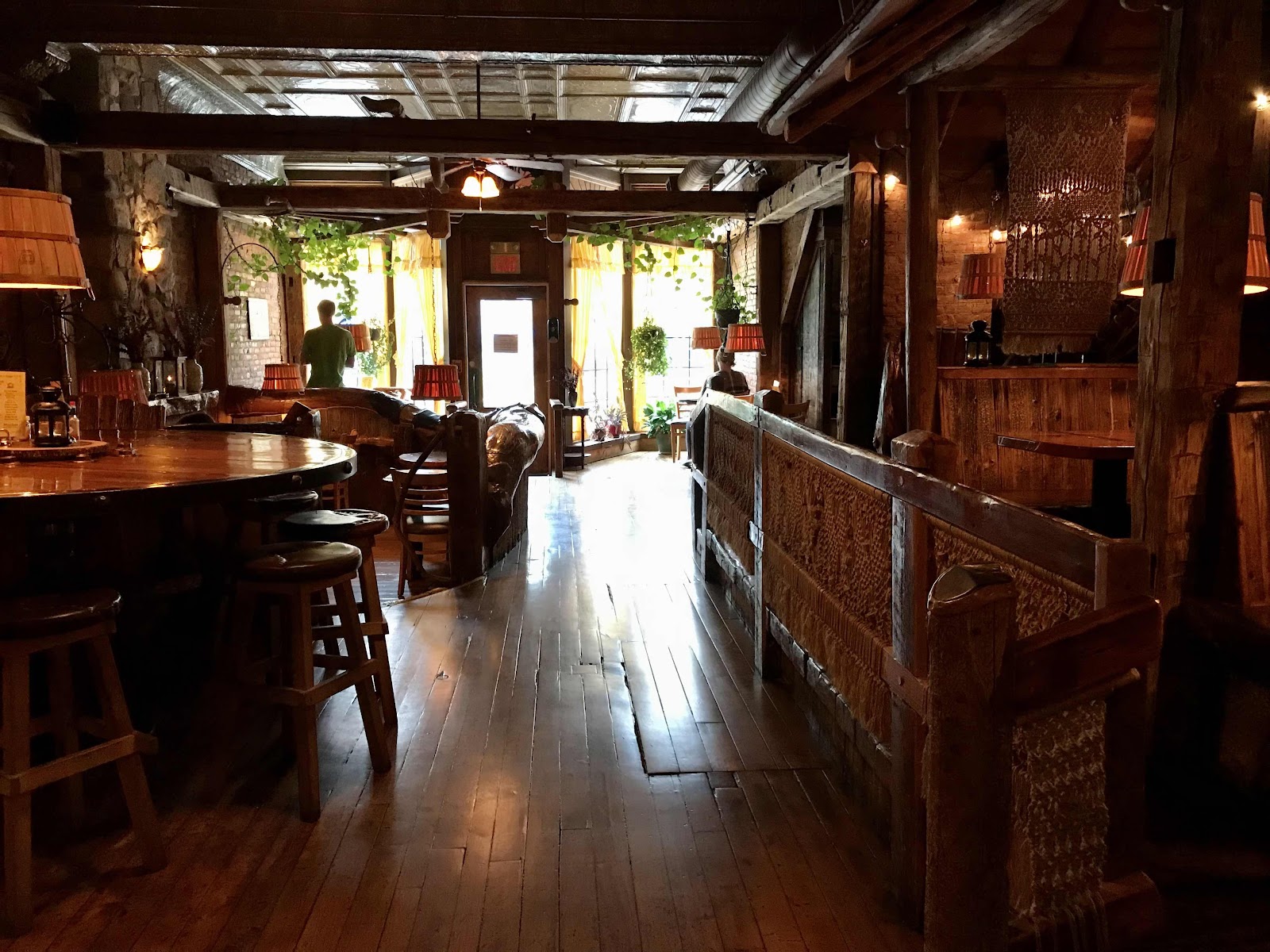
Really cool architecture inside of the deli. It’s kind of dimly lit in there and hard to get a good photo.

View on Cooper Street, downtown Rutland, out front of the hostel

View of the hostel and deli
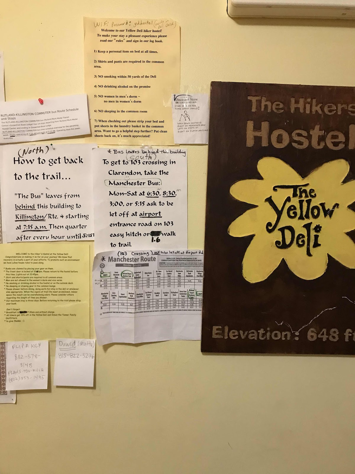
Bus information wall

They gave us each a gift basket on our beds! Contains their homemade soap bar, a maté granola bar, a juice and a maté tea bag.
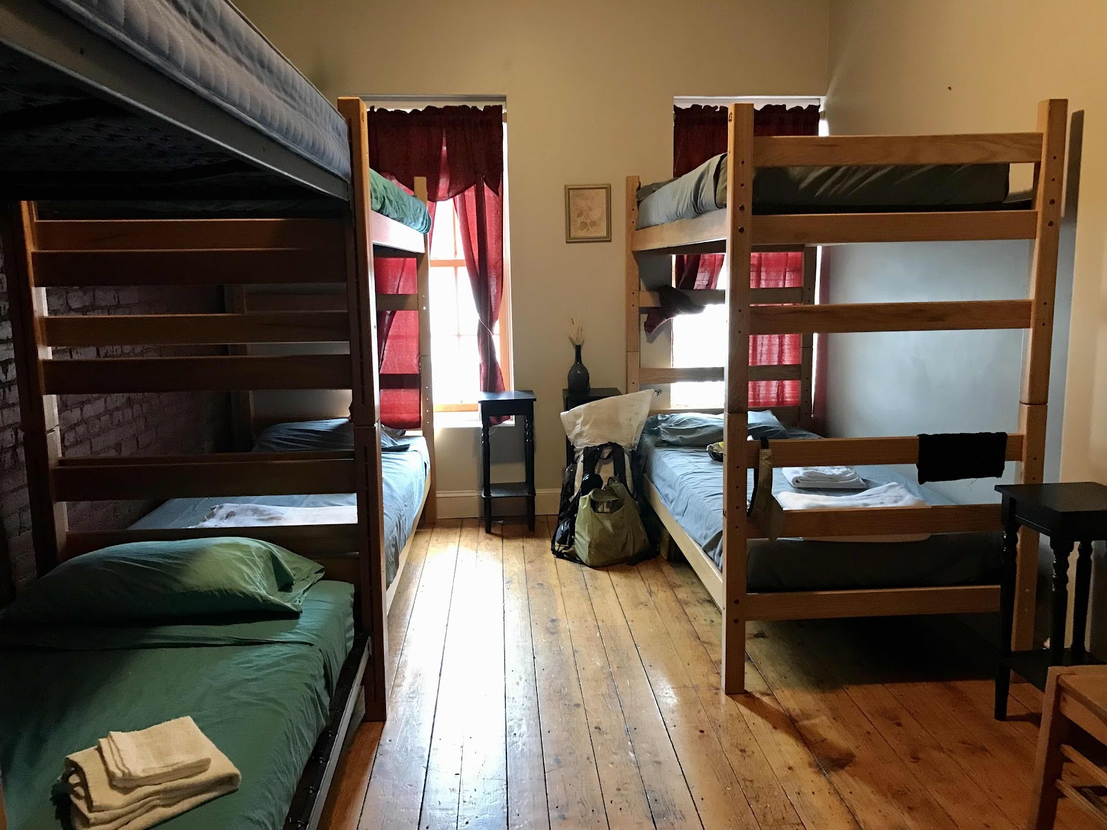
My rooms in one of the ladies dorms, on the third floor above the street

Picking chamomile in the garden at their housing compound in loaner clothes.


Comments
Post a Comment