08/06-08/10 Andover to Gorham, NH
Day 27:
Friday August 6th
256.9 - 268.1 = 11.2 miles
Stealth spot near cascades just south of Grafton Notch (0.9 miles South)
We get shuttled back to the trail at 7, having not slept terribly well or for long enough. We had a feeling last night that we’d want to go later, but we stick to it, knowing it will leave us better off in the afternoon when we’re trying to find a campsite.
We stop at the stream that parallels the road we are dropped off at. We eat the oatmeal that I made for breakfast before we left the house. They gave us a muffin, but it’s not enough. Before we get going we see Chelsea. I guess her, Dr Dolittle and the Queen of Denmark camped here at the road last night. They are part of the group that we called the early risers. We learn from Dr Dolittle that they all saw a moose last afternoon here at the stream, Peter and Kae included. He says Peter and Kae moved on another 4+ miles to the lean to to camp.
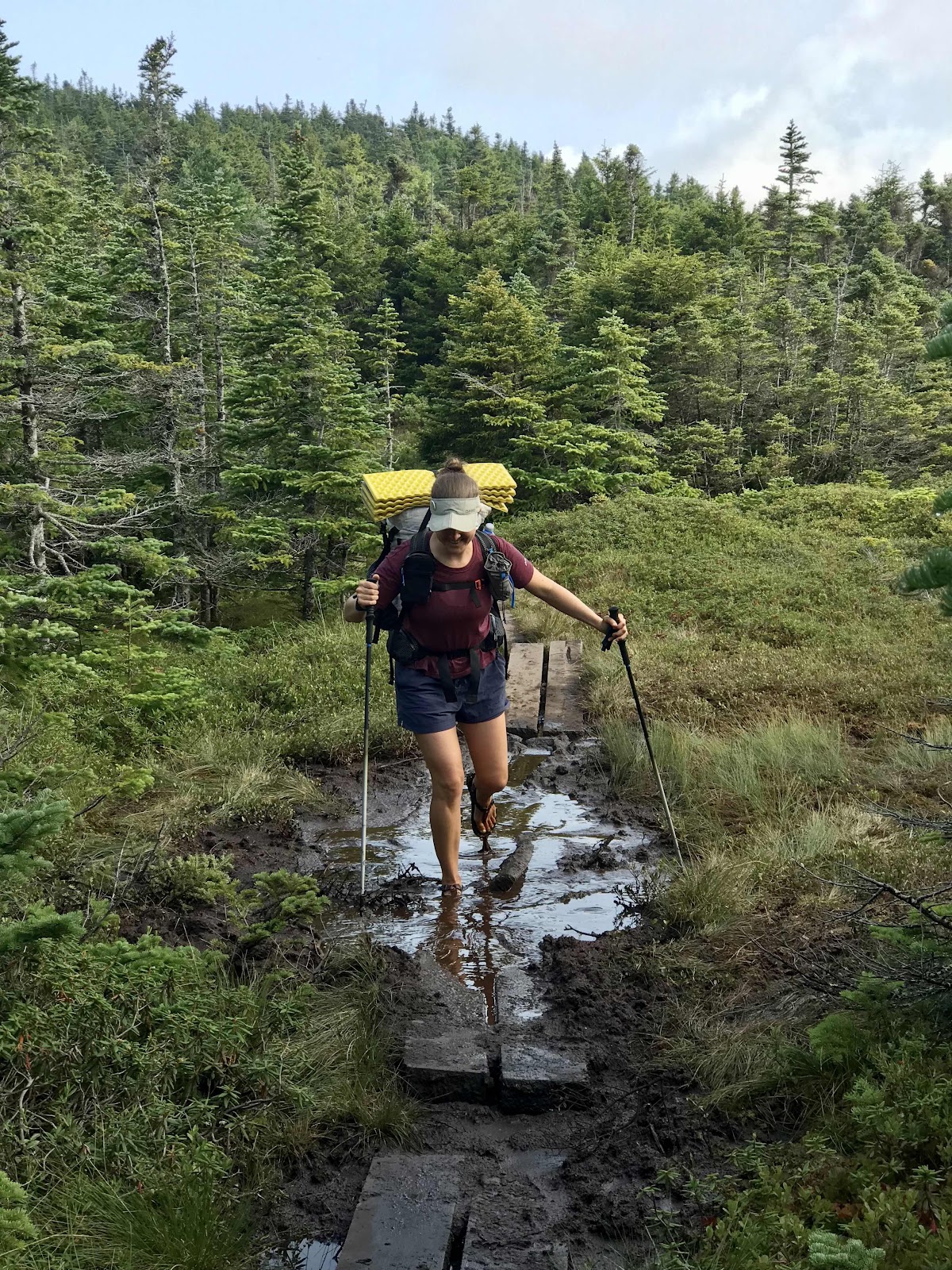
We are faster hikers with our light day packs. Jeff has a colorful Jansport and I have a monogrammed girls L.L.Bean one. We quickly leave everyone behind and we are in the lead again, breaking down all the spider webs until the first NOBO comes along. We are climbing Baldpate Mountain today. For awhile the climb is easy, up and over Surplus Mountain, a lesser peak that we must get over before reaching the real climb. It’s a forested summit that doesn’t even have a summit post. From there it’s down into a little valley and past the Frye Notch Lean-To. We make it there by 9:30, but Peter and Kae are already gone. Lean tos are generally the place to get water, so we fill up for the climb up and over the top. It’s just a tiny stream with a little trickle, but it’s good enough for us.
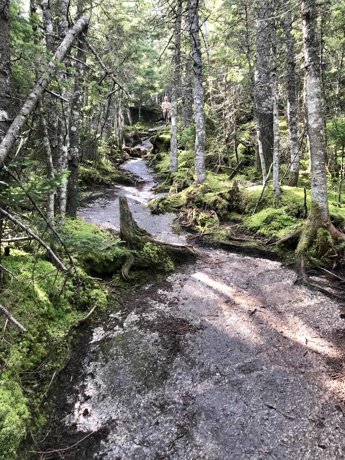
The climb gets hard when we get close to the first view ledges, the trail gets steep and becomes a bedrock ramp. Moisture oozes from the forest making it a bit slippery and scary. It is truly a slide. If you slipped, you’d go quite away before you could get stopped again. The trail is just a ribbon of exposed bedrock that was once covered by a thin layer of alpine mosses and soil but it’s long been worn away by footsteps. It probably gets a little wider every year as scared hikers stick to the edges and trample the mosses, step on the roots and grab onto the scraggly trees for support.
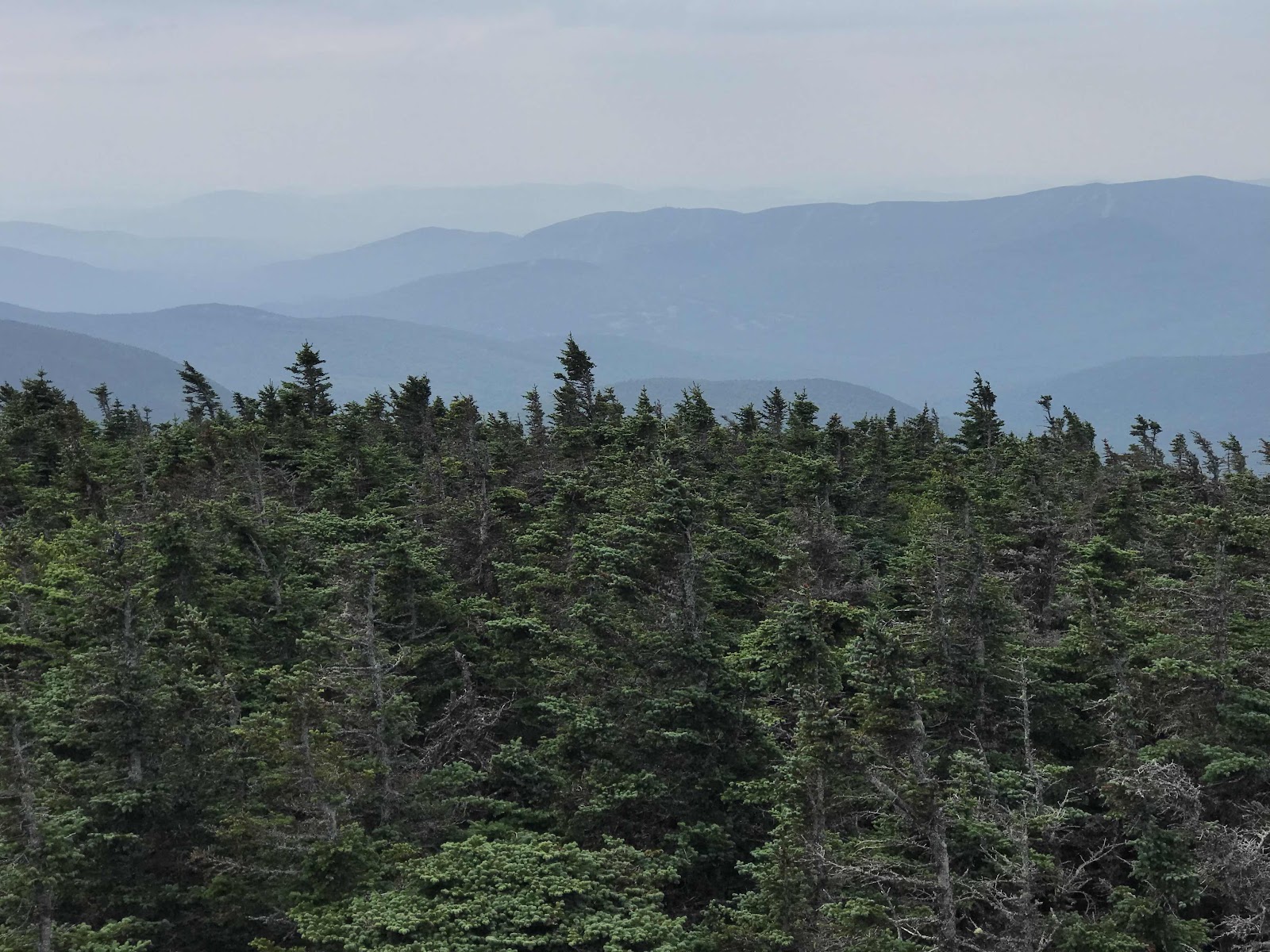
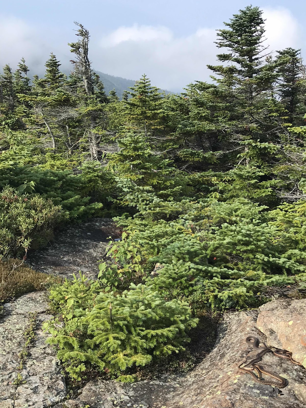
We get above tree line and have views all around us, but it’s blurred by humidity trapped smoke again. This is the third day now with smoke. We hope it goes away soon. There are blueberries and stunted alpine fir and spruce trees, lichen covered rock slabs, blue sky and big puffy white clouds. It’s beautiful. After the main peak, there is a saddle and a second shorter peak, then it’s down to Grafton Notch and across highway 26. It’s a mostly easy descent, but for a short while we are on slippery bed rock slopes with a spring running down it.
It’s nice being anonymous day hikers today. We don’t stand out as thru hikers, which means the NOBOs are nicer to us and some even seem to want to make sure we know that they are thru hikers and that want us to be impressed by them. One especially cocky guy asks us if we are from around here and we tell him no, we’re just slack packing today. He says to him that makes us day hikers and he is a thru hiker. He says it like he is superior and as if we can no longer call our journey a thru hike since we didn’t carry our full load today. So he is not only a condescending NOBO, he’s also a purist. There is definitely a rivalry between NOBOs and SOBOs, with many NOBOs having the attitude that they are better than us. It’s really strange that this is really a thing! Being a purist is also a big deal to some hikers, they must hike every step of the trail with their fully loaded backpack. (note: a NOBO is Northbound hiker that started in Georgia, a SOBO is a Southbound hiker that started in Maine.)
We stop at a second lean to for lunch. A true luxury meal, hummus tortillas with coconut almond butter, olives and cucumbers plus a giant cookie.
We arrange for our back pack shuttle to meet us at 3. We are on the trail about 7 hours after hiking 10 miles, but it’s only a 20 minute drive for them. The lady from our hostel is there waiting when we get there and we sadly trade our little day packs for the big ones.
There’s trail magic at the parking lot, a lady called Queen Diva. She has a whole spread of homemade food. We try her whoopie pies, and have bananas and she makes me a salad and Jeff a soft taco. We sit in her lounge chairs for almost 2 hours and rest. A big pack of NOBOs left right when we got there, so it’s just us. She tells us all kinds of stories about her years of hiking experiences and trail magic and about all the hikers she has met. We hear about her history in New Jersey, being a nanny when she was young. Now she is a teacher, which is how she gets summers off for hiking and being a trail angel. She asks us our trail names and we tell her the tentative names, Side Trail for me and Sweet Releaf for Jeff. She says they are great ones that she’s never heard before, so I guess those are our names now. Eventually we get the motivation to leave and she sends me off with a big bag of extra lettuce.
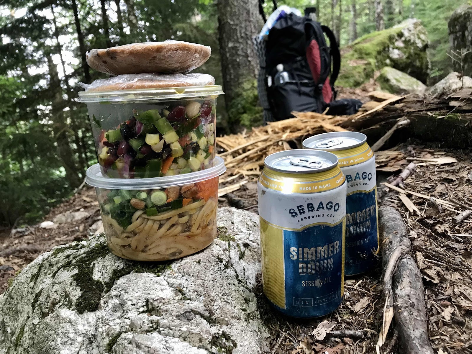
We have to climb again and plan to stop as soon at we find any place we can put our tent. We see lots of day hikers coming down the trail. We don’t make it far before stopping at a waterfall. While we are stopped we see a girl come past with bananas attached to her backpack. Jeff mentions them and she immediately offers them to us. Then she opens up her backpack which is full of prepared foods from the health food store in Bethel and offers us to take whatever we want. It’s the last of what she still has to give away. We get 2 bananas, 2 big chocolate chip cookies, a bean salad, a peanut noodle salad and two beers! She has two more cookies and another bean salad and peanut noodle salad, it’s temping but we refrain from taking it all! We wonder how much she started the day carrying! What a day of trail magic! She says her trail name is Banana and that she thruhiked in 2010. She now lives somewhere near Bethel and works on a lettuce farm!
We hike just a little further to a small clearing where a tree must have fallen over, creating just enough space for us to lay flat in our tent on the side of the trail. We eat our luxuries, mixing the bean salad with the lettuce. It is a double dose of trail magic that was meant to go together! It’s better than having gone into Bethel ourselves. Sadly we don’t make a dent in our heavy backpack food bags. Our packs are the heaviest they have been all trip and we have one of the most technical days tomorrow going through Mahoosuc Notch. We definitely won’t go hungry!
What a great day it was! We are so glad we slack packed and don’t regret it for a second, no matter what any snarky NOBOs say! We are also incredibly thankful for all the trail magic. We are in the tent by 8, exhausted and ready for another round of rest!
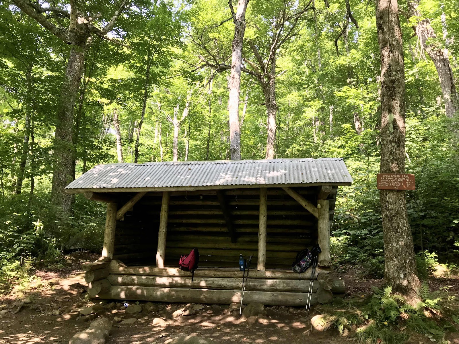
Frye Notch Lean to in a beautiful maple and birch forest
Steep climb on smooth slab rock up Baldpate Mountain
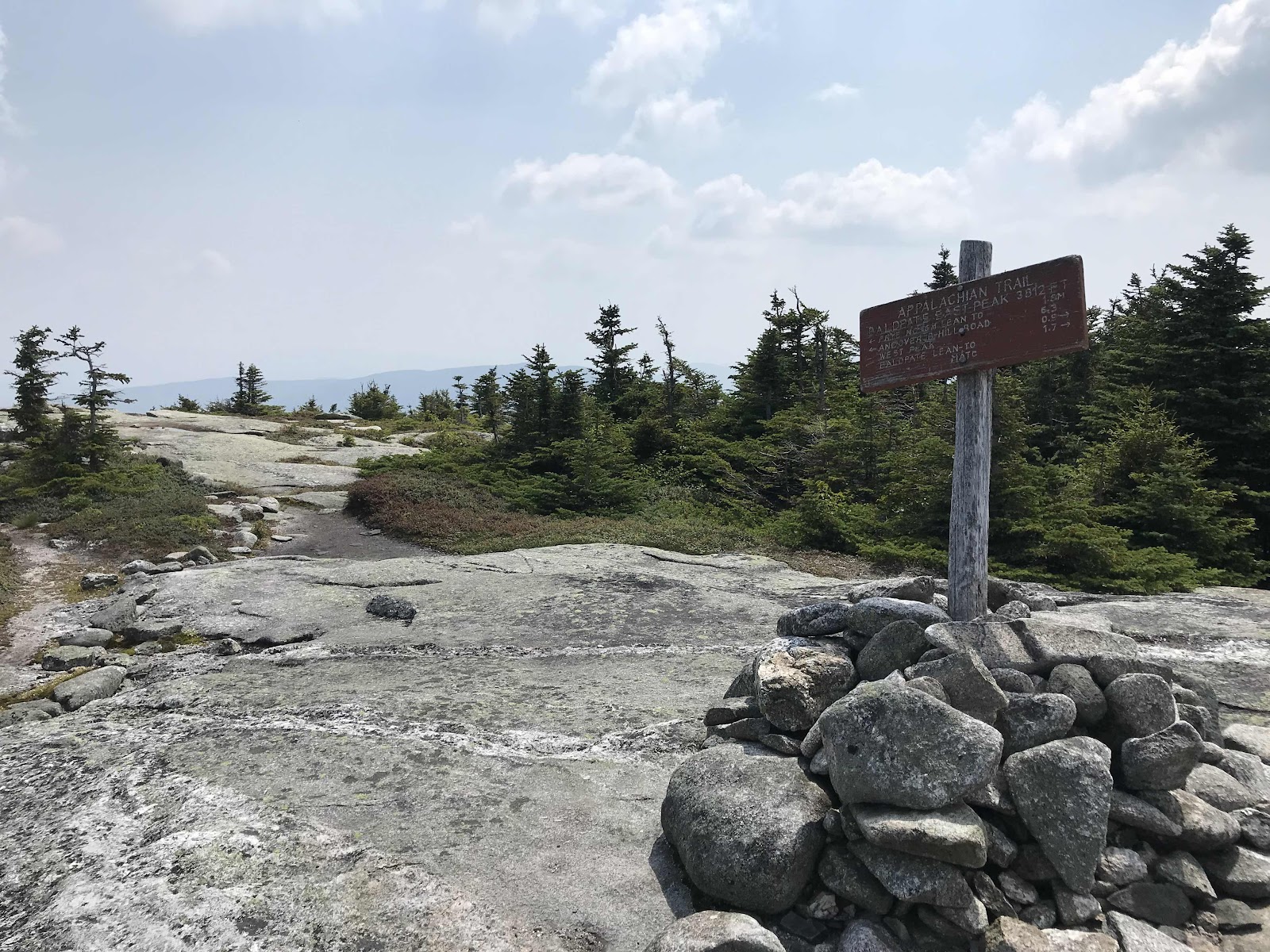
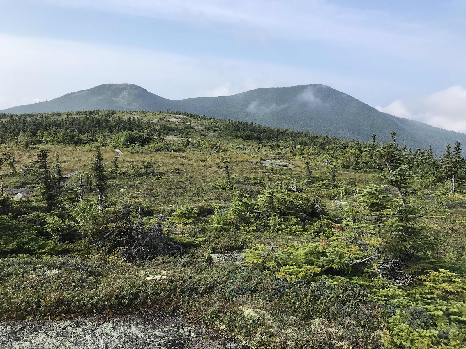
Top of East Peak of Baldpate

Sitting at the top of East Peak looking toward Old Speck, tomorrow’s mountain

Really enjoying my little monogrammed girls L.L.Bean backpack
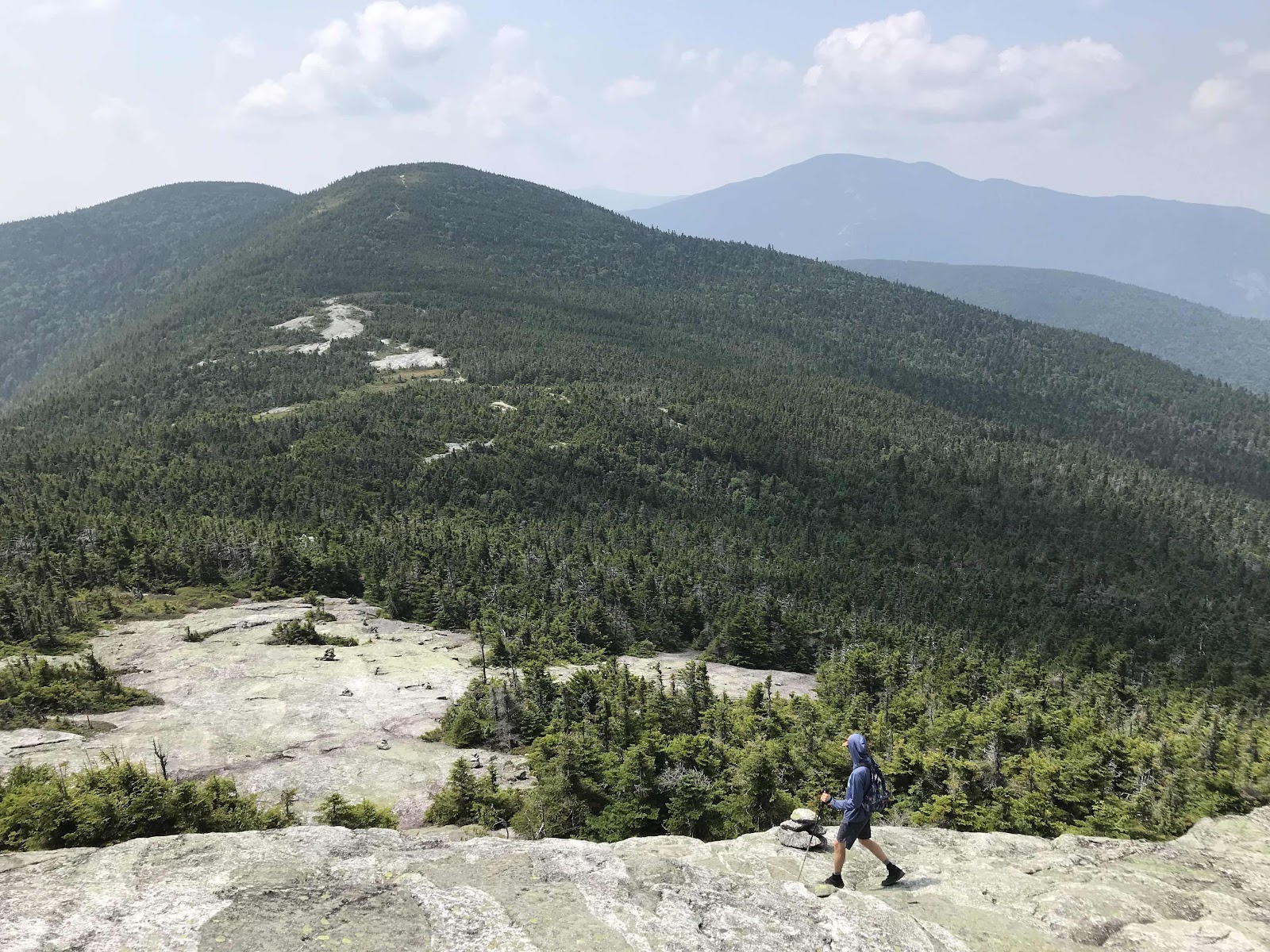
Going down from East Peak toward the forest West Peak

Looking back at East Peak of Baldpate Mountain from the boggy saddle.

Forested West Peak, no views
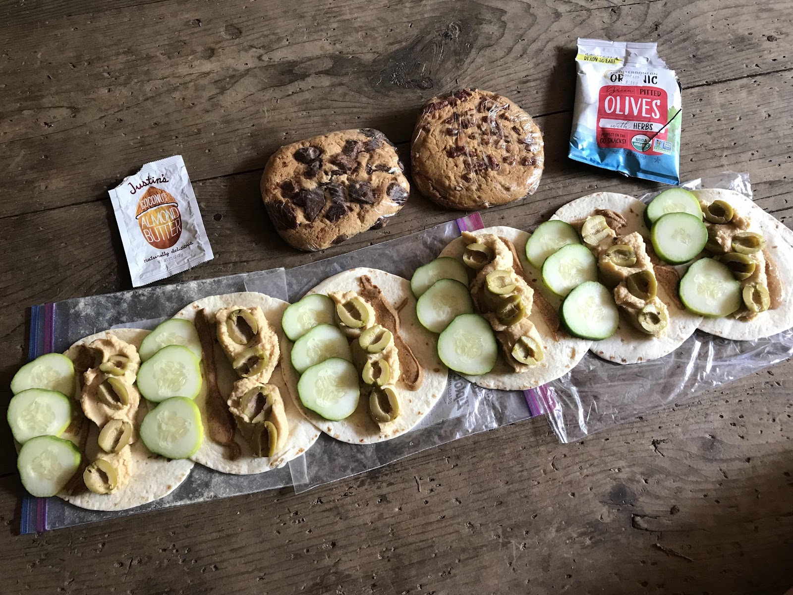
A really good trail lunch of giant cookies and tortillas with hummus, almond butter, cucumbers and olives.

Thank you MATC!
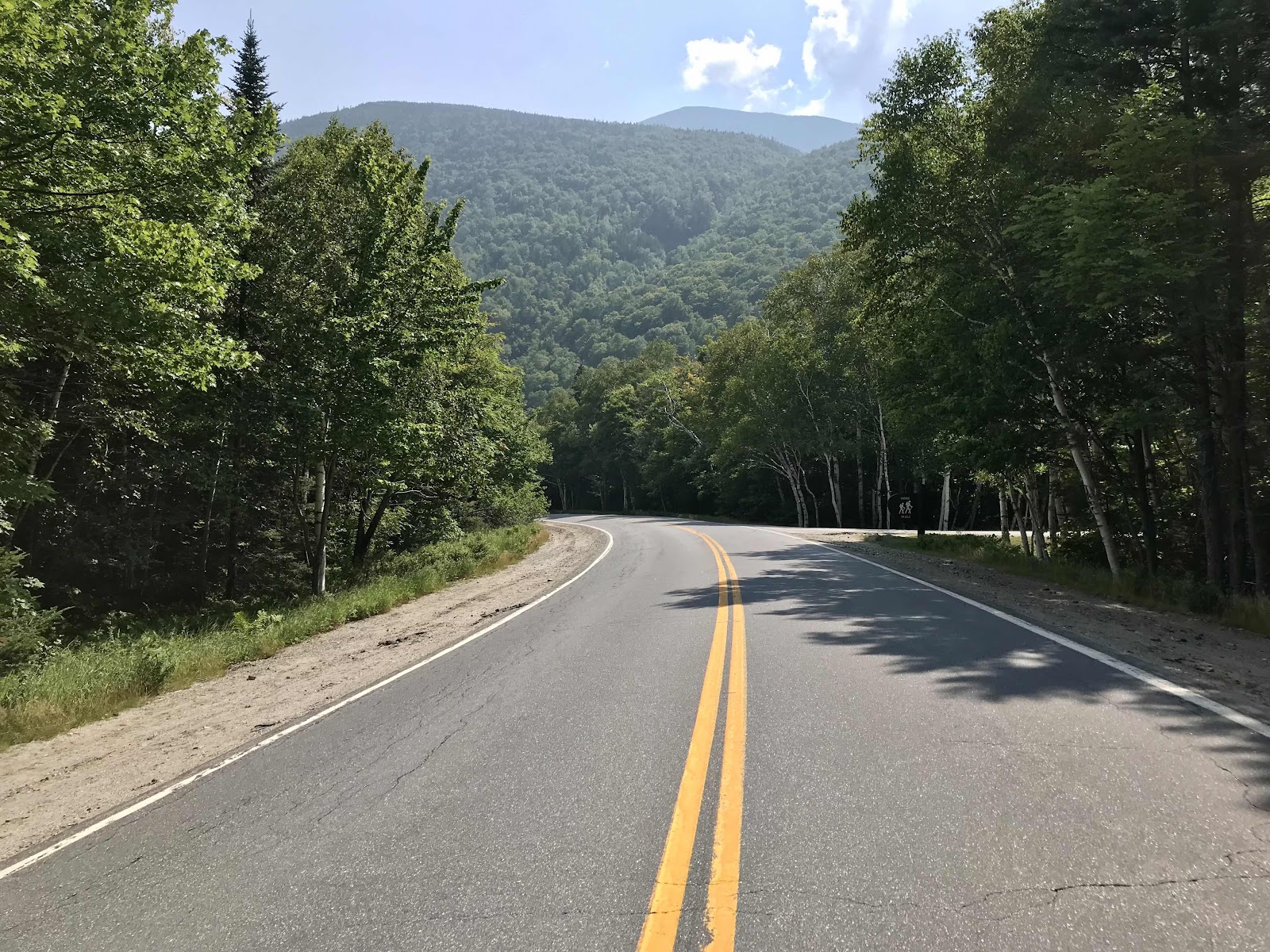
Maine Route 26, Grafton Notch

Cascades on the way up Old Speck
Trail magic!
Day 28
Saturday August 7th
Full Goose Shelter
268.1 - 276.9 = 8.8 miles
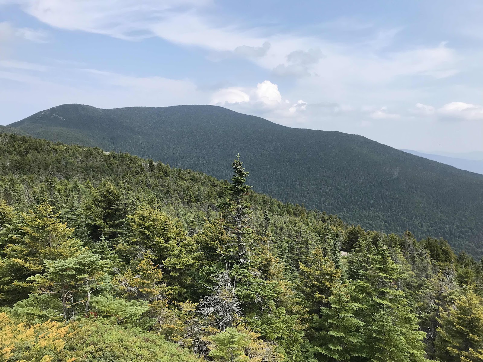
We are up at 5 thanks to ultra runners coming by chatting loudly amongst themselves. We have an easy ascent up to shoulder of Old Speck. We make good time and leave our packs at the junction with the side trail to the top. It’s a super easy 0.3 miles to the summit, which has a neat fire tower for climbing up and looking at the view. Sadly it’s once again smoke mixed with humidity, but we can still see pretty well. There are views across Grafton Notch to Baldpate and West toward Bethel and Sunday River ski area and South to Mt Washington.
The trail gets more technical as we descend off of the mountain on rock ramps. We stop a short while later at Speck Pond, one of Maine’s highest alpine lakes with the AT’s highest elevation shelter at 3,419 feet. There is also tenting on wooden platforms and a composting toilet. It’s a fee area for camping that’s run by AMC (The Appalachian Mountain Conservancy). It’s $10 per person. We meet the caretaker and she teaches me how the composting toilet works. It’s pretty neat, but hard work. She has to stir the poop every day, move it to various finishing bins, dry it in the sun and disperse the finished product in the woods. The liquids get strained out and she also has to disperse that in the woods too! I don’t know how old she is, but she looks young, maybe early 20s or even younger. She will spend the whole summer staffing the site. I’m curious how much money they pay her. We hear from another hiker that her wage is more than what she collects in fees.
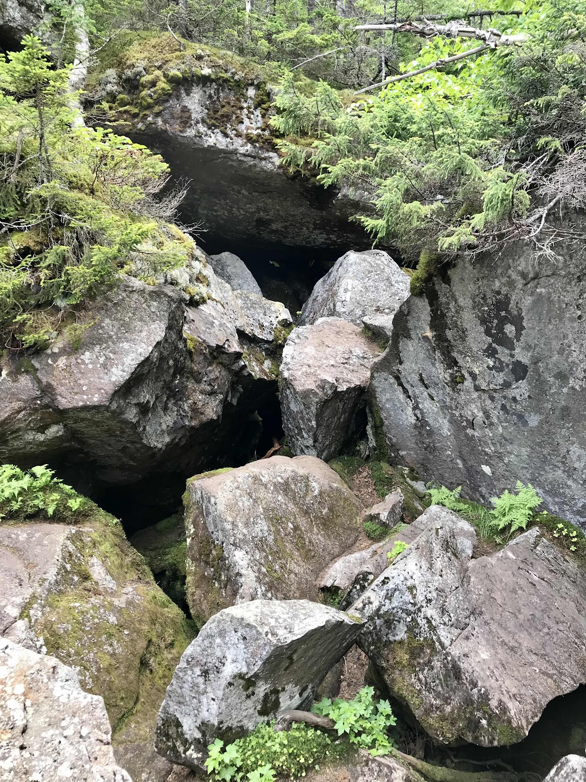
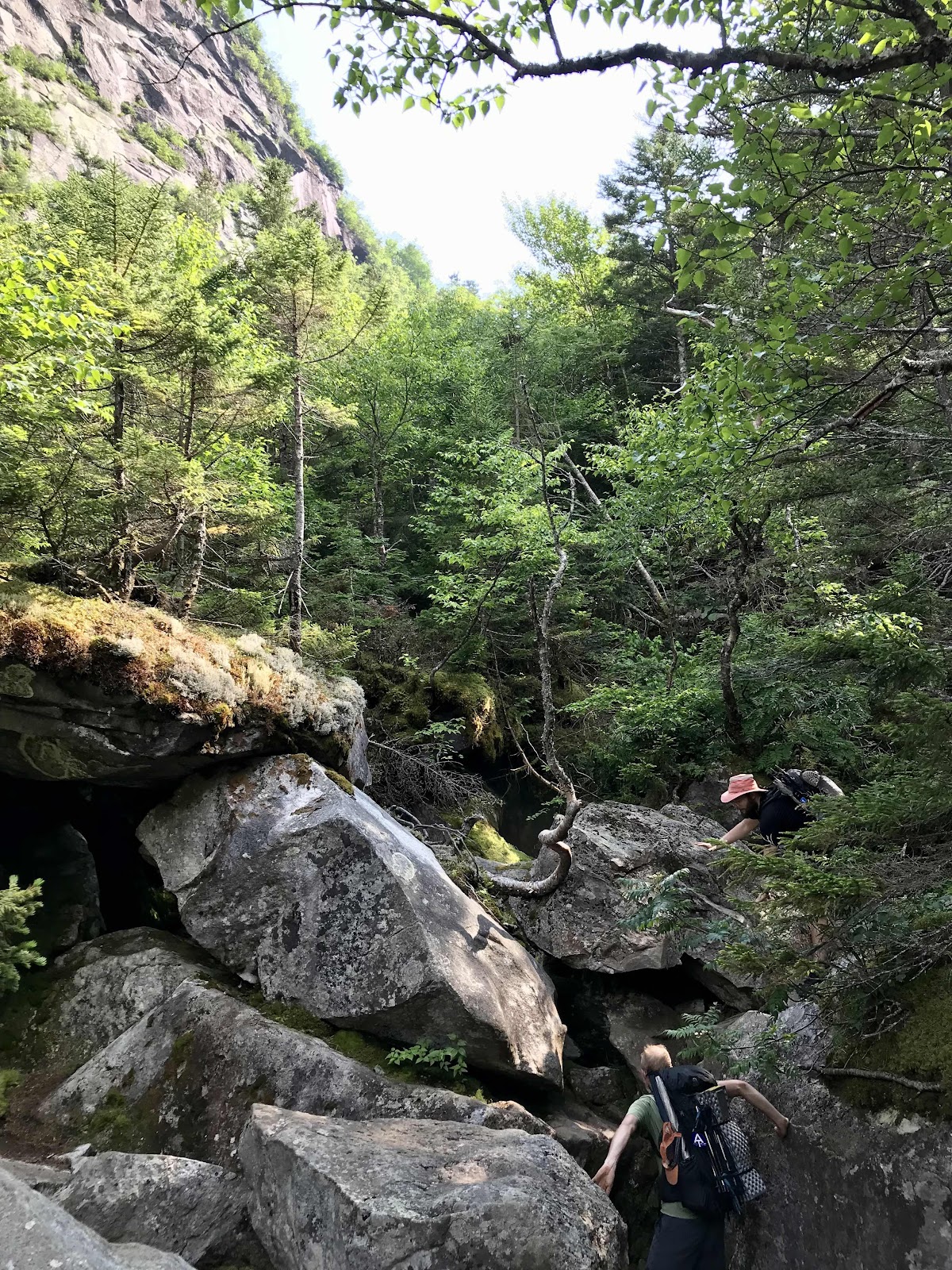
We stop there for a lengthy lunch, then continue on down the Mahoosuc Arm and into Mahoosuc Notch. This is a part of the trail we’ve been hearing about since the beginning. It’s known to be the hardest part of the whole AT. Going down the arm is the steepest part of the whole trail, dropping 1,500 feet in 1 mile. It is indeed very steep and we imagine very slippery when wet since it’s mostly rock slabs. It doesn’t seem any worse than other steep stretches we’ve seen in Maine, but we’re still grateful to be going down and not up and also grateful that it’s totally dry today. At the bottom of the valley we rest briefly at a creek, then enter the notch, a crazy jumble of giant boulders to maneuver up, over and around. We meet a SOBO flipper named Toe Jam and he hikes through the notch with us for safety in numbers. He is a sandal wearer like me, but recently broke a toe and is currently hiking in cheap Walmart sneakers until it heals. A flipper is a hiker who takes a non traditional route, most often starting in Georgia going north and then jumping to Maine at some point and going south, back to wherever they left off.
The notch is pretty neat. We are deep in a valley that is surrounded by tall cliffs. Cool air flows out of the deep rock crevices and some of them even still hold snow or ice! It’s definitely a challenge maneuvering through, but we find it fun! We put our trekking poles away and use our hands to climb, crawl and scoot our way through.
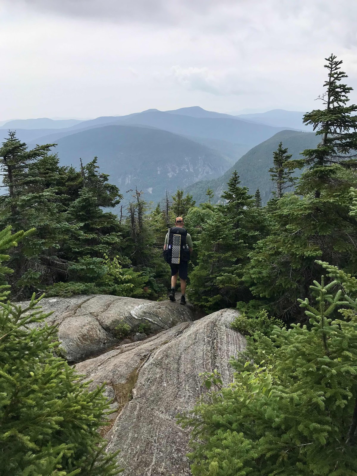
It takes an hour and twenty minutes to make it the 1 mile through the notch, then we are climbing up and out on steep valley walls. Luckily the trail is well built up here and we have stairs and rebar to help us out. It’s a mile to Fulling Mill Mountain and we have excellent views again from the bare rock slabs up top. We can still see the ski area and Mt Washington and now Old Speck and it’s tower. We watch a storm roll in and get briefly rained on. We hurry the last half mile down the mountain to the next lean to, Full Goose, where we stop for the night.
There is a large youth group camped here that takes up most of the tenting in the area, so we decide to sleep in the shelter. We usually don’t sleep as well in shelters, but the forecast calls for heavy rain overnight and into the morning, so we decide it’s worth it to keep the tent dry.
We didn’t make it far today, but didn’t expect to on this most difficult of days. We are exhausted and hungry. The youth groups have just finished cooking dinner and they have leftovers. We each get offered a big scoop of curried rice and veggies. It’s delicious and saves us from having to cook dinner. Before bed a heavy soaking rain comes through with some real loud thunder, but we are safe and dry in the shelter. After dark with 8 hikers already in the shelter and ready for bed another hiker shows up, having hiked the 20 miles from highway 2. We all have to make room for him and listen to him do all the crinkling and zippering and velcro-ing and inflating that goes along with getting ready for bed. He even has the nerve to fire up his stove and cook a ramen bomb, which is ramen noodles with instant mashed potatoes mixed into the broth. We know because we can smell it, then we hear his loud slurping and mouthing and ridiculously exaggerated blowing sounds as he attempts to cool the noodles and potatoes and eat them. Jeff’s misophonia goes through the roof! It’s nearly 10 by the time we get to sleep and then we are awoken intermittently by the sounds of the slurper and two other old men taking turns snoring and vibrating the wooden floor of the shelter.
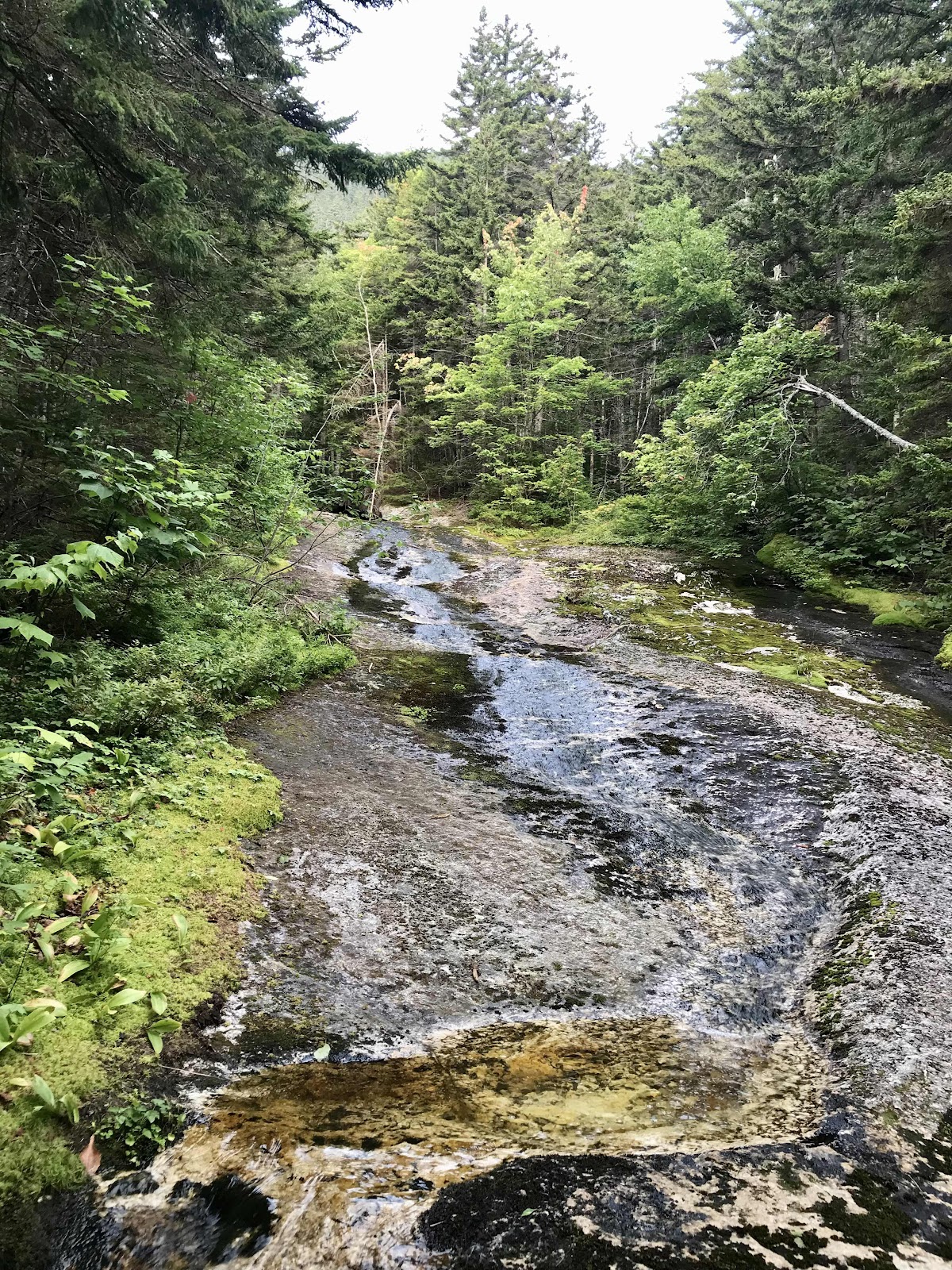
Water falling on smooth slabs, right next to where we camped
View toward Sunday River ski area from Old Speck mountain, 4,170 ft. It’s hard to tell in the photos, but we could see ski runs.

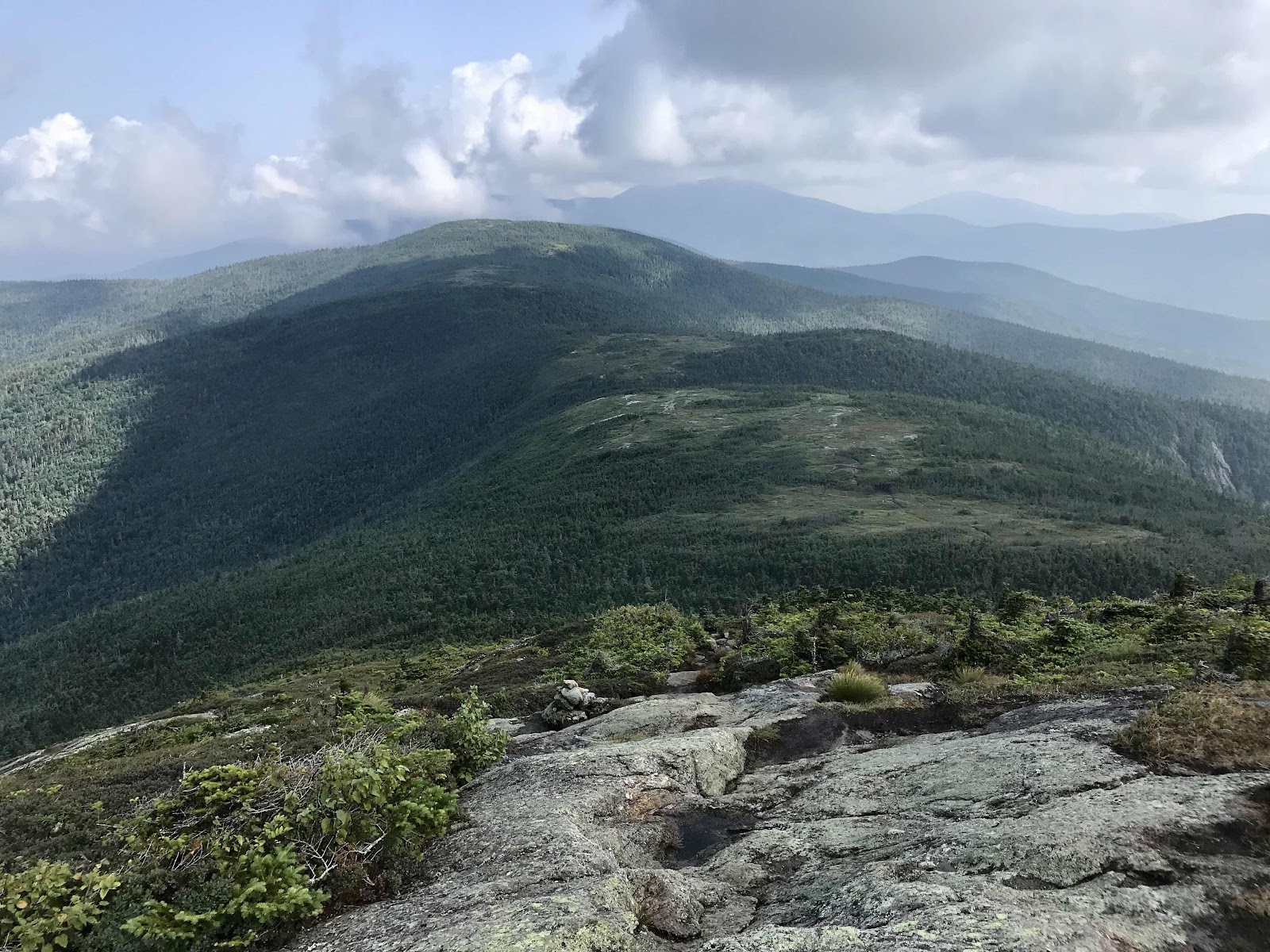
View from Old Speck toward our upcoming mountains and Mahoosuc Notch, the valley down to the right.

View back to yesterday’s mountains from the fire lookout tower

Tower on top of Old Speck

Going down from the top. This kind of rock is so slippery to walk down on.

Speck Pond, one of the highest elevation alpine ponds in Maine
View back to Old Speck
Going down Mahoosuc Arm, near the top

Down Mahoosuc Arm, the photos never make it looks as steep and challenging as it is

Another look back up on the trail down Mahoosuc Arm

Going through the boulder field of the Notch with Toe Jam

Trail through Mahoosuc Notch
Trail through Mahoosuc Notch
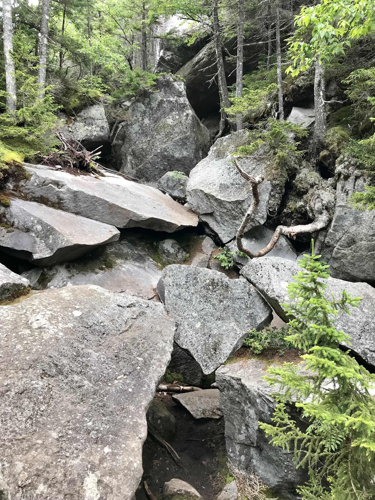 Trail through Mahoosuc Notch
Looking out of the Notch
A view of the steep cliffs above Mahoosuc Notch. We’ve been seeing a lot of notches recently. It seems to be a fancy way of saying valley.

Dwarf dogwoods blooming, normally an early spring flower
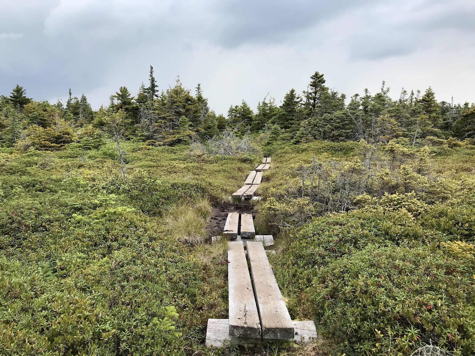
Bog bridges on Fulling Mill Mountain

Watching the storm come in on Fulling Mill Mountain around sunset. Back lit in the distance is Mt Washington

We can still see Sunday River ski area near Bethel
Day 29
Sunday August 8th
Gentian Pond Shelter
276.9 - 286.5 = 9.6
In the shelter in the morning one of the old snorers has an alarm set for 5 AM, which he snoozes until 6. Snorers and snoozers should not be allowed in the shelter! Because of them, we do not end up getting the deep peaceful sleep we so desperately needed. We are tired all day and feel headachey. For the first time our legs felt stiff and sore all night. We’re dragging all day. I am so tired all day that I feel if I laid down I’d be sleeping instantly.
The forecast was originally for rain today but since it came early last night we seem to be ok in the morning. We have really been lucky with the rain so far in our hike and have yet to have a truly miserable wet day. The day starts off foggy, then becomes somewhat sunny. We begin with some really difficult cliff climbing and have 5 mountains to go up and over. There are some ladders, stairs and rebar, which help, but mostly we’re on our own, to find our way up the steep sections. It’s also rather boggy, with wet feet being unavoidable in some areas due to sinking bridges and a lack of bridges and stepping stones in some places. Through the misery there are cool alpine plants to look at and beautiful shifting clouds and fog. We are in the alpine most of the day.
It’s an exhausting day with so much up and down. We are tired all day, but it gets a little easier at the end. Just before camp, we get a bit of rain. It last about half an hour but we fare well with our umbrellas on an easier part of the trail through the forest. Somehow we make the almost 10 miles to camp. We set up our tent on a platform, get dinner ready quick and fall into a deep sleep before dark.
It’s always nice when we have help getting up or down the steep stuff


No help from ladders, steps or rebar on this cliff face, that’s the trail, you just go up however you can
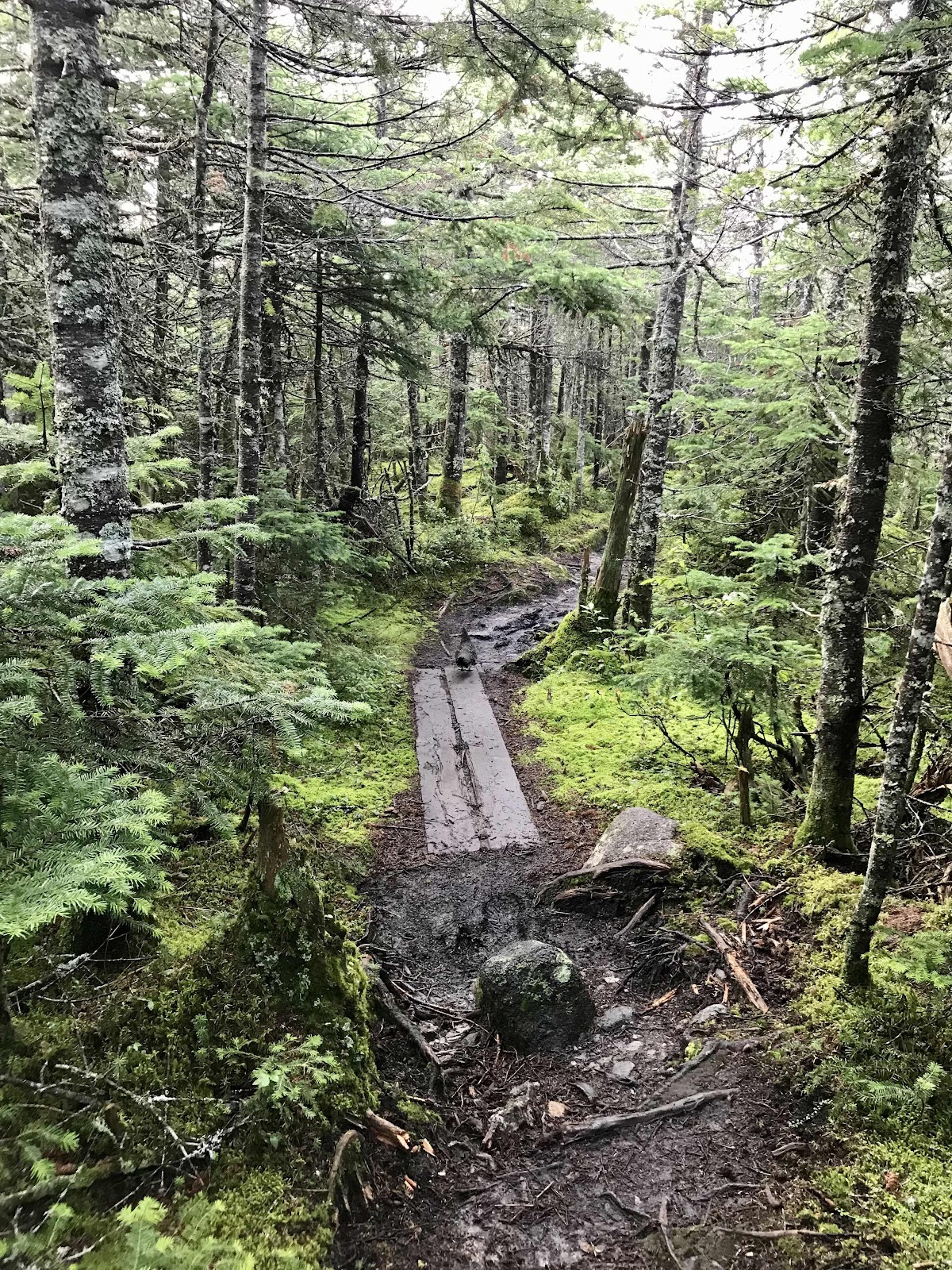
Spruce grouse in this photo, on the bog bridge
Goose Eye East and West Peaks
3 snakes sunning themselves in the alpine
The bog bridges aren’t always helpful, sometimes they sink

A particularly nice stretch of trail work
Looking back toward Old Speck

View back to Goose Eye East from the West Peak

View down from Goose Eye West Peak

After the clouds have cleared a bit more, a look back at the mountains we just climbed, the Goose Eyes
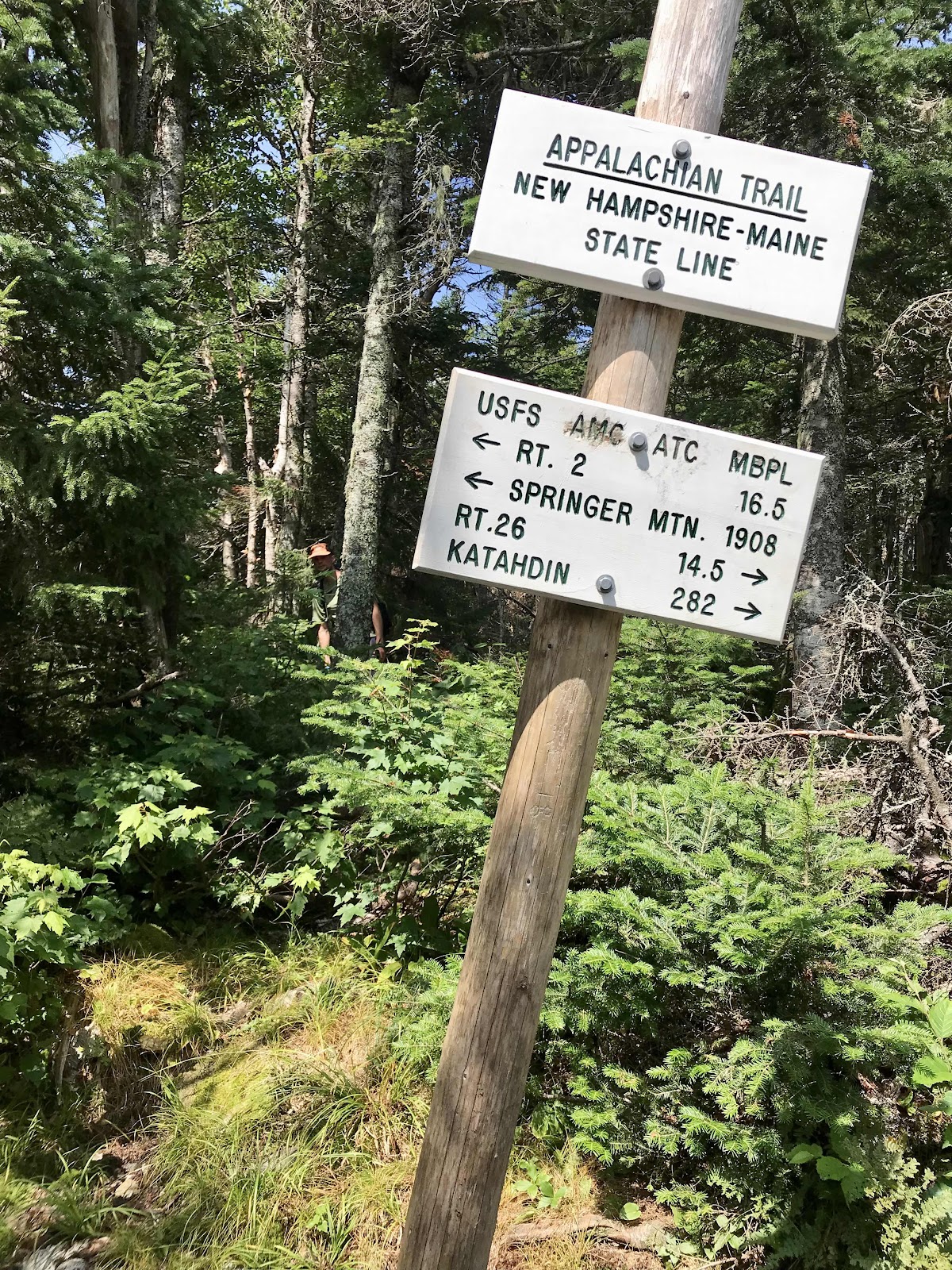
New Hampshire - Maine state line

More walking on smooth slabs

View back on today’s terrain from Mt Success

Shielding from the burning hot sun on Mt Success
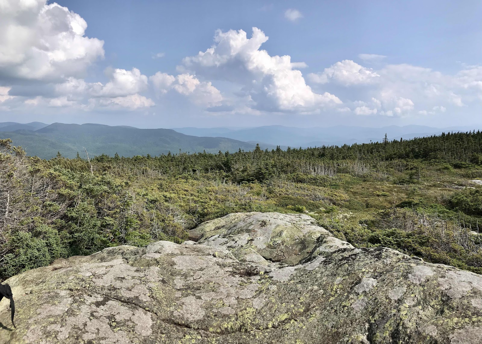
View from Mt Success
Day 30
Monday August 9th
US Route 2
286.5 - 298.3 = 11.8
It’s another foggy morning. We can hear the noises of industry and have been able to since last night. We’re up on a ridge above the Androscoggin River Valley. Highway 2 is down there and our next resupply town, Gorham. We can hear trucks on the road, the train and wood chippers. We have almost 12 miles to hike along the ridges, so it’s a tease seeing and hearing all that and having to hike all day to reach it.
A hiker on the PCT once told us there’s no breaks on town days, and there is some truth to that. Most hikers tend to go faster, stop less and eat less when they know town is coming. On these days our packs are theoretically lighter due to lack of food weight which helps with the going faster and the motivation to get there and eat again. Unlike the average hiker we try to enjoy the day, continuing to take breaks and eat and not rush to go sit in a hostel.
It’s warm and windy today. A weather shift is coming, a heat wave through the weekend. There are cloud caps on the mountains all around us but blue skies and sun above.
It turns out to be a super easy day in which we can make good time. There is a good amount of elevation change but no obstacles for our feet, we walk on level ground covered with soft leaf litter. It’s wonderful!
We reach the highway around 4:45 and call the hostel owner, Paul, who leaves immediately to drive the 5 miles out to the trail to get us. He runs the Barn Hostel and historic Libby House B&B. He says it’s the oldest hostel in New Hampshire. He’s incredibly nice.
We are in pretty good sized town for the first time since the town we flew into in Maine. There is fast food and Walmart, but it’s all a bit of a walk, so I find leftover food from other hikers and make a meal out of it. I use tortillas, a can of refried beans, an avocado, a tomato and salsa to make us two burritos each. It’s always surprising how much food people leave behind. There is also lots of food in the hiker box, so we won’t need to buy much tomorrow for our next leg.
It’s supposed to be pretty nice tomorrow, so we wanted to go back to the trail. We have a unique opportunity here to go back out for two days and hike the Carter and Wildcat mountains then come back to the same hostel from a different highway that leads back to Gorham. The only problem is that the hostel will be closed on Wednesday because the owner has to go to a funeral, and that’s the day we’d be getting back. After a lot of indecision, we decide to take a day off tomorrow instead, regardless of the weather, so we will return when the hostel is open on Thursday. It’s probably for the best anyway, we need a day of rest!

Page Pond

A view down toward the Androscoggin River Valley

Nice maple forest

Mesmerizing mushrooms
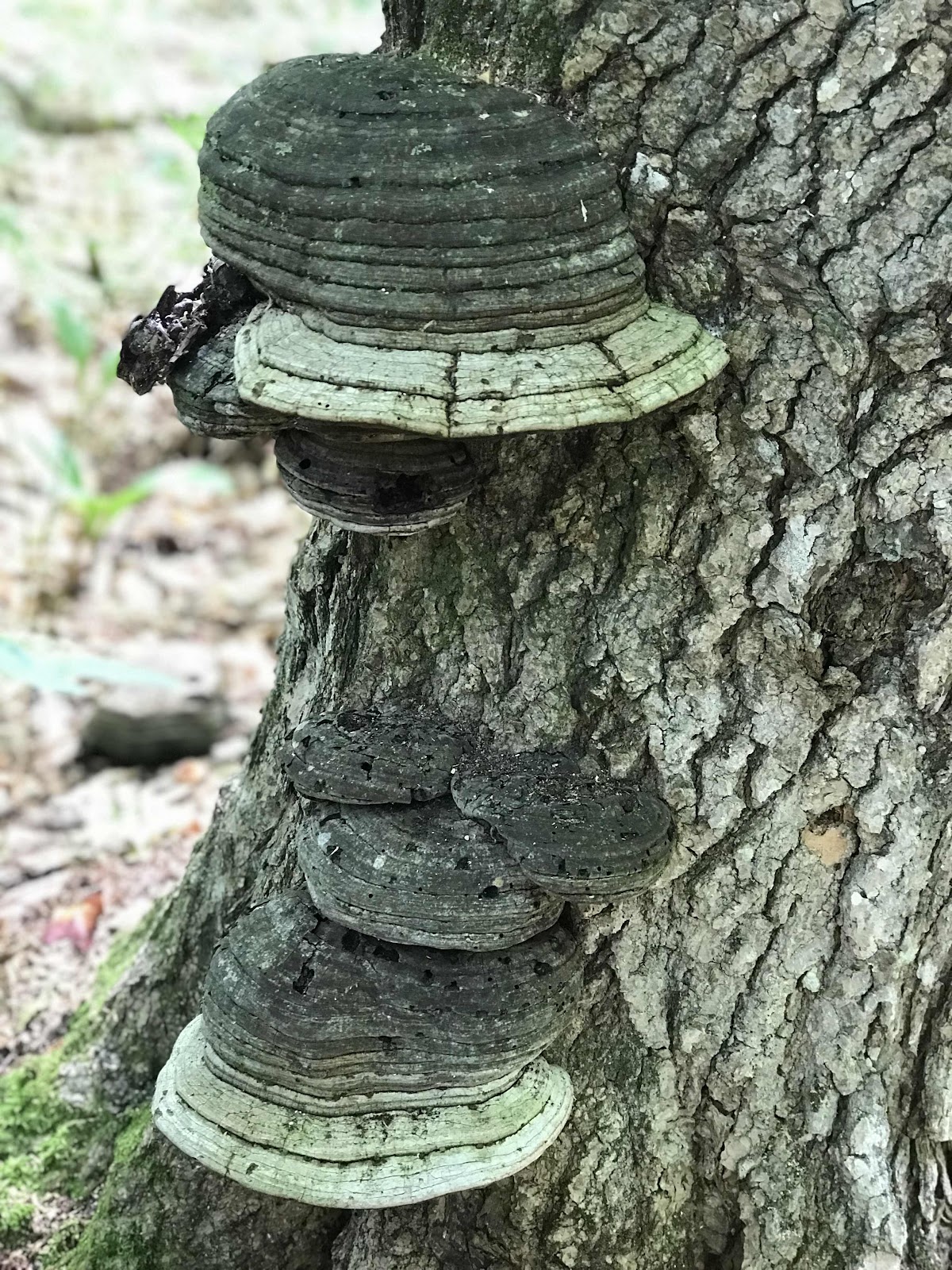
A nice colony of chaga mushrooms on a dead birch trunk
A cool lichen covered rock and some nice stone stairs on the way down Mt Hayes
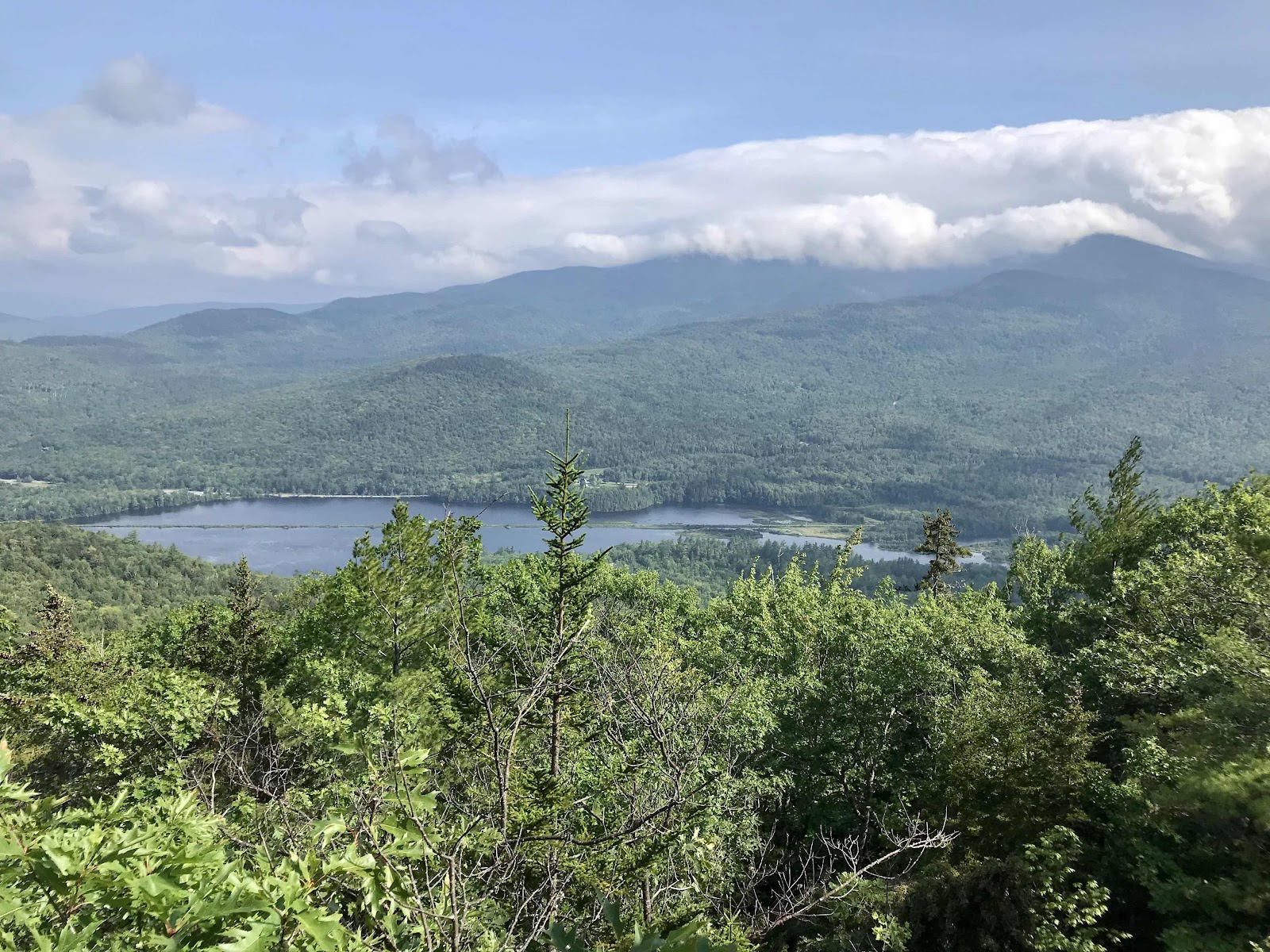
Androscoggin River Valley and our upcoming mountains in the clouds

Crossing the Androscoggin at a dam

Androscoggin River below the dam
Day 31
Tuesday August 10th
Zero in Gorham at the Barn Hostel
To save money, we decided to camp in the yard behind the hostel. We are planning to stay in a couple of the Appalachian Mountain Club huts in the next week or so as we travel through the White Mountains. It’s really expensive, at about $135 per person per night, so we are trying to save money where we can to offset those costs. The camping is probably better than being inside, because it’s been so hot out and the dorm room is in the attic hay loft area of the barn where heat gets trapped well into the night. There was a lot of traffic noise overnight though, from logging trucks on highway 2. A train track also runs through the backyard of the hostel. We were awoken several times by train horns in the night. I don’t think the noise would have been any better inside either though, with the open windows. We are rather exhausted from poor sleep.
In the morning we visit the gas station convenience store across the street to see if we can get anything for breakfast. Although we are in town, most food places are 0.5-2 miles away. The store is called Cumberland farms. It’s a popular chain in the northeast. Judging by the name, I thought they might have some fresh items, but it’s very similar to 7-11 and there isn’t much there. We get some expensive bananas and two little squares of dark chocolate. I raid the hiker box for a more substantial breakfast and come up with curried chocolate lentils on tortillas and rice cakes with salsa. It sounds a little strange but is pretty good and filling too.
Our next chore is to pack up a box of our extra accumulations and send them home from the post office. We have extra articles of clothing, found on the trail and in the hiker box and now an extra water filter too, because we found one on the trail. We try to pack out everything we find on the trail, knowing it doesn’t belong out there and that most other hikers won’t pack anything out.
After the post office we go in search of food and find the White Mountain Café, a coffee shop with salads, sandwiches and smoothies. We get a nice big spinach salad, veggie panini and a vegan oatmeal creme pie cookie. Afterward we shop at Dollar General and find everything we need to get through the next two days on the trail.
Our final chore of the day is to sort our backpacks and leave behind anything we can live without for a night to make our trip over the Wildcat Mountains easier. Since we get to come back to this hostel, it makes sense to leave anything we can and travel lighter. For dinner we have baked beans from a can with free Triscuits that were left behind by another hiker and some free wine, also left behind by another hiker. We are early to bed and hope for a quiet night.

Historic Libby Inn B&B. The Barn Hostel is attached to the other side.
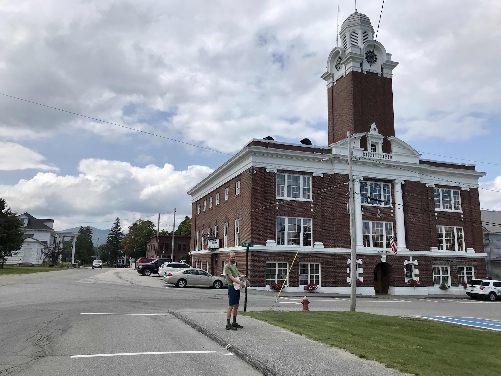
City Hall in Gorham, NH
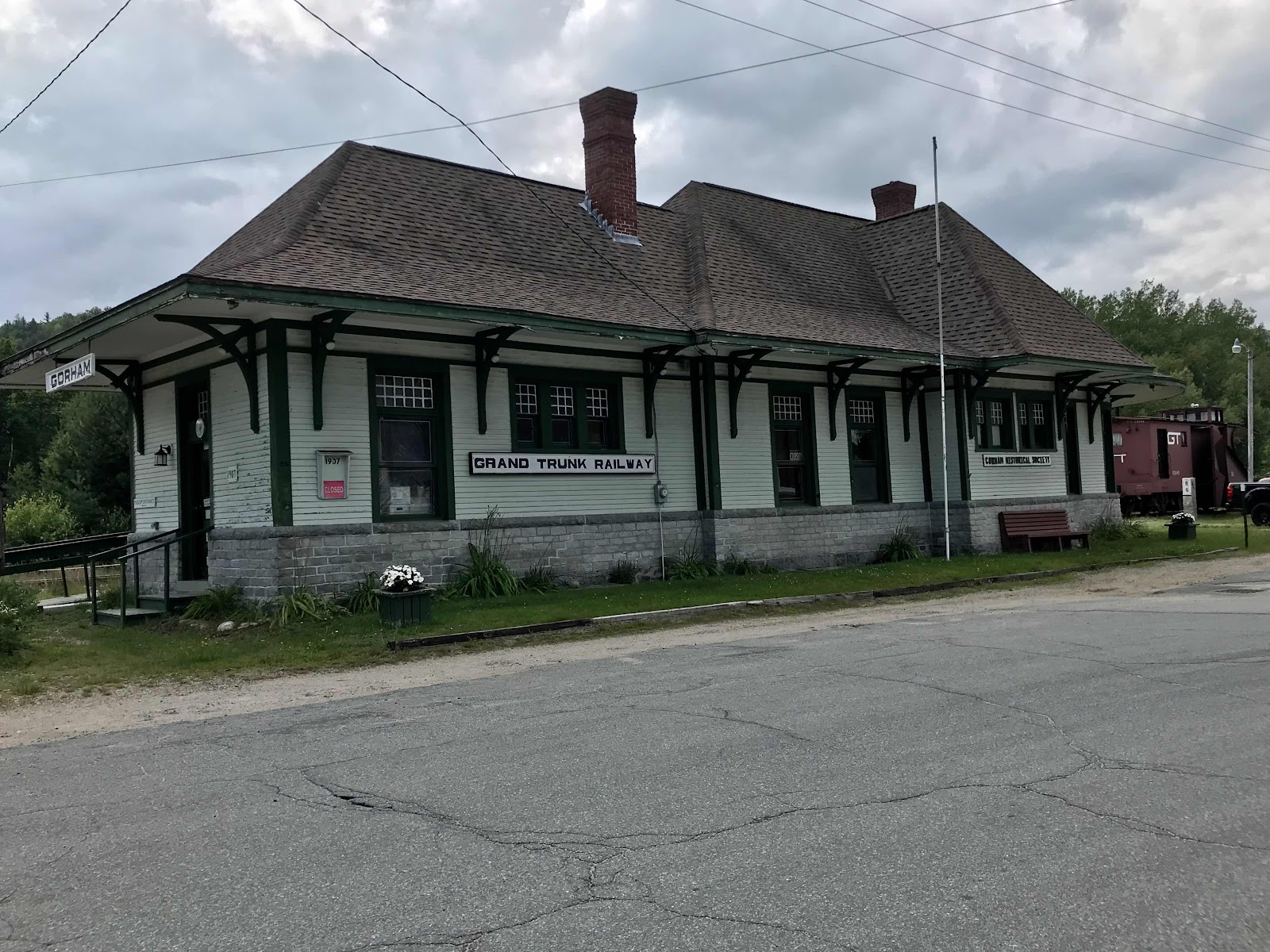
Old railroad depot in Gorham, NH
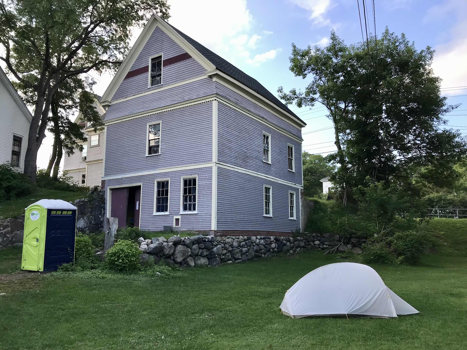
Camping the in yard behind the Barn Hostel


Comments
Post a Comment